


Hiking in Hügel- and Schöcklland
The Schöckl mountain shapes the character of the Hügel- and Schöcklland area in the Graz Region. From Graz’s local mountain, the hiking region stretches across St. Radegund bei Graz and the high plateau of Semriach to the gentle hills around Laßnitzhöhe and Eggersdorf bei Graz. Summit hikes, gorges, themed trails and panoramic circular routes make the area a varied hiking landscape east of Graz.
Among the best-known hiking destinations and places for day trips are the Schöckl, the Hochtrötsch, the Kesselfallklamm gorge and the two entrances to the Lurgrotte cave in Semriach and Peggau. The Quellenwege spring trails in St. Radegund bei Graz, the sebastian RELOADED® adventure trail in Laßnitzhöhe and the Planets Trail in Eggersdorf bei Graz add family-friendly and leisurely walks to the region’s hiking offer.
Hügel- and Schöcklland at a glance
- Schöckl (1,445 m), Graz’s local mountain
- Hochtrötsch and the high plateau of Semriach
- Kesselfallklamm gorge, Lurgrotte cave in Semriach and Peggau
- Quellenwege trails in St. Radegund bei Graz
- sebastian RELOADED® and the Planets Trail in Eggersdorf bei Graz
- Themed trails, circular hikes and family-friendly routes
- Air spa and climatic health resorts
- Easy to reach from Graz

Schöckl
At 1,445 metres, Schöckl is Graz’s local mountain and one of the best-known hiking and excursion destinations in the Graz Region. Routes to the summit start in St. Radegund, Semriach, Stattegg and Weinitzen, as well as at Schöcklkreuz and Steingraben. They lead up to the broad mountain plateau with its alpine pastures, huts and viewpoints.
Hiking routes cross the eastern and western summits, including the summit cross, and offer wide views across Styria. The plateau, with St John’s Chapel, grazing cows and numerous mountain inns and huts, is one of Schöckl’s defining features. With a little luck, ibex can also be spotted along the trails.
The hiking options are complemented by the Schöckl Cable Car and the accessible panoramic trail. Other leisure activities include the Hexenexpress toboggan ride, the climbing park, disc golf, the Trail Area and launch sites for paragliders and hang gliders.
The Schöcklhexe, or Schöckl Witch, is also part of the mountain’s identity. An old legend tells of a mysterious figure who roamed the mountain in fog and thunderstorms, giving Graz’s local mountain an atmosphere that can still be felt today.
- Schöckl (1,445 m), Graz’s local mountain
- Eastern and western summit with the summit cross
- Ascents from St. Radegund bei Graz, Semriach, Stattegg and Weinitzen
- Schöckl Cable Car, Schöcklkreuz and Steingraben
- St John’s Chapel, alpine pastures and grazing cattle
- Accessible panoramic trail
- Hexenexpress, disc golf, climbing park and Schöckl Trail Area
- Launch sites for paragliding and hang-gliding
- A wide range of places to eat, as well as diverse flora and fauna


Semriach and Peggau
The Semriach high plateau is among the most varied hiking areas in the Hügel- und Schöcklland region. Hiking routes lead from here to Hochtrötsch, Windhofkogel and Schöckl. Peggau extends the area with trails towards the Grazer Bergland and a varied selection of hikes around the village.
The best-known natural attractions include Kesselfallklamm gorge, Lurgrotte cave Semriach and Lurgrotte cave Peggau. 14 circular hiking trails explore the high plateau around Semriach, leading to viewpoints, natural monuments and family-friendly excursion destinations. A varied network of routes around Peggau further broadens the hiking options.
- Schöckl, Hochtrötsch and Windhofkogel
- The Semriach high plateau
- Kesselfallklamm gorge
- Lurgrotte cave Semriach and Lurgrotte cave Peggau
- 14 circular hiking trails for different levels of difficulty
- Connecting hiking routes between Peggau, Semriach and the Grazer Bergland
- From family-friendly walks to panoramic summit hikes


More Hikes around Semriach and Peggau
The new “Rund um Semriach and Peggau” hiking map provides a comprehensive overview of the hiking area, including all 14 circular routes, detailed tour descriptions and useful information for planning a hike.
Peggau is also an important junction on the Grazer Bergland Hiking Trail. Stage 1 starts here, while Stage 3 ends in Peggau. Several circular routes also follow sections of the long-distance trail. One example is the circular hike to Hochtrötsch, where the Grazer Bergland trail crosses the summit.
Trail 750 through Badlgraben near Peggau is open and accessible again after an extended closure. The route has been repaired and fitted with new cables and steps.
- Rötschgraben Trail R13
- Boden-Rechbergkogel-Greithweg (R10)
- Windhofkogel Loop (R12a)
- Sandwirt – Präbichl – Glett – Theisslwirt Circular Trail (R5a)
- Badlschlucht gorge – an adventure hike
- From Peggau to Semriach
- From Friesach to Semriach
St. Radegund, Weinitzen, Stattegg
Around St. Radegund bei Graz, Weinitzen and Stattegg, hiking trails lead through forests, across panoramic hills and along historic routes at the foot of Schöckl. The climatic health resort of St. Radegund bei Graz is one of the region’s main starting points for hikes in the area and up Graz’s local mountain.
Alongside the ascents to Schöckl, the Quellenwege trails in St. Radegund bei Graz, the Dr Hans Fuchs Trail in Weinitzen, the Lange Weg trail in Stattegg and Novystein offer a varied selection of hikes. Stage 7 of the Mariazeller Weg long-distance trail also passes through this area.
- Quellenwege trails in St. Radegund bei Graz
- Dr Hans Fuchs Trail in Weinitzen
- Lange Weg trail in Stattegg
- Novystein
- St. Radegund climatic health resort
- Stage 7 of the Mariazeller Weg long-distance trail
- Peaceful forest trails and panoramic circular hikes


Laßnitzhöhe and Hügelland
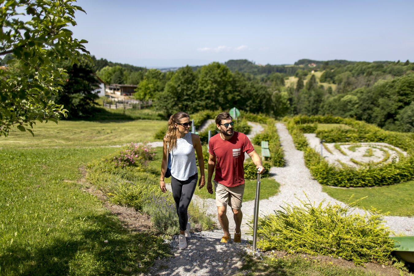
Around Laßnitzhöhe, Kainbach bei Graz, Eggersdorf bei Graz, Nestelbach bei Graz and Vasoldsberg, hiking trails lead through the gentle hills east of Graz. The climatic health resort of Laßnitzhöhe is the starting point for a varied selection of themed and circular hikes that combine nature, outdoor activity and regional attractions.
Among the best-known routes are the sebastian RELOADED® adventure trail in Laßnitzhöhe, the Planets Trail in Eggersdorf bei Graz and the Taggerwald circular trail in Kainbach bei Graz. Further themed trails, family-friendly circular routes and leisurely hikes around Nestelbach bei Graz and Vasoldsberg complete the hiking offer.
- sebastian RELOADED® in Laßnitzhöhe
- Planets Trail in Eggersdorf
- Taggerwald Circular Trail in Kainbach
- Laßnitzhöhe climatic health resort
- Themed trails and family-friendly hikes
- Gentle hills and expansive views
- Easy to reach from Graz


Hiking map „Wandern rund um Laßnitzhöhe“
The “Wandern rund um Laßnitzhöhe” hiking map brings together signposted routes through Laßnitzhöhe, Kainbach bei Graz and Nestelbach bei Graz. The trails lead through forests, meadows and long-established villages east of Graz.
One of the highlights is the 7.3-kilometre sebastian RELOADED® adventure trail. Rest areas, places to stop for food and drink, local sights and additional cycling routes make the region well suited to relaxed outings combining nature, outdoor activity and culture.


Experience nature
Gorges, caves and distinctive natural sites complement the hiking opportunities in the Hügel- und Schöcklland region. Many attractions are located directly along the trails or can easily be combined with a hike. This creates varied day trips for families, nature enthusiasts and those who enjoy exploring at a leisurely pace.
Time for a refreshment stop
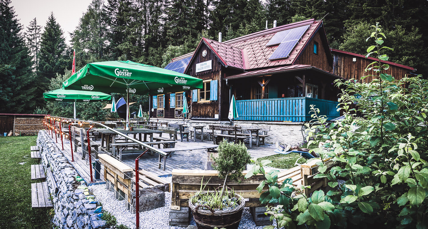
From the Johann Waller Hut on Schöckl to the traditional inns of the surrounding hills, stopping for food and drink is an essential part of hiking in the region. Sunny terraces, regional specialities and wide views make many of these places a natural part of the route.
Numerous inns and restaurants are located directly on the hiking trails or just a few steps away.
FAQ: Hiking in Hügel- and Schöcklland
Schöckl can be reached on foot from St. Radegund, Semriach, Stattegg and Weinitzen, as well as via Schöcklkreuz and Steingraben. Depending on the starting point, routes range from shorter ascents to more demanding summit hikes.
Family-friendly hikes can be found throughout Hügel- und Schöcklland. The sebastian RELOADED adventure trail in Laßnitzhöhe, the Planets Trail in Eggersdorf bei Graz and the many circular hikes around Semriach and Schöckl are particularly popular.
Yes. Kesselfallklamm is one of the best-known natural attractions in Hügel- and Schöcklland. Walkways and bridges lead through the gorge alongside the Kesselfallbach stream. Sure-footedness and sturdy footwear are recommended.
Kesselfallklamm is located near Semriach in the Hügel- and Schöcklland area of the Graz Region. It is one of the region’s most popular hiking destinations and can easily be combined with other hikes around Semriach..
Yes. Several hiking maps are available for Hügel- und Schöcklland. These include the “Rund um Semriach und Peggau” hiking map, the “Rund um Laßnitzhöhe” hiking map and the map of the Quellenwege trails in St. Radegund. They provide suggested routes, orientation and information about the respective hiking areas.
Among the most striking natural attractions are Kesselfallklamm gorge with its walkways and waterfalls, the Lurgrotte caves in Semriach and Peggau, and the expansive views from Schöckl and Hochtrötsch. The Quellenwege trails, varied forest landscapes and gentle hills around Laßnitzhöhe add further ways to experience nature in the region.
Yes. Trail 750 through Badlgraben near Peggau is open and accessible again after an extended closure. The route has been repaired and fitted with new cables and steps.


