


Hiking in the Graz Region
City, Alpine Pastures, Summit Crosses
Alpine pastures, summit crosses, gorges and scenic heights shape the hiking experience in the Graz Region. Quiet forest paths, gentle hills, riverside landscapes and urban trails in and around Graz add even more variety.
Four hiking areas provide orientation: Grazer Bergland, Lipizzanerheimat, Hügel- and Schöcklland, and Graz and the south of Graz.
With Graz as the capital of Styria and Austria’s second-largest city, an urban starting point lies right next to very different hiking landscapes. Plabutsch within the city limits and Schöckl just outside Graz show this proximity particularly well. From city to countryside in 10 minutes often applies quite literally here.


Many trails are closer than you might think.
Guided hikes
Guided hikes reveal trails, landscapes and stories that can easily go unnoticed along the way. Local guides lead through gorges, across alpine pastures, up to scenic heights and to special places throughout the Graz Region.
The programme ranges from themed and nature-focused hikes to more challenging summit tours. In winter, snowshoe hikes add another way to explore the landscape. Culture, regional character and places to stop for food and drink are part of many tours.


Grazer Bergland Hiking Trail
The new Grazer Bergland Hiking Trail covers 103 kilometres and around 4,300 metres of elevation gain through the Grazer Bergland. Six daily stages lead across summits, along forest trails and scenic heights, and through Frohnleiten, Übelbach, Peggau, Deutschfeistritz, Gratwein-Straßengel and Gratkorn.
Cultural sites such as Lurgrotte Peggau, the Austrian Open-Air Museum Stübing, Rein Abbey and Maria Straßengel lie directly on or close to the route. Train, bus and the flux shared taxi make it easy to plan individual stages or complete the full circular trail.
Bike & Hike
Bike & Hike combines cycling and hiking in one tour. By bike or e-bike, the route leads through valleys and over hills to higher starting points. From there, the journey continues on foot to alpine pastures, viewpoints and summits.
This combination extends the range and shortens longer approaches. Some tours start directly in Graz, while others are well connected by train and bus. Depending on the route, options range from relaxed day trips to more demanding combinations with greater elevation gain.


Digital hiking badge
The SummitLynx digital hiking badge works like a modern stamp pass. Hiking destinations are recorded along the way and count towards bronze, silver and gold badges.
There are three options to choose from. The Hiking Experience includes urban walks, themed trails, alpine pastures and viewpoints. The Summit Experience focuses on prominent destinations such as Schöckl, Hochtrötsch, Rappoldkogel, Reinischkogel, Gleinalm and Stubalm Speik. The Grazer Bergland Hiking Trail has its own stage badge, plus a reward for completing all six stages.
35 hikes around Graz
Browse and plan
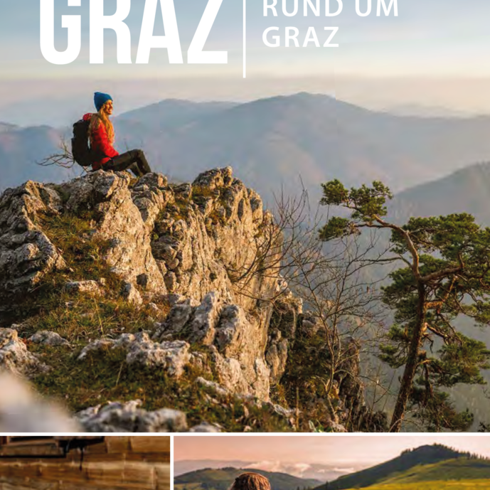
The “Hiking Around Graz” brochure presents 35 selected tours in the Graz Region. It includes urban walks, themed trails, alpine hikes and summit tours, with the key information clearly summarised.
The brochure can be browsed online, and a printed copy can be ordered free of charge. Hiking maps and the tour portal provide further details for planning individual routes.
Explore tours
Go straight to maps, elevation profiles and tour details.
FAQ: Hiking in the Graz Region
The Graz Region has four hiking areas, each with its own character: Grazer Bergland, Lipizzanerheimat, Hügel- and Schöcklland, and Graz and the south of Graz.
The range extends from urban walks and themed trails to alpine hikes, summit tours and multi-day routes. The tour portal provides details on distance, duration, elevation gain and difficulty for each tour.
The main recreational areas include Plabutsch, Schlossberg, Platte, Reinerkogel, Buchkogel and Schöckl. Many of these destinations are located within the city or just a few minutes away and are well suited to walks, urban hikes and longer tours. More routes can be found on the Graz and the south of Graz and Hügel- and Schöcklland pages.
Easy hikes lead through the Graz city area, the Mur river meadows, around lakes and through the gentle hills near Laßnitzhöhe. Short circular walks and themed trails can also be found in the Lipizzanerheimat and the Grazer Bergland.
At lower elevations, the hiking season often starts early in the year and continues well into autumn. For higher alpine pasture and summit hikes, the snow-free months are generally the best time to go.
The Grazer Bergland Hiking Trail is a 103-kilometre circular route with six stages and around 4,300 metres of elevation gain. The trail passes through six municipalities in the Grazer Bergland and can also be hiked stage by stage. Accommodation along the route makes it easy to plan a multi-day hike with overnight stays in the stage towns.
The “Hiking Around Graz” brochure features 35 selected tours. Additional hiking maps, the tour portal and a dedicated map for the Grazer Bergland Hiking Trail are also available and can be ordered free of charge.
Yes, many hiking trails are well suited to walks and hikes with dogs. Quiet forest paths, pilgrimage routes and trails along streams or lakes offer good alternatives away from grazing livestock.
Extra care is needed on alpine pastures and grazing areas. Dogs and cows with calves should be kept apart whenever possible. Dogs should be kept on a short lead. If an attack by grazing livestock appears imminent, the dog should be released immediately. Where possible, choose a route that avoids livestock pastures. Leash requirements and proper disposal of dog waste should always be observed.
Tips on grazing livestock and hiking with dogs can be found here.


