Styria as a year-round holiday destination

Tours through Styria

The various tours through the heart of Styria impress holidaymakers no matter the season. The hiking routes include numerous gems such as the "From Glacier to Wine" route, which leads you from the Dachstein region to the Styrian Wine Country. River cycle paths run through nature reserves and small historic towns – among them, the famous Enns cycle path through the alpine north and the Mur cycle path through the Mediterranean south, where we meet the Styrian Wine Country Route. From spring to autumn, visitors can go on an exciting journey to culinary manufactories or experience local art and culture first hand.

Covered in snow, Styria turns into a glittering natural spectacle. The Schladming-Dachstein region welcomes skiers at the Schladming 4-Mountain Ski Area with its countless kilometres of ski runs. If you prefer something a little more relaxed and with a magnificent view of wintry lakes, the Ausseerland-Salzkammergut region offers exactly that. And away from the slopes, excellent cross-country ski trails, high-altitude winter hiking trails and sledging runs ensure plenty of variety.

If you take a closer look and are open to experiencing something new, you will get to know and love the green heart of Austria. The tour portal helps you find the right tour for that:
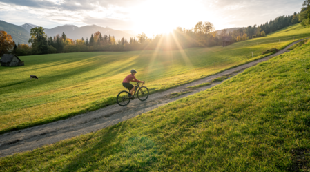
Filter
Length in km
km
km
Duration in h
h
h
Elevation gain/loss
m
m
3277 Results
Accessible by public transport
Christian Strobl | © Erlebnisregion Thermen- & Vulkanland
Thermen- & Vulkanland challenging Open
Route 73,7 km
Duration 5:55 h

FB6 Hill Tour Thermal & Volcanic Land Styria (FB6 Hügeltour Thermen- & Vulkanland Steiermark)

Accessible by public transport
Klippitztörl See | Schober Erich | © Unknown
Styria challenging Open
Route 396,1 km
Duration 5:30 h

Lake tour - Carinthia - Soboth - Pack

Accessible by public transport
Trofaiach | M. Pezmann | © Tourismusverband ERZBERG LEOBEN
Erzberg Leoben medium Open
Route 20,5 km
Duration 1:45 h

Reitingblicktour LN 3

Accessible by public transport
Information point, village of Rohrmoos | Gerhard Pilz | © Gerhard Pilz
Schladming-Dachstein easy Open
Route 3,4 km
Duration 1:00 h

The Encounter Walk

Tourismusverband Schladming-Dachstein | © www.tita.at
Bezirk Liezen challenging Open
Route 6,1 km
Duration 7:30 h

Austria-Via Ferrata Sinabell

Salza Wasserfall | Schladming Dachstein | © Erlebnisregion Schladming-Dachstein
Schladming-Dachstein easy Open
Route 4,0 km
Duration 1:00 h

Salza Waterfall

Accessible by public transport
Theresa Schwaiger | © Ausseerland
Grundlsee easy Open
Route 1,8 km
Duration 0:45 h

Gaiswinkler circular path

Pölser Badeteich - Pölstal | Anita Fössl | © Erlebnisregion Murtal
Murtal easy Open
Route 5,8 km
Duration 1:30 h

Mühltalweg Pöls

Etappe_06__Leitner | Tourismusverband Gesäuse | © TV Gesäuse
Gesäuse challenging Open
Route 22,6 km
Duration 8:25 h

Etappe 06 Luchs Trail Johnsbach - Ennstalerhütte (schwierig)

St. Ruprecht Hobby running track, Eastern Styria | © Oststeiermark Tourismus
Sankt Ruprecht an der Raab medium Open
Route 5,0 km
Duration 0:45 h

St. Ruprecht - Hobby running track

Blick ins Krakautal | podpera | © Steiermark Tourismus/Podpera
Schladming-Dachstein medium Open
Route 15,2 km
Duration 6:30 h

Stage 08 From Glacier to Wine South Route Putzentalalm - Krakau

Accessible by public transport
Pöllau Castle and main square in Eastern Styria | © Helmut Schweighofer
Pöllau medium Open
Route 3,2 km
Duration 1:30 h

Organ Hiking: Stage Pöllau - Pöllauberg

Mugel | Anton Hirschmann | © Tourismusverband ERZBERG LEOBEN
Leoben challenging Open
Route 15,5 km
Duration 3:00 h

Mountain bike trail Mugel

Hubertussee | Fred Lindmoser | © TV Hochsteiermark
Hochsteiermark medium Open
Route 29,3 km
Duration 3:15 h

Lake Hubertussee - Round

Mountainbiken | Mediadome | © Tourismusverband Region Murau
Murau medium Open
Route 19,3 km
Duration 2:20 h

Mühlsteinboden-Tour

Die Glattjochkapelle im Hintergrund die Hochweberspitze | Roland Gutwenger | © Erlebnisregion Schladming-Dachstein
Schladming-Dachstein medium Open
Route 17,7 km
Duration 6:30 h

Up to the Glattjoch - elev. 1.988 m

3277 Results