


Closed
Winter hiking trail in the village of Tauplitz
Characteristics
FitnessThe tour in numbers
Level of difficulty
easy
Route
4,5 km
Time
1:10 h
Uphill
67 hm
Downhill
67 hm
Highest point
970 m
The approximately 5.3 km long winter hike across the Tauplitzalm plateau offers magnificent views and cozy places to stop along the way. It takes about two hours, is classified as moderately difficult, and requires some fitness. The hike starts either from the parking area on the Tauplitzalm or from the top station of the 4-seater chairlift. The prepared trail leads past the Naturfreundehaus and the snow-covered Tauplitzsee to the Grazerhütte and continues to the Linzerhaus before returning to the starting point.
The 5.3 km trail showcases the many possibilities of the Tauplitzalm in winter.
The plateau is easy to navigate, allowing for individual route variations. With
a duration of about two hours, the hike is classified as moderately difficult
and requires some fitness.
It can be started either from the parking area on the Tauplitzalm, where
plenty of parking spaces are available, or from the top station of the 4-seater
chairlift. The prepared trail leads past the Naturfreundehaus to the
snow-covered Tauplitzsee at the foot of Mount Traweng, continues
to the Grazerhütte, then in a wide loop to the Linzerhaus, and
finally returns via the Naturfreundehaus to the starting point.
Discover the diversity of the Ausseerland region: the Newsletter provides up-to-date information on news, weather, events, and special offers – perfectly preparing every day. Current brochures can be conveniently ordered to your home through Prospektbestellung .
Best season
January
February
March
April
May
June
July
August
September
October
November
December
More information
It is best to plan your journey to Tauplitz with google.at/maps.
There are plenty of free parking spaces at the entrance to Tauplitz.
There are plenty of free parking spaces at the entrance to Tauplitz.
From the parking lot turn left and hike up towards the church. A little above you will find the starting point of the hike.
The hike starts at the village square in Tauplitz. From there, walk east along the road. Cross the bypass road and then continue straight on along the road towards Gnanitzalm. After about two kilometers, turn left onto the “Freiberg Weg” and return to the starting point.
If you prefer, you can also continue along the road towards Gnanitzalm and after about 20 minutes on foot you will come to the waterfall on the right (only accessible when there is little snow) and the Sagtümpel pond on the left.
Emergency Mountain Rescue: 140
Emergency Notification Tip - Provide answers to the six W-questions:
- What happened?
- How many people were injured?
- Where did the accident happen? (possibly GPS coordinates)
- Who reports? (callback number)
- When did the accident happen?
- Weather at the accident site?
- pack heavy things first.
- The water bottle should always be within easy reach in a side pocket.
- All things that are often needed, such as sunglasses, camera or hiking map, belong on top.
- An emergency kit including blister plaster belongs in every backpack and a clothing according to the "onion system" is always recommended.
Tourist Office Ausseerland Salzkammergut
Information office Tauplitz
Tauplitz 70
8982 Bad Mitterndorf
+43 3688 24 46
Send e-mail
Website
Map & downloads
Gallery
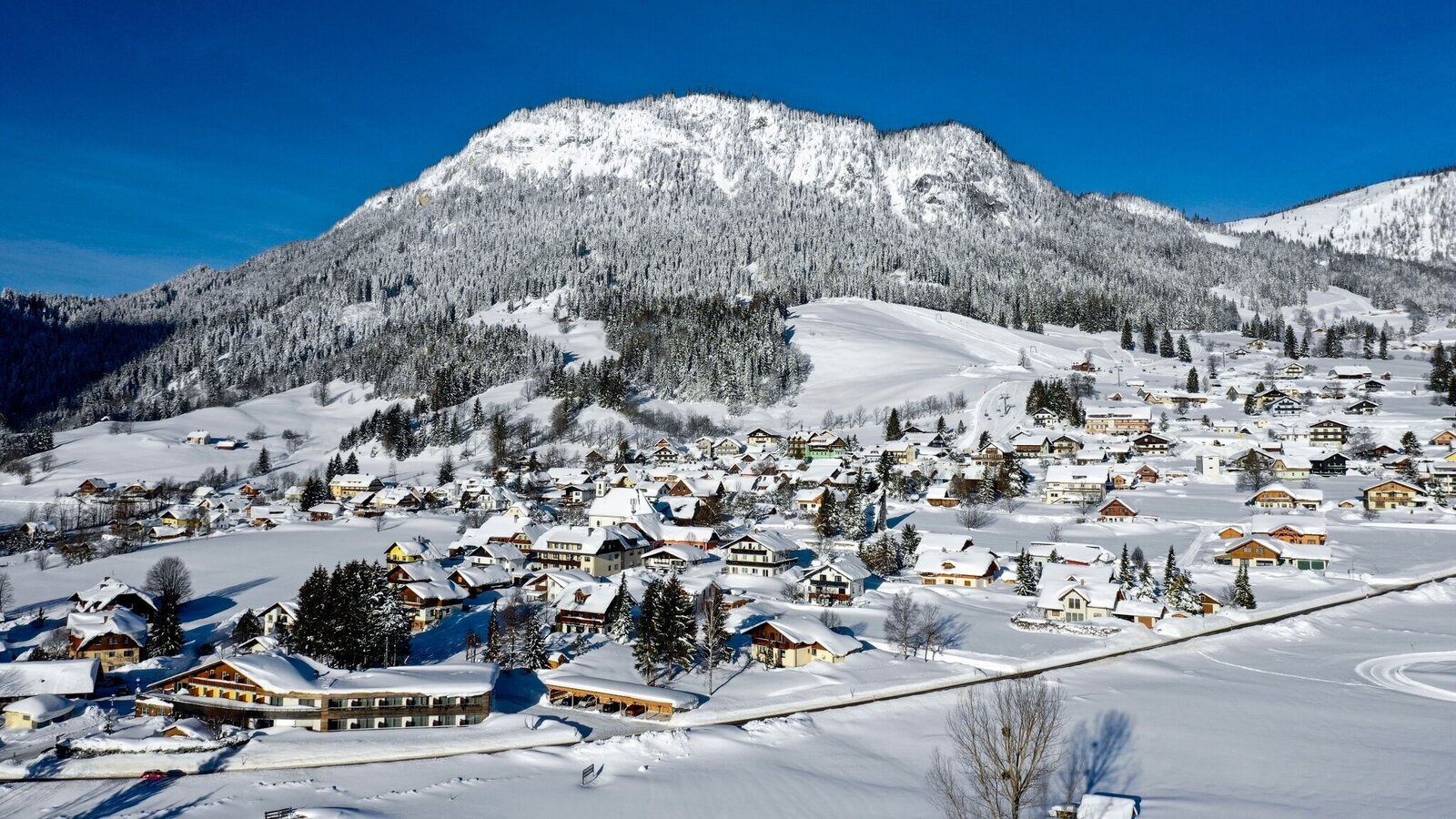
Winter in Tauplitz | © Tourismusverband Ausseerland Salzkammergut | Tomm Lamm
1/1

What the weather will be like Bad Mitterndorf (800m)
Today, 23.10.2026
Fog and clouds will clear slowly and the day will be partly sunny.Morning

-2°C
sr.Regenwahrscheinlichkeit
0%
sr.Windstärke
0 km/h
Noon

10°C
sr.Regenwahrscheinlichkeit
0%
sr.Windstärke
10 km/h
Night

5°C
sr.Regenwahrscheinlichkeit
10%
sr.Windstärke
5 km/h
Tomorrow, 24.10.2026
Rainfall will end around noon, then the clouds will break up.Morning

3°C
sr.Regenwahrscheinlichkeit
85%
sr.Windstärke
5 km/h
Noon

6°C
sr.Regenwahrscheinlichkeit
80%
sr.Windstärke
5 km/h
Night
2°C
sr.Regenwahrscheinlichkeit
40%
sr.Windstärke
0 km/h
Forecast
25.10.2026
-1°C
9°C
26.10.2026
1°C
12°C
27.10.2026
0°C
14°C
