


Stage 11 From Glacier to Wine North Route Alpine Variant Gesäuse Heßhütte - Radmer
Characteristics
SkillThe tour in numbers
Level of difficulty
challenging
Route
19,1 km
Time
7:30 h
Uphill
860 hm
Downhill
1838 hm
Highest point
1818 m
The alpine variant of Stage 11 of the Hiking Trail From Glacier to Wine between the Heßhütte and Radmer requires excellent sure-footedness and alpine experience. In particular, the descent to Radmer beneath the imposing Lugauer involves several technically demanding sections.
The first kilometres of the route are identical to the main trail. Via the beautifully situated Sulzkaralm, we reach the junction at the Bärenhöhle, where the main route branches south towards the Haselkaralm before continuing to Radmer an der Hasel.
The alpine variant, however, remains on Trail 01, bypassing the Lugauer on its northern side before descending to Radmer an der Stube.
Rising prominently on the southeastern edge of the Ennstal Alps, the Lugauer is an impressive limestone massif between Hieflau and the Radmer Valley. With its steep rock faces and distinctive double summit, it is undoubtedly one of the most striking mountain personalities in the region.
The Lugauer owes its nickname, the "Styrian Matterhorn", to its characteristic appearance when viewed from the west. Seen from the east, however, its shape is more reminiscent of a pyramid.
Best season
January
February
March
April
May
June
July
August
September
October
November
December
More information
The alpine variant of Stage 11 of the Hiking Trail From Glacier to Wine leads from the well-known Heßhütte (Tel. +43 664 4308060) in the Gesäuse via the Sulzkaralm and past the Lugauer into the Radmer Valley, a secluded side valley nestled between the Gesäuse and the Eisenerz Alps. The route initially follows the main trail to the Bärenhöhle trail junction.
At this junction, the alpine variant branches northwards. Keeping left, the trail climbs gently past the summit of the Goldeck before becoming steeper as it ascends in a series of switchbacks to the small Scheucheggalm at the foot of the Lugauer. Continuing on Trail 01, the route climbs for another two kilometres before reaching a junction below the Lugauer summit. Here we keep left and from this point onwards descend steadily towards Radmer.
However, a descent does not necessarily mean an easy walk. The upper section remains alpine in character and leads over large boulder fields and steep switchbacks that require concentration and sure-footedness. Gradually, the terrain becomes gentler and the trail enters a shady forest, passing the former imperial hunting lodge before reaching the village of Radmer an der Stube (Tourist Information Tel. +43 3635 2110), where it rejoins the main route.
By choosing this variant, the following Stage 12 to Eisenerz is shortened somewhat, making the next day's hike a little less demanding.
Emergency call mountain rescue: 140
Tips when reporting an emergency – Answer these six WH questions: What happened? How many people are injured? Where did the accident happen (are there GPS coordinates)? Who is reporting the incident (callback number)? When did the accident happen? What is the weather like at the site of the incident?
Proper backpack packing makes many things easier: Pack heavy things first. The water bottle should always be within reach in a side pocket. All the things that are often needed, such as sunglasses, camera or hiking map, belong on top. An emergency kit, including blister plasters, belongs in every rucksack and it is always advisable to dress in layers.
If you want it more alpine, go around the Lugauer in the north - details of the variant can be found here. Attention: alpine experience is a must!
Accessible by
train and bus: detailed information about arriving by ÖBB (Austrian Federal
Railways) can be found at www.oebb.at or
on the Verbundlinie Steiermark website www.busbahnbim.at
With
Verbundlinie’s BusBahnBim route planner app, planning your journey
has never been easier: simply enter towns and/or addresses, stop names or
points of interest to check all bus, train and tram connections in Austria. The
app is available free of charge for smartphones – on Google Play and in the App
Store
Steiermark Tourismus, Tel. +43 316 4003
www.steiermark.com
Kompass WK69 Gesäuse, Ennstaler Alpen, Pyhrnpass, Eisenerz www.kompass.at
Freytag & Berndt WK62 Gesäuse · Ennstaler Alpen · Schoberpass www.freytagberndt.at
Map & downloads
Gallery
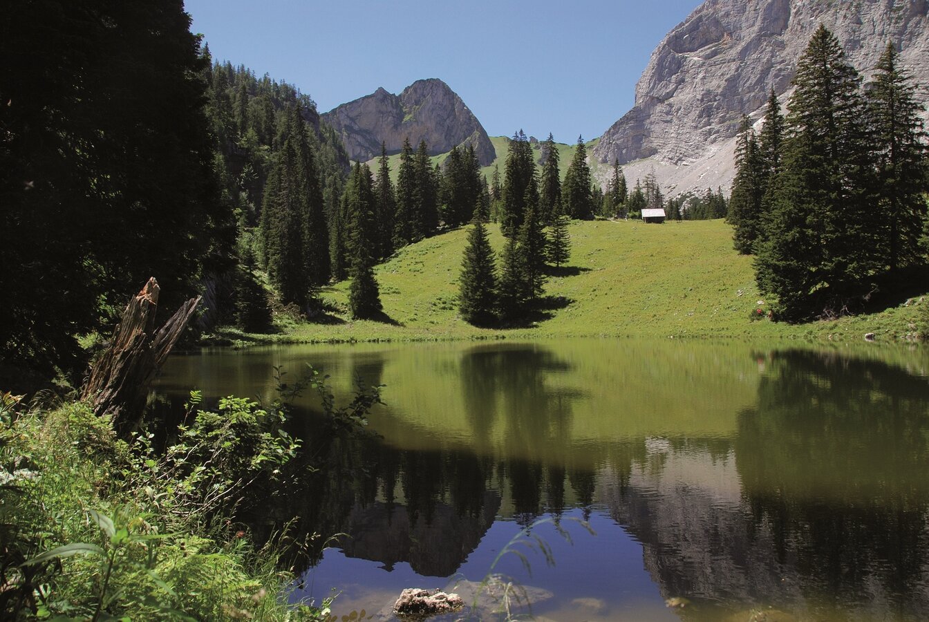
Sulzkarsee mit Sulzkarhund | © TV Gesäuse | Tourismusverband Gesäuse
1/4
Wanderroute "Vom Gletscher zum Wein" | Weitwanderweg Steiermark | © Steiermark - Das Grüne Herz
2/4
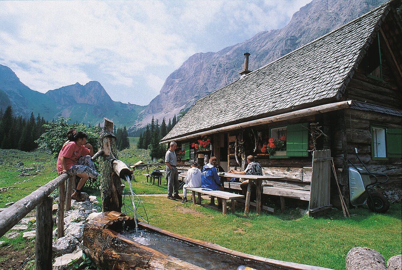
Rast auf der Sulzkaralm | © TV Gesäuse | Tourismusverband Gesäuse
3/4
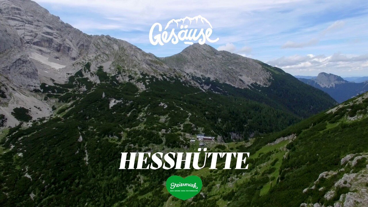
Hütten im Gesäuse | Hesshütte | © Tourismusverband Gesäuse
4/4

What the weather will be like Admont (635m)
Today, 16.10.2026
Dry and sunny throughout the day with hardly any clouds.Morning

5°C
sr.Regenwahrscheinlichkeit
0%
sr.Windstärke
5 km/h
Noon
15°C
sr.Regenwahrscheinlichkeit
0%
sr.Windstärke
0 km/h
Night
8°C
sr.Regenwahrscheinlichkeit
0%
sr.Windstärke
0 km/h
Tomorrow, 17.10.2026
Sunny and cloudy periods will alternate throughout the day.Morning

5°C
sr.Regenwahrscheinlichkeit
0%
sr.Windstärke
0 km/h
Noon
15°C
sr.Regenwahrscheinlichkeit
0%
sr.Windstärke
0 km/h
Night
11°C
sr.Regenwahrscheinlichkeit
15%
sr.Windstärke
5 km/h
Forecast
18.10.2026

6°C
17°C
19.10.2026
5°C
17°C
20.10.2026
6°C
17°C
