


Absetzwirt - Round over the Reinischkogel Nr. A2
Characteristics
SkillThe tour in numbers
Level of difficulty
medium
Route
8,2 km
Time
2:30 h
Uphill
250 hm
Downhill
250 hm
Highest point
1463 m
On this route, you can not only enjoy the unique hilly landscape, but you should also be sure to ring the little bell for world peace at the summit of the Reinischkogel.
This walk starts at the car park of the former Absetzwirt inn. Follow the signposts and turn left at Scheerbründl onto a forest track. This leads through the Stainzer Forest up to the Unger wayside shrine. At the fork in the path, continue to follow trail A2 and walk further uphill. You will pass the blue Kaltenbrunnerkreuz; below it lies the source of the Stainzbach. Continue to the left and you will soon reach the access path to the Reinischkogel summit. At the top, a wooden summit cross and a chapel await you. It is situated around 100 metres from the geographical, actual summit of the Reinischkogel. You will find your way back to trail A2 via the alpine pasture. This trail now leads steeply downhill to a fork in the path. Here, turn left and continue on almost level ground. A little further on, trail A1 joins the route and the path continues downhill across a flower-filled meadow and then through an idyllic forest back to the Absetzwirt.
Best season
January
February
March
April
May
June
July
August
September
October
November
December
More information
Coming from Graz via the A9, take the A2 towards Klagenfurt at the Graz-West motorway junction. Take the Lieboch exit and follow the B76 towards Lannach-Deutschlandsberg.
Car park at the Absetzwirt (the inn is closed)
Car park at the Absetzwirt (the inn is closed)
This tour starts at the car park of the former "Absetzwirt". At an altitude of 1240 metres above sea level, you set off northwards, exhilarated and full of anticipation of what awaits you. After about 700 metres, turn left at the Scheerbründl, where you can refresh yourself and fill your water bottle, and follow the forest road.
This leads through the Stainz forest, which provides shade on hot days and is colourful in autumn, up to the Unger wayside shrine. At the fork in the road, trail A1 leads back down to the Absetzwirt. However, you take trail A2 and continue hiking uphill full of verve. After a while you will reach the blue Kaltenbrunner cross and in front of it, a little below, the Stainzbach spring. Here, where the Stainzbach springs, you have the opportunity to refresh your tired legs before the ascent up the Reinischkogel. This does you good and gives you new energy.
Then continue left and you will soon reach the access path to the Reinischkogel summit, at an altitude of 1463 metres. The wooden summit cross and a chapel await you at the top. The summit cross was erected in 1985. It is about 100 metres away from the geographical, actual Reinischkogel summit. This ascent is easy to do and well worth it. Because here you have the opportunity to ring the bell of the wooden chapel by hand. The attached sign explains that the sound is to serve world peace. Here in the arbour you can take a break and really enjoy yourself.
After a good rest, you return to trail A2 via the alpine pasture. The trail now descends steeply to a fork in the road. Turn left here and continue almost level. On the left side you can already marvel at the natural monument "Wetterfichte". It is an old spruce with several tops. Take the opportunity to linger a little at this magical place.
A little further on, trail A1 joins and you continue downhill across a flowering meadow and then through an idyllic forest back to the Absetzwirt. Here the circle closes on which you could experience what beauty the area around the Reinischkogel has to offer.
Small rucksack with water bottle, light hiking boots, Nordic walking poles, sunscreen, umbrella, mobile phone, detailed map/hiking map of the hike.
Please take into account your personal fitness level, the weather forecast and the current opening hours of refreshment stops. No liability can be accepted for the accuracy of the information provided.
Reinischkogel summit: Here at the summit cross, there is also a lovingly decorated chapel with the sound of bells ringing, inviting you to linger.
Many starting points for our hikes in southern Styria can also be reached by public transport.
For a relaxed and sustainable journey, we recommend travelling by bus and train wherever possible. Depending on the region, additional local transport options are available.
This allows you to start your tour stress-free while also contributing to climate and nature conservation.
All information on public transport,
local mobility services and timetables can be found at: www.suedsteiermark.com/arrival
Nearest train
stations are: Lannach, Frauental or Deutschlandsberg.
Information offices:
Stainz Tourist Office, Tel.: +43 (5) 7730 710, 8510 Stainz, Hauptplatz 1
South Styria Tourist Association, Tel.: +43 (5) 7730, 8530 Deutschlandsberg, Hauptplatz 40
Map & downloads
Gallery
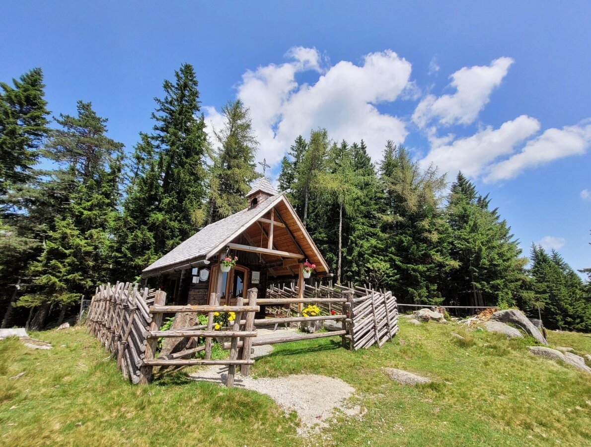
Reinischkogel_Kapelle.jpg | © TVB Südsteiermark/Irene Löschnig | Irene Löschnig
1/3
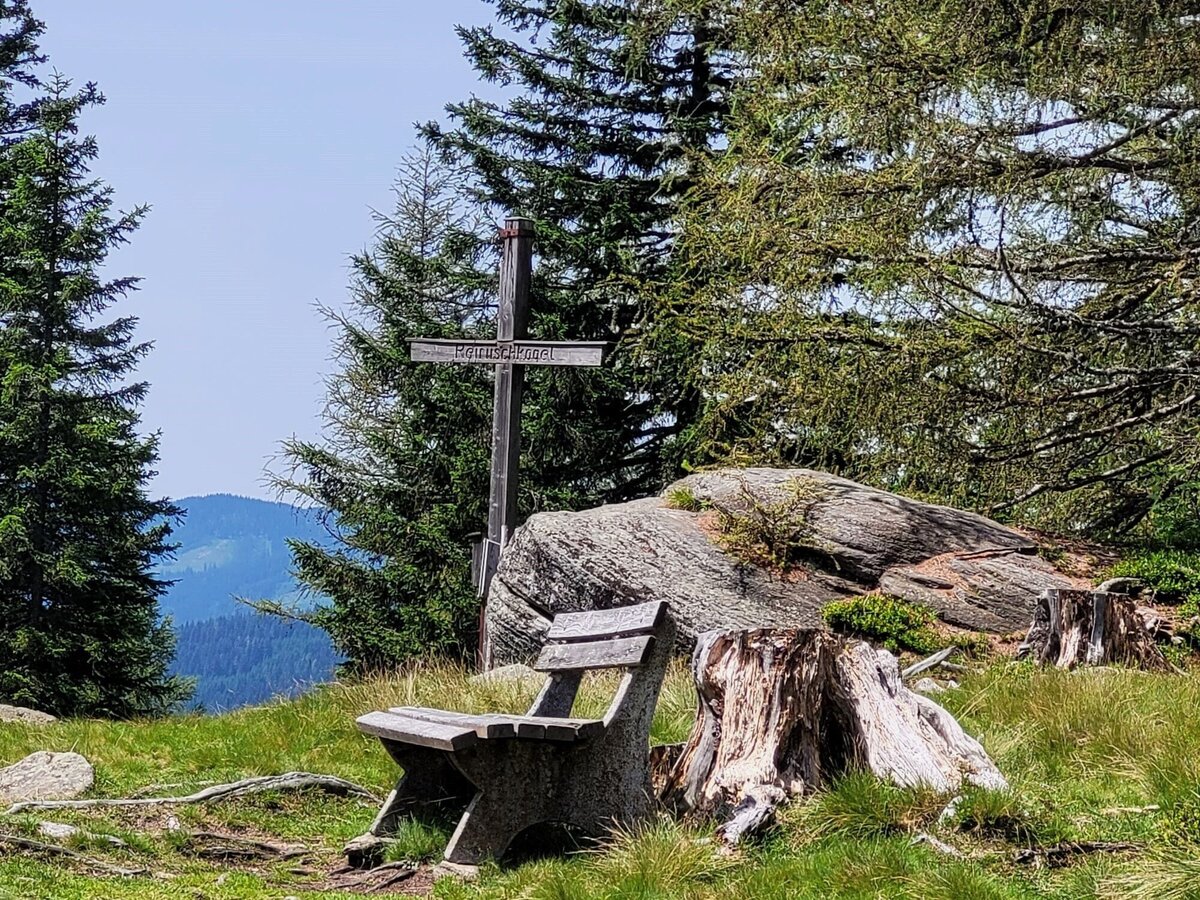
Reinischkogel_Gipfelkreuz.jpg | © TVB Südsteiermark/Irene Löschnig | Irene Löschnig
2/3

Reinischkogel_Blumen Kapelle.jpg | © TVB Südsteiermark/Irene Löschnig | Irene Löschnig
3/3

What the weather will be like Stainz (339m)
Today, 25.10.2026
Partly sunny in the morning, gradually becoming cloudy in the afternoon.Morning

1°C
sr.Regenwahrscheinlichkeit
0%
sr.Windstärke
0 km/h
Noon

10°C
sr.Regenwahrscheinlichkeit
5%
sr.Windstärke
5 km/h
Night

7°C
sr.Regenwahrscheinlichkeit
35%
sr.Windstärke
5 km/h
Tomorrow, 26.10.2026
The day starts sunny, but will be partly cloudy in the afternoon.Morning

3°C
sr.Regenwahrscheinlichkeit
5%
sr.Windstärke
0 km/h
Noon
14°C
sr.Regenwahrscheinlichkeit
10%
sr.Windstärke
5 km/h
Night
7°C
sr.Regenwahrscheinlichkeit
0%
sr.Windstärke
0 km/h
Forecast
26.10.2026
2°C
15°C
27.10.2026
2°C
14°C
28.10.2026
3°C
15°C
