


Pleschaitz
Characteristics
SkillThe tour in numbers
Level of difficulty
medium
Route
16,6 km
Time
6:30 h
Uphill
976 hm
Downhill
983 hm
Highest point
1797 m
Depending on your condition, this is a half-day or day hike with several steep uphill sections, but mostly through the forest. Return via the same route.
After the first steep but shady climb to Hinterburg, a sunny section of the trail leads us back into the forest, where there are several more steep climbs until we reach the ridge. We follow this ridge, passing ancient trees, until we finally come to a clearing at the tree line. After a short climb across a mountain meadow, we reach the summit cross of the “Pleschaitz” (Slavic, translated: “bald head”). Here we are rewarded with a magnificent view in both directions of the Mur Valley.
Best season
January
February
March
April
May
June
July
August
September
October
November
December
More information
Coming from Judenburg via Unzmarkt to Scheifling. Turn right here towards Murau. In Niederwölz turn right to Oberwölz.
Public parking spaces are available in the area of the city parish church.
Coming from Murau via Teufenbach to Niederwölz. Turn left here towards Oberwölz.
Coming from Tamsweg via Ranten, drive to St. Peter am Kammersberg and via Pöllau am Greim to Oberwölz.
Public parking spaces are available in the area of the city parish church.
Continue in the direction of the sports field. Directly behind the training ground you enter the area of the high ropes course. At the fork in the high ropes course, keep left in the direction of Hinterburg and Pleschaitz. After the first ascent, cross a forest road diagonally to the left and then follow the hiking trail uphill. This section of the trail requires some physical fitness due to its steepness. After about ¾ hour you leave the steep forest path and reach the municipal road to Hinterburg.
At the GH "Alpenblick" you can enjoy the wonderful view of the Wölzer Tauern.
In Hinterburg, follow the municipal road in the direction of Katsch. After the chapel on the left side ("Leitgabkreuz") in the farmstead vlg. "Leitgab" you branch off to the left and follow the ÖAV signs "936-Pleschaitz". The way back is via the same route.
- Good shoes
- Sun protection
- Sufficient food
With the BusBahnBim app from the interconnected line, timetable information is easier than ever: All bus, train and tram connections in Austria can be queried by entering locations and/or addresses, stops or important points. The app is available as a free app for smartphones (Android, iOS) - on Google Play and in the App Store.
ÖBB www.oebb.at | Styria connection line www.busbahnbim.at
From July 14, 2025 partially closed due to logging work!
Affects parts of the section Wölzerbach - Hinterburgerweg.
The ideal time for this tour is from April to November. Information brochures are available at the various information offices.
Affects parts of the section Wölzerbach - Hinterburgerweg.
The ideal time for this tour is from April to November. Information brochures are available at the various information offices.
Map & downloads
Gallery
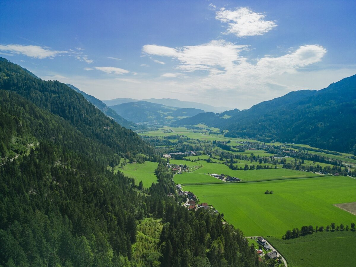
Aussicht vom Pleschaitz | © Tourismusverband Murau | Andreas Siebenhofer
1/2
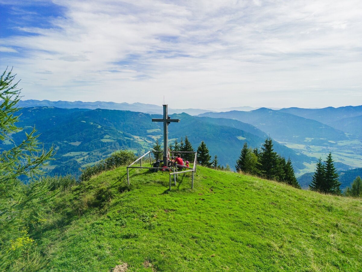
Pleschaitz | © Tourismusverband Murau | Andreas Siebenhofer
2/2

What the weather will be like Oberwölz (833m)
Today, 23.10.2026
The day starts sunny, but will be partly cloudy in the afternoon.Morning

1°C
sr.Regenwahrscheinlichkeit
0%
sr.Windstärke
5 km/h
Noon

10°C
sr.Regenwahrscheinlichkeit
0%
sr.Windstärke
5 km/h
Night
6°C
sr.Regenwahrscheinlichkeit
5%
sr.Windstärke
0 km/h
Tomorrow, 24.10.2026
The rain will end in the early afternoon, and the skies will break up afterwards.Morning

3°C
sr.Regenwahrscheinlichkeit
80%
sr.Windstärke
0 km/h
Noon
7°C
sr.Regenwahrscheinlichkeit
75%
sr.Windstärke
5 km/h
Night
2°C
sr.Regenwahrscheinlichkeit
35%
sr.Windstärke
0 km/h
Forecast
25.10.2026

-1°C
9°C
26.10.2026

1°C
13°C
27.10.2026
0°C
15°C
