


Windhofkogel Loop (R12a)
Accessible by public transport- Hiking taxi
Characteristics
SkillThe tour in numbers
Level of difficulty
easy
Route
5,1 km
Time
1:30 h
Uphill
150 hm
Downhill
150 hm
Highest point
1064 m
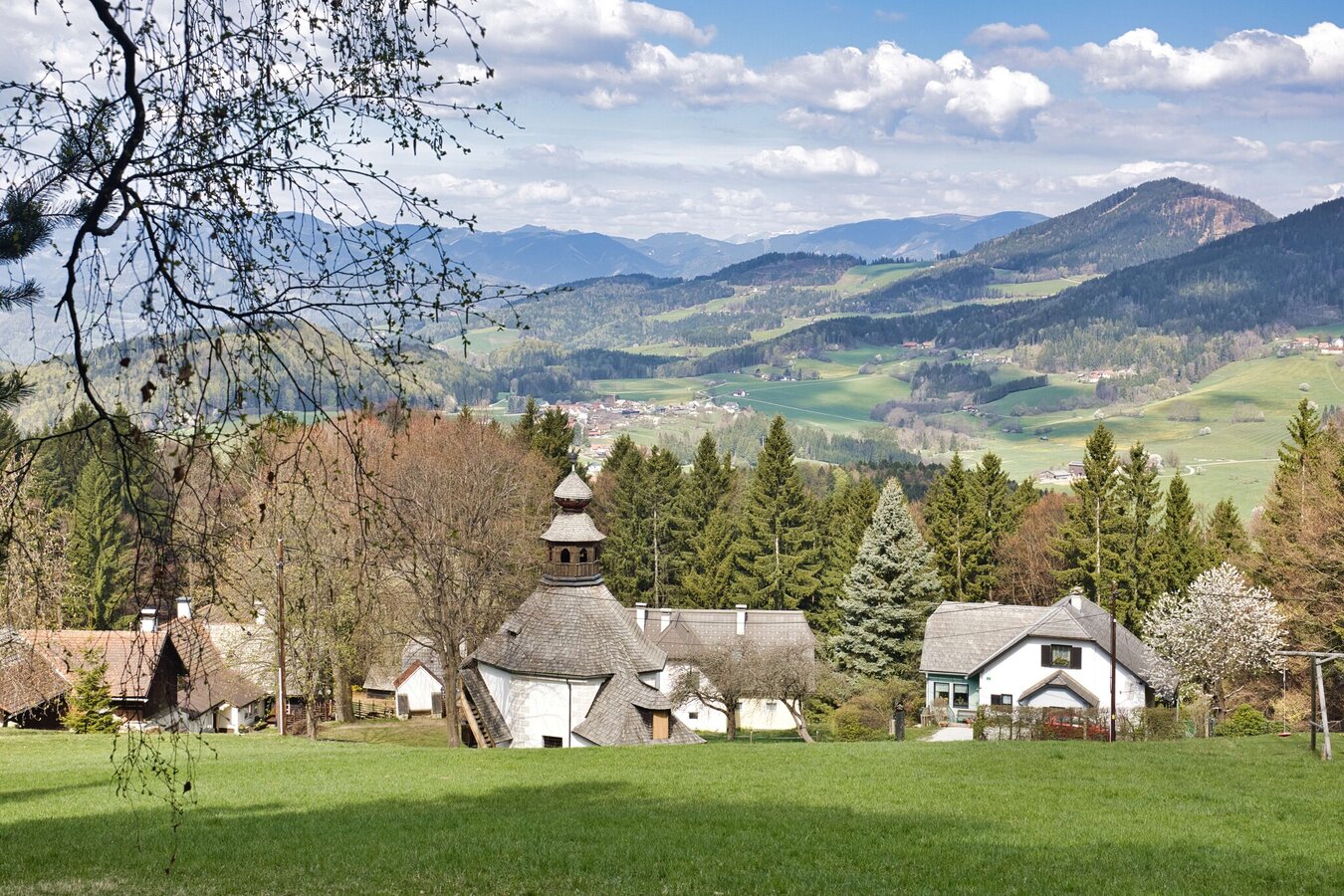
Short forest loop with Ulrichsbrunn Chapel and a summit cross above 1000 meters. Views extend across the Almenland towards Fladnitz and Passail.
This easy hike links the Ulrichsbrunn Chapel with the wooded summit of Windhofkogel at 1064 meters. Mostly quiet forest paths lead in gentle gradients around the mountain and provide a relaxed route throughout. In the first section, pay attention to the signage, as the Windhof loop (R12) partly runs parallel.
After about 30 minutes, the summit is reached, featuring a cross, summit register and a bench. The summit cross was erected in summer 2023 by the Semriach fire brigade and is connected to the long-standing tradition of the Floriani procession to Ulrichsbrunn. In the second part of the hike, views repeatedly open towards the nearby Almenland.
Quiet forest loop with Ulrichsbrunn Chapel and a short ascent to the summit.
Best season
January
February
March
April
May
June
July
August
September
October
November
December
More information
By car: Ulrichsbrunn Chapel, Ulrichsbrunnweg 3, 8102 Semriach
Limited parking available along the state road (L318) near the junction and access road to the chapel.
Limited parking available along the state road (L318) near the junction and access road to the chapel.
From the starting point at the state road, a narrow access road leads uphill to Ulrichsbrunn Chapel. Shortly after, a forest path branches off to the right and follows the edge of the ტყrest above the chapel. The route continues across the summit of Windhofkogel (1064 m) and then descends through the forest. At the forest edge, follow the path to a junction with a sign pointing to the Schlegl mountain hut (approx. 300 m). Pass it and shortly after turn sharply left at the next junction into a hollow way.
The following forest road continues with views towards the Almenland until reaching the road junction at the flux shared taxi stop Anger HP 2 (GU1532). Keep left there and continue slightly uphill back into the forest. Follow the forest road back to Ulrichsbrunn Chapel and return to the starting point along the same route.
Start: parking at L318
0.3 km Ulrichsbrunn Chapel
1.5 km Windhofkogel (1064 m)
2.5 km Junction
3.7 km Road junction (flux stop Anger)
5.1 km Parking at L318
Hiking boots, in winter traction aids and trekking poles recommended
Backpack with sun, wind and rain protection, drinks and snacks
Mobile phone, wallet, tour planning
Optional trekking poles
Backpack with sun, wind and rain protection, drinks and snacks
Mobile phone, wallet, tour planning
Optional trekking poles
For a longer hike, the Windhof loop (R12) is a good option, leading to Ulrichsbrunn Chapel and, with a short detour, over Windhofkogel.
Shared taxi flux: By train to Bahnhof Peggau-Deutschfeistritz, then take the flux shared taxi to Ulrichsbrunn – Ulrichsbrunn Kirche (GU1527).
The Semriach circular hiking trails were created in close cooperation between local associations, the municipality of Semriach and landowners, and are maintained with great voluntary commitment.
Free hiking maps and information:
Graz Region Tourist Board
Herrengasse 16, 8010 Graz
T +43 316 80750
info@regiongraz.at
www.regiongraz.at/hiking
Free hiking maps and information:
Graz Region Tourist Board
Herrengasse 16, 8010 Graz
T +43 316 80750
info@regiongraz.at
www.regiongraz.at/hiking
Map & downloads
Gallery

img_5443.jpg | Weges OG
1/10

img_5396.jpg | Weges OG
2/10

20260418_175442.jpg | Weges OG
3/10

img_5399.jpg | Weges OG
4/10

20260418_174924.jpg | Weges OG
5/10

img_5116.jpg | Weges OG
6/10
img_5109.jpg | Weges OG
7/10

img_5447.jpg | Weges OG
8/10

img_5456.jpg | Weges OG
9/10

img_5459.jpg | Weges OG
10/10

What the weather will be like Semriach (715m)
Today, 22.10.2026
Light morning rain, then more and more sunshine during the day.Morning

8°C
sr.Regenwahrscheinlichkeit
95%
sr.Windstärke
20 km/h
Noon

11°C
sr.Regenwahrscheinlichkeit
60%
sr.Windstärke
10 km/h
Night

6°C
sr.Regenwahrscheinlichkeit
5%
sr.Windstärke
5 km/h
Tomorrow, 23.10.2026
The day starts sunny, but will be partly cloudy in the afternoon.Morning
2°C
sr.Regenwahrscheinlichkeit
0%
sr.Windstärke
0 km/h
Noon
11°C
sr.Regenwahrscheinlichkeit
0%
sr.Windstärke
10 km/h
Night
6°C
sr.Regenwahrscheinlichkeit
0%
sr.Windstärke
5 km/h
Forecast
24.10.2026
2°C
8°C
25.10.2026
1°C
10°C
26.10.2026

4°C
13°C
