


Osterwitz Hill Hike Nr. 578/17/578/5+815/553
Characteristics
SkillThe tour in numbers
Level of difficulty
challenging
Route
15,5 km
Time
6:00 h
Uphill
817 hm
Downhill
845 hm
Highest point
1771 m
A beautiful yet challenging day hike through picturesque alpine pastures awaits you, where you can recharge your batteries and enjoy breathtaking views at every turn.
This hike begins and ends at the church square in the small, idyllic mountain village of Osterwitz. You’ll follow Trail No. 17 downhill to the Bethleitenbach stream (980 m) and then continue slightly uphill to the Kupper Forest House: There used to be a station here for Forest Railways II and III, whose timber was transported via a cable car to Forest Railway I and the Laßnitztal valley. After about 1 km, near the Mörtlkreuz, you’ll reach Trail No. 578, which mostly goes uphill through the forest. Above the tree line, you’ll reach the Handalm Wind Farm and hike past the Glashüttenkogel to the Handhöhkreuz. From here, you’ll enjoy a magnificent panoramic view over the Koralpe to the Graz Basin. Now follow trail no. 578B downhill to the right—which is also the Way of St. James—to the Poschkreuz. On the gently sloping forest road, which is Trail No. 553, you hike to the Poschalm and past the Poschhütte. The route continues downhill through the forest to the Trahütter Hütte (1,317 m), which invites you to stop for a break. After a well-deserved rest and refreshments at the rustic hut, you make your way back at a leisurely pace to the starting point in Osterwitz.
Best season
January
February
March
April
May
June
July
August
September
October
November
December
More information
Coming from Graz via the A9 and S highways, take the Lieboch exit and continue on the B76 to Deutschlandsberg. Then take Hebalmstraße (L606) to Osterwitz.
Parking available at the Maria Osterwitz pilgrimage church.
Parking available at the Maria Osterwitz pilgrimage church.
Small rucksack with water bottle, light hiking boots, Nordic walking poles, sunscreen, umbrella, mobile phone, detailed map/hiking map of the hike.
Please take into account your personal fitness level, the weather forecast and the current opening hours of refreshment stops. No liability can be accepted for the accuracy of the information provided.
The Maria Osterwitz Pilgrimage Church is surrounded by an old churchyard wall and situated in a beautiful mountainous setting—it’s definitely worth a visit!
Many starting points for our hikes in southern Styria can also be reached by public transport.
For a relaxed and sustainable journey, we recommend travelling by bus and train wherever possible. Depending on the region, additional local transport options are available.
This allows you to start your tour stress-free while also contributing to climate and nature conservation.
All information on public transport,
local mobility services and timetables can be found at: www.suedsteiermark.com/arrival
The nearest railway station is in Deutschlandsberg.
South Styria Tourist Association, Tel.: +43 (5) 7730, 8530 Deutschlandsberg, Hauptplatz 40
Map & downloads
Gallery
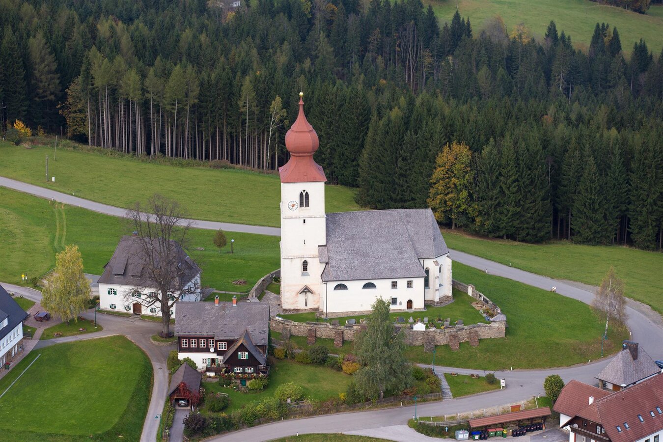
Wallfahrtskirche Maria Osterwitz | © Kath. Kirche Stmk./Hr. Schiffer | Herr Schiffer
1/1

What the weather will be like Deutschlandsberg (370m)
Today, 10.10.2026
At first cloudy or foggy, then some sunshine, and finally scattered rain showers.Morning

8°C
sr.Regenwahrscheinlichkeit
0%
sr.Windstärke
0 km/h
Noon

15°C
sr.Regenwahrscheinlichkeit
5%
sr.Windstärke
5 km/h
Night

13°C
sr.Regenwahrscheinlichkeit
60%
sr.Windstärke
5 km/h
Tomorrow, 11.10.2026
Dry and partly sunny throughout the day, with cloudy periods from time to time.Morning
9°C
sr.Regenwahrscheinlichkeit
35%
sr.Windstärke
0 km/h
Noon

17°C
sr.Regenwahrscheinlichkeit
40%
sr.Windstärke
5 km/h
Night
12°C
sr.Regenwahrscheinlichkeit
45%
sr.Windstärke
0 km/h
Forecast
12.10.2026
6°C
16°C
13.10.2026

4°C
17°C
14.10.2026
3°C
18°C
