


Oberlaufenegger Schilcher Circular Route S
Characteristics
SkillThe tour in numbers
Level of difficulty
challenging
Route
11,1 km
Time
4:00 h
Uphill
480 hm
Downhill
470 hm
Highest point
800 m
This hike around Deutschlandsberg impresses with its diverse landscape – from gentle meadow paths to idyllic forest trails and impressive viewpoints.
You start at Deutschlandsberg train station and walk to Fabrikstraße. Turn right, cross the railway tracks, and continue along Freiländerstraße until you reach a fork in the road. Go straight ahead on Teichweg to a junction with two hiking trails that rejoin after about 1 km. Continue along Teichweg past the Mahler winery, then take a steep path through a meadow (sheep pasture) to Franz-Gröblbauerstraße. Turn right and enjoy the beautiful view until you reach a higher natural stone wall (meeting point with other hiking options).
Then hike uphill to the hillside path. Turn left onto Gröbelbauerstraße and continue until just before Freiländerstraße, where you turn right into the forest. (After about 100 meters, you also have the option of hiking down into the Wildbach valley.) After at least 2 km along the forest path, you will reach the Moserjosl farmstead on Lärchenweg and continue along this path to the Stöckl farmstead (formerly a wine tavern). Here, the S-path meets trail no. 553, and you hike downhill via a forest path to the Kogelreinisch farmstead on Oberlaufeneggerstraße. Shortly after, turn left onto a field and forest path that leads downhill to the municipal reservoir (castle viewpoint).
Walk briefly along the asphalt road, then take the hiking trail straight ahead through the forest. You'll come to the wayside cross (also known as the Kortschak Cross) and ascend to the Urbani Chapel. Continue to the Jauk wine tavern, then descend the Schlossweg (Castle Path) to the Resch wine tavern. Take the narrow footpath to the Stiftungspark (Foundation Park), continue onto Villenstraße (Villa Street), and cross the railway line. Continue onto Florian-Pojatzi-Straße, then cross Fabrikstraße (Factory Street). You are now back on Bahnhofstraße (Station Street) and walk back to the train station.
Then hike uphill to the hillside path. Turn left onto Gröbelbauerstraße and continue until just before Freiländerstraße, where you turn right into the forest. (After about 100 meters, you also have the option of hiking down into the Wildbach valley.) After at least 2 km along the forest path, you will reach the Moserjosl farmstead on Lärchenweg and continue along this path to the Stöckl farmstead (formerly a wine tavern). Here, the S-path meets trail no. 553, and you hike downhill via a forest path to the Kogelreinisch farmstead on Oberlaufeneggerstraße. Shortly after, turn left onto a field and forest path that leads downhill to the municipal reservoir (castle viewpoint).
Walk briefly along the asphalt road, then take the hiking trail straight ahead through the forest. You'll come to the wayside cross (also known as the Kortschak Cross) and ascend to the Urbani Chapel. Continue to the Jauk wine tavern, then descend the Schlossweg (Castle Path) to the Resch wine tavern. Take the narrow footpath to the Stiftungspark (Foundation Park), continue onto Villenstraße (Villa Street), and cross the railway line. Continue onto Florian-Pojatzi-Straße, then cross Fabrikstraße (Factory Street). You are now back on Bahnhofstraße (Station Street) and walk back to the train station.
Best season
January
February
March
April
May
June
July
August
September
October
November
December
More information
Coming from Graz via the A9, at the Graz-West motorway junction take the A2 towards Klagenfurt. Take the Lieboch exit and follow the B76 towards Lannach-Deutschlandsberg.
At the train station in Deutschlandsberg.
At the train station in Deutschlandsberg.
Wegbeschreibung entgegen dem Uhrzeigersinn:
Wir starten beim Bahnhof Deutschlandsberg, gehen die Bahnhofstraße (250 m nach Westen) bis zur Fabrikstraße und überqueren dort die Bahnlinie. Dann Richtung Freiländer Straße bis zum Anstieg, dort biegen wir dann rechts in den Teichweg ein und gehen beim Weingut Mahler vorbei. Weiter bis zum Ende der Asphaltstraße und dort dann den steilen Wiesenweg (Schafkoppel) hinauf bis zur Franz-Gröblbauer-Straße. Dort dann weiter Richtung Osten (ca. 300 m) bis zu einem Graben mit beidseitiger hoher Natursteinmauer.Alternative: Wahlweise ist auch ein Anstieg zu diesem Punkt möglich, indem wir den Teichweg schon nach 300 m verlassen und rechts in den Mittersulzweg abzweigen. Dort gehen wir dann beim Hof vlg. Trahütterl zwischen Haus und Stall durch, über ungleichmäßige Steinstufen (Haus-am-Hang-Steig) und dann über einen Wiesenweg zur Franz-Gröblbauer-Straße hinauf. Auf dieser gehen wir dann ca. 100 m Richtung Westen bis zu einem Graben mit beidseitiger hoher Natursteinmauer.Schilcherweg, Großer Oberlaufenegger Rundweg Variante 2.Im Graben führt nun der Weg hinauf bis zum Hangweg, dann gehen wir am Hangweg weiter, die Franz-Gröblbauer-Straße hinauf (ca. 500 m) bis zur Hofeinfahrt vlg. Posch, rechts in den Waldweg abbiegen und auf diesem ca. 2 km bis zur Freiländer Straße bzw. zum ehem. Gasthof Moserjosl und Bauernhof Moserjosl (Lärchenweg) weitergehen. Am Lärchenweg gehen wir dann weiter zum Bauernhof und Buschenschank Stöckl, über den Feldweg, weiter bergab über einen Waldsteig zum Bauernhof Koglreinisch an der Oberlaufenegger Straße, dann zweigen wir links in einen Feldweg ein, der in einen Waldsteig mündet und bis zum Hochbehälter der Stadtgemeinde Deutschlandsberg hinunterführt (Burgblick). Dann 100 m entlang der Asphaltstraße, danach nehmen wir in gerader Richtung den Wandersteig durch den Wald, dort kommen wir zum Wegschoadkreuz (auch Kortschakkreuz) und gehen dann den Wanderweg durch den Wald hinauf zum Gasthof Stöcklpeter bzw. zur Urbanikapelle. Dort gehen wir Richtung Buschenschank Jauk weiter, den Schlossweg bergab zum Buschenschank Resch und auf die Bürgerwaldstraße. Von hier nehmen wir den schmalen Fußweg zum Stiftungspark, weiter in die Villenstraße und überqueren dort die Bahnlinie. Weiter in die Florian-Pojatzi-Straße, dort überqueren wir dann die Fabrikstraße. Wir sind nun in der Bahnhofstraße und gehen dort weiter bis zum Bahnhof (Endpunkt).
Small rucksack with water bottle, light hiking boots, Nordic walking poles, sunscreen, umbrella, mobile phone, detailed map/hiking map of the hike.
Please take into account your personal fitness level, the weather forecast and the current opening hours of refreshment stops. No liability can be accepted for the accuracy of the information provided.
Besorgen Sie sich vor dem Beginn der Wanderung die Wanderkarte "Über Stock und Stein durchs Schilcherland" im Tourismusverband Schilcherland Deutschlandsberg.
Many starting points for our hikes in southern Styria can also be reached by public transport.
For a relaxed and sustainable journey, we recommend travelling by bus and train wherever possible. Depending on the region, additional local transport options are available.
This allows you to start your tour stress-free while also contributing to climate and nature conservation.
All information on public transport,
local mobility services and timetables can be found at: www.suedsteiermark.com/arrival
The train station is located directly in Deutschlandsberg, at the starting and ending point of the hike.
South Styria Tourist Association, Tel.: +43 (5) 7730, 8530 Deutschlandsberg, Hauptplatz 40
Map & downloads
Gallery
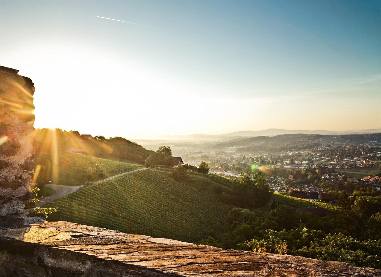
Blick auf Deutschlandsberg | © Lupi Spuma | TV Südsteiermark
1/1

What the weather will be like Deutschlandsberg (370m)
Today, 09.10.2026
Scattered showers in the beginning, gradually becoming sunny in the afternoon.Morning

11°C
sr.Regenwahrscheinlichkeit
95%
sr.Windstärke
0 km/h
Noon

15°C
sr.Regenwahrscheinlichkeit
30%
sr.Windstärke
5 km/h
Night

12°C
sr.Regenwahrscheinlichkeit
15%
sr.Windstärke
0 km/h
Tomorrow, 10.10.2026
Partly sunny in the morning, gradually becoming cloudy in the afternoon.Morning

9°C
sr.Regenwahrscheinlichkeit
5%
sr.Windstärke
0 km/h
Noon
16°C
sr.Regenwahrscheinlichkeit
25%
sr.Windstärke
5 km/h
Night
12°C
sr.Regenwahrscheinlichkeit
50%
sr.Windstärke
0 km/h
Forecast
11.10.2026
9°C
18°C
12.10.2026
6°C
16°C
13.10.2026

4°C
17°C
