


Around the Josefiberg Nr. 9
Characteristics
SkillThe tour in numbers
Level of difficulty
easy
Route
3,1 km
Time
1:15 h
Uphill
100 hm
Downhill
100 hm
Highest point
525 m
A short hike up Bad Schwanberg’s popular local hill.
You are on one of the most popular walks for many residents of Bad Schwanberg, where there is plenty to discover. It leads up to the local hill, the Josefiberg. You’ll only have to put in a short effort to climb up to Schwanberg Castle, but once you reach the top, you’ll be rewarded with a breathtaking view. At St Joseph’s Church, where the market town of Bad Schwanberg and the fertile valley of the Schwarze Sulm lie at your feet, you’ll be captivated and will remember this little corner of the world for a long time to come.
The path runs along the monastery wall, past the “Heilmoorbad Schwanberg”. It then continues to the right along the river Schwarzen Sulm. Shortly after the weir, the path climbs uphill. You will reach Schwanberg Castle, and the signpost leads on to St Joseph’s Church. Follow the Way of the Cross or the road to return to the market town.
The path runs along the monastery wall, past the “Heilmoorbad Schwanberg”. It then continues to the right along the river Schwarzen Sulm. Shortly after the weir, the path climbs uphill. You will reach Schwanberg Castle, and the signpost leads on to St Joseph’s Church. Follow the Way of the Cross or the road to return to the market town.
Best season
January
February
March
April
May
June
July
August
September
October
November
December
More information
Coming from Graz via the A9, take the A2 towards Klagenfurt at the Graz-West motorway junction. Take the Lieboch exit and follow the B76 towards Lannach-Deutschlandsberg-Bad-Schwanberg.
There are plenty of parking spaces available in the town centre. Long-term parking is available at Car Park 1 at the municipal depot in Bad Schwanberg.
There are plenty of parking spaces available in the town centre. Long-term parking is available at Car Park 1 at the municipal depot in Bad Schwanberg.
Entlang der Klostermauer führt der Weg vorbei am "Heilmoorbad Schwanberg". Danach geht es rechts am Fluss der Schwarzen Sulm weiter. Kurz nach dem Stauwerk geht es bergan weiter. Sie gelangen zum Schloss Schwanberg und die Markierung führt weiter zur Josefikirche. Den Kreuzweg oder der Straße nach, gelangen Sie wieder in den Markt.
Small rucksack with water bottle, light hiking boots, Nordic walking poles, sunscreen, umbrella, mobile phone, detailed map/hiking map of the hike.
Please take into account your personal fitness level, the weather forecast and the current opening hours of refreshment stops. No liability can be accepted for the accuracy of the information provided.
The key to St Joseph’s Church can be collected from the tourist information office, the Heilmoorbad Schwanberg, the Hotel ‘Zum Schwan’ and the Hotel ‘Zur alten Post’.
Many starting points for our hikes in southern Styria can also be reached by public transport.
For a relaxed and sustainable journey, we recommend travelling by bus and train wherever possible. Depending on the region, additional local transport options are available.
This allows you to start your tour stress-free while also contributing to climate and nature conservation.
All information on public transport,
local mobility services and timetables can be found at: www.suedsteiermark.com/arrival
The nearest railway station is in Bad Schwanberg.
Information offices:
Bad Schwanberg Tourist Office, Tel.: +43 (5) 7730 610, 8541 Bad Schwanberg, Hauptplatz 1
South Styria Tourist Association, Tel.: +43 (5) 7730, 8530 Deutschlandsberg, Hauptplatz 40
Map & downloads
Gallery
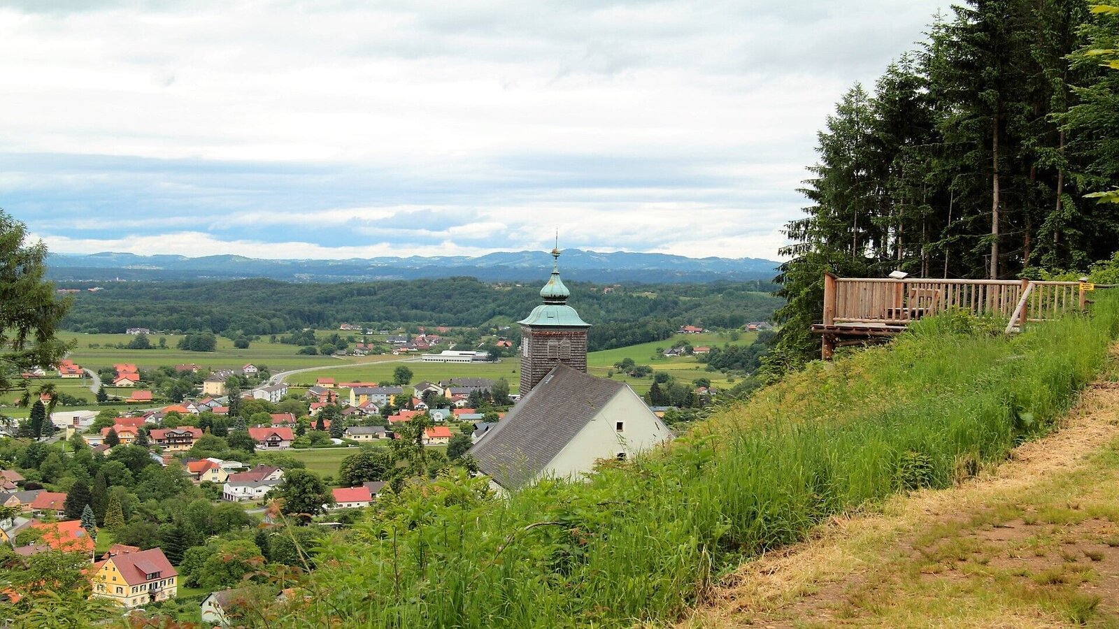
Am Josefiberg | © TVB Südsteiermark/Christa Ortner | Christa Ortner
1/1

What the weather will be like Schwanberg (418m)
Today, 04.10.2026
Dry and sunny throughout the day with hardly any clouds.Morning

4°C
sr.Regenwahrscheinlichkeit
0%
sr.Windstärke
0 km/h
Noon
20°C
sr.Regenwahrscheinlichkeit
0%
sr.Windstärke
5 km/h
Night
11°C
sr.Regenwahrscheinlichkeit
0%
sr.Windstärke
0 km/h
Tomorrow, 05.10.2026
Dry and partly sunny throughout the day, with cloudy periods from time to time.Morning

6°C
sr.Regenwahrscheinlichkeit
0%
sr.Windstärke
0 km/h
Noon
19°C
sr.Regenwahrscheinlichkeit
0%
sr.Windstärke
5 km/h
Night
11°C
sr.Regenwahrscheinlichkeit
5%
sr.Windstärke
0 km/h
Forecast
06.10.2026
5°C
22°C
07.10.2026
7°C
22°C
08.10.2026

9°C
19°C
