


Closed
WinterHikingWonder
Characteristics
SkillThe tour in numbers
Level of difficulty
easy
Route
12,0 km
Time
3:23 h
Uphill
153 hm
Downhill
231 hm
Highest point
1278 m
“Die WinterWide”: Discover the enchanting winter side of the Murtal adventure region: The well-groomed circular tour in Hohentauern covers around 12 km – an ideal mix of exercise and enjoyment at a leisurely pace. From the very first step, you will be transported to a tranquil winter landscape full of magical moments – snow-covered slopes, clear air, and sweeping views that will leave you in awe.
Magnificent views and a fantastic panorama - it's hard not to be amazed on the winter hiking trail in Hohentauern. The groomed 12 km route takes you on a long loop through the snow-covered winter landscape, while the leisurely pace offers plenty of time to discover the beauty of nature and wildlife. You can start your tour at different starting points and choose shorter or longer variants depending on your stamina. Culinary delights await all hardy hikers, for example in the Alpenhotel Lanz or at the top of the pass, all refreshment stops are located directly in Hohentauern in the Murtal adventure region.
Best season
January
February
March
April
May
June
July
August
September
October
November
December
More information
From Vienna (approx. 2.5 hours):
-
Take the A2 towards Graz.
-
At exit 161-St. Michael junction, change to the A9 towards Linz/Salzburg.
-
Exit at 100-Trieben.
-
Continue on the B114 towards Judenburg/Hohentauern.
-
Follow the B114 to the Hohentauern Pass summit.
From Graz (approx. 1.5 hours):
-
Take the A9 towards Linz/Salzburg.
-
Exit at 100-Trieben.
-
Continue on the B114 towards Judenburg/Hohentauern.
-
Follow the B114 to the Hohentauern Pass summit.
From Salzburg (approx. 2.5 hours):
-
Take the A10 towards Villach.
-
At exit 63-Altenmarkt, change to the B320 towards Radstadt.
-
Continue via Schladming to Liezen.
-
Join the A9 towards Graz.
-
Exit at 100-Trieben.
-
Continue on the B114 towards Judenburg/Hohentauern.
-
Follow the B114 to the Hohentauern Pass summit.
Pass summit parking lot
Pile dwelling village
Trail center
Ski center Moscher
All parking is free of charge
The winter hiking trail in Hohentauern stretches over approx. 12 km. However, it is not always necessary to hike all 12 km, as there are several entry and exit points along the trail. The trail can be walked on with winter boots without any additional equipment as everything is perfectly well prepared. You hike in the forest, next to the cross-country ski trail or on open meadows. Simply follow the prepared trail and the blue winter hiking trail signs. Your four-legged friend may also accompany you on the winter hike, but he must be kept on a leash and you must dispose his droppings in one of the waste bins along the way.
Equipment for Winter Hiking
- Sturdy, waterproof hiking boots with good grip
- Backpack with rain cover
- Layering system: functional underwear, mid-layer, weatherproof winter jacket
- Warm hiking pants, gaiters if needed
- Gloves (plus a spare pair), hat/headband, scarf/buff
- Sunglasses and sun protection
- Hiking poles (with winter baskets)
- Water bottle or thermos, snacks
- First aid kit, emergency blanket, personal medication
- Headlamp, mobile phone with emergency numbers, hiking map or GPS
Additional safety gear in alpine terrain:
For snowshoe or ski tours in unsecured alpine areas, an avalanche
transceiver, probe, and shovel are essential. They are crucial for enabling
quick rescue in case of an emergency.
Even a basic winter hike needs proper preparation:
- Mountain weather for Styria (including Murtal): wetter.ORF – Bergwetter Steiermark
- Emergency numbers: Mountain Rescue 140 | EU Emergency Number 112
Along the winter hiking trail there are plenty of opportunities to rest and enjoy this beautiful area at its best
Unfortunately, this tour cannot be reached by public transport.
- Recommendation: Travel by car or organize a carpool.
More information at www.murtal.at and at the Hohentauern tourist office, Tel.: +43 3577 26600, Tauernstraße 15, 8785 Hohentauern. You can find a route map in the Hohentauern cross-country skiing folder, otherwise simply follow the prepared route and the blue signs
Map & downloads
Gallery
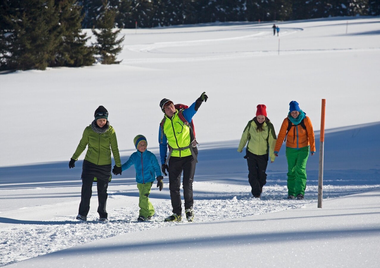
winterwanderwunder_img_15356690 | © Erlebnisregion Murtal | Tourismusverband Murtal Standort Hohentauern
1/2
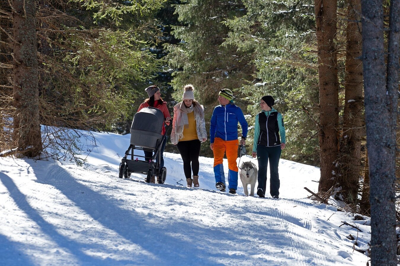
winterwanderwunder_img_75685268 | © Erlebnisregion Murtal | Herbert Raffalt
2/2

What the weather will be like Hohentauern (1272m)
Today, 26.10.2026
Snow showers continuing into the afternoon, then clouds breaking up.Morning

1°C
sr.Regenwahrscheinlichkeit
95%
sr.Windstärke
15 km/h
Noon
6°C
sr.Regenwahrscheinlichkeit
60%
sr.Windstärke
15 km/h
Night

1°C
sr.Regenwahrscheinlichkeit
5%
sr.Windstärke
5 km/h
Tomorrow, 27.10.2026
Sunny and cloudy periods will alternate throughout the day.Morning
0°C
sr.Regenwahrscheinlichkeit
0%
sr.Windstärke
5 km/h
Noon

9°C
sr.Regenwahrscheinlichkeit
0%
sr.Windstärke
5 km/h
Night
3°C
sr.Regenwahrscheinlichkeit
0%
sr.Windstärke
5 km/h
Forecast
28.10.2026
2°C
10°C
29.10.2026
0°C
9°C
30.10.2026

-1°C
8°C
