


Schauplätze Hohentauern
Characteristics
SkillThe tour in numbers
Level of difficulty
easy
Route
5,1 km
Time
1:30 h
Uphill
107 hm
Downhill
116 hm
Highest point
1277 m
The Schauplatzwanderung Hohentauern is a fun and interesting walk. It leads past a total of ten stations, at which several boards inform ramblers about the past of Hohentauern, the locals and the unique natural landscape.
Experience the diversity of nature in a playful way along the water trail at various stations and on the barefoot trail and get to know Hohentauern at the 10 "locations". The rock and cave world, where you can immerse yourself in the history of mining in Hohentauern or whizz down into the valley on the longest slope slide in Styria, is about halfway along the trail
Best season
January
March
March
April
May
June
July
August
September
October
November
December
More information
Coming via the B114, drive to the centre of the village or to the top of the Hohentauern pass.
Parking is best at the large car park at the top of the pass
Parking is best at the large car park at the top of the pass
This 5.6-kilometre-long hike starts at Alpenhotel Lanz. From there, the route takes you through town, past the monument of heroes and along the exciting water path to the world of rocks and caves. Über den Irzen geht es schließlich wieder zurück zum Ausgangspunkt. The hike takes about 1.5 hours.
For a conflict-free coexistence on alpine pastures and meadows it is important to observe a few rules, especially when traveling with dogs. (Source: www.sichere-almen.at - 06/2021)
- Avoid contact with grazing animals, do not feed them, keep a safe distance!
- Keep calm, do not frighten grazing animals!
- Mother cows protect their calves. Avoid encounters between mother cows and dogs!
- Always keep dogs under control and on a short leash. If an attack by a grazing animal is foreseeable: Immediately unleash!
- Do not leave hiking trails on alpine pastures and meadows!
- If grazing animals block the way, avoid them as far as possible!
- When grazing animals approach: Stay calm, do not turn your back, avoid the animals!
- Leave the grazing area quickly at the first sign of restlessness of the animals!Fences must be respected!
- If there is a gate, use it, then close it well and cross the pasture quickly!
- Treat the people working here, nature and the animals with respect!
A few tips for correct and fair behavior in the forest: (Source: www.bundesforste.at - 6/2021)
- Hikers should avoid visits to the forest about 1.5 hours before sunrise and after sunset, as wildlife is especially active during this time.
- Plastic bottles, handkerchiefs, cigarette butts & Co have no place in the forest! Please make sure that you do not leave any trash in the forest.
- Camping and making fire - is strictly forbidden in the forest!
- In principle, each person is allowed to collect 2 kg of mushrooms and berries per day for personal use in the forest. It is only forbidden if the forest owner expressly forbids it.
Alpine emergency call:
Mountain rescue emergency number: 140
EU emergency number: 112
Weather service: www.zamg.ac.at
Direct link mountain weather Styria: https://www.zamg.ac.at/cms/de/wetter/produkte-und-services/bergwetter/steiermark
- Backpack with rain cover
- Telescopic / hiking poles
- Mountain / hiking boots
- Gloves: waterproof and warming
- Headgear / sunglasses
- Outerwear: Onion layer system, T-shirt, sweater, jacket and winter jacket with hood
- Hiking pants
- Seat pad
- Drinking bottle / thermos flask (on cooler days a warming drink is pleasant)
- Snack
- First aid kit with blister plaster and tick tongs
Other important equipment
- Route descriptionDetailed
- plan of the hike
- Hiking map: For overview a map in scale 1 : 50 000 of the respective region
- GPS device
- cell phone
History QUIZES: The folder is a must-have for your hike! Hidden in the folder is a participation card and quiz. With the correct answer and the HOHENTAUERN guest card, you will receive a small surprise at the tourist office.
Information on public transportation can be found at www.verbundlinie.at
More information at www.murtal.at/wandern You can also find this tour on the following hiking map:
Region Murtal - Hiking map 3
The hiking maps 1,2&3 - you can get for free at the tourism association Murtal - info@murtal.at - Tel.: +43 3577 26600
You can also find more information about the region on - www.murtal.at
Den Schauplätzefolder erhaltet ihr beim Tourismusbüro und vielen Berieben in Hohentauern
Map & downloads
Gallery
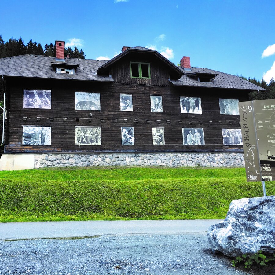
Irzen Haus am Schauplatzweg | © Erlebnisregion Murtal | Peter Fritz
1/1

What the weather will be like Hohentauern (1272m)
Today, 29.09.2026
Dry and sunny throughout the day with hardly any clouds.Morning

8°C
sr.Regenwahrscheinlichkeit
0%
sr.Windstärke
5 km/h
Noon
17°C
sr.Regenwahrscheinlichkeit
0%
sr.Windstärke
10 km/h
Night
9°C
sr.Regenwahrscheinlichkeit
0%
sr.Windstärke
10 km/h
Tomorrow, 30.09.2026
Dry and sunny throughout the day with hardly any clouds.Morning
5°C
sr.Regenwahrscheinlichkeit
0%
sr.Windstärke
5 km/h
Noon
16°C
sr.Regenwahrscheinlichkeit
0%
sr.Windstärke
10 km/h
Night
9°C
sr.Regenwahrscheinlichkeit
0%
sr.Windstärke
10 km/h
Forecast
01.10.2026
5°C
18°C
02.10.2026

5°C
17°C
03.10.2026
4°C
17°C
