


Römerweg
Characteristics
SkillThe tour in numbers
Level of difficulty
easy
Route
6,6 km
Time
2:00 h
Uphill
90 hm
Downhill
90 hm
Highest point
920 m
On the Roman Trail in the Murtal adventure region, you hike along the old cart path over the Roman bridge to the road to Oberzeiring. The way back leads through the Birkach forest where the gallows - a place of judgement - is located.
You follow the Katzling cycle path in the direction of Oberzeiring in the Murtal adventure region, where you go to Unterwinden and on to Oberwinden. On a cart path you come over the Roman bridge (13th century) to the road to Oberzeiring. The path leads to the right along the stream to Unterzeiring. In the Birkach forest is the gallows as the Murtaler say a judgement place which played a decisive role in early times. There were records that the practice of wheeling was also carried out in the district court of Offenburg-Reifenstein but this was only proven by the archaeological excavations. Now you hike further via Winden back to the starting point.
Best season
January
February
March
April
May
June
July
August
September
October
November
December
More information
The "Katzlinger Wirt" is located in the municipality of Oberkurzheim in the district of Katzling.
You can park opposite or directly at the Katzlinger Wirt!
You can park opposite or directly at the Katzlinger Wirt!
You follow the cycle path Katzling in the direction of Oberzeiring, where you go to Unterwinden and further to Oberwinden. On a cart path you come over the Roman bridge to the road to Obereiring. The path leads to the right along the stream to Unterzeiring. From the Birkachwald you walk further via Winden back to the starting point.
Basic rules for hikers in the Pölstal...
On the way...With respect for wildlife and the environment!
In the Pölstal special emphasis is placed on the preservation of untouched nature. So that the pleasure of the people does not become a problem for wild animals and nature, it requires consideration measures. For the sake of nature and the environment, correct behavior in the mountains is the top priority for the hiking enthusiast.
- Use designated parking areas- Do not block access roads and please observe local driving bans- Observe information boards at trailheads and stick to recommended marked routes- Avoid approaching wildlife
Before each mountain tour, check your personal condition and estimate your strength correctly. This will determine the length of your tour. Plan each tour carefully. Pay close attention to the required equipment, sufficient provisions and the local weather forecast.Inform acquaintances about your hiking destination, as well as the planned return time if necessary. Always stay on the marked trails. Always close fences and pasture gates. Watch out for falling rocks and do not kick any rocks yourself. Doing so will endanger other hikers. In case of bad weather, sudden indisposition or other difficulties, do not take risks and turn back in time. Avoid approaching wild animals. - Observe from a distance. Keep dogs on a leash. Use designated parking areas, please do not block access roads, and observe local driving restrictions.
What do I need when hiking?The equipment is depending on the difficulty, location and duration of the hiking route,as well as according to your own needs: - sturdy shoes- backpack- clothes suitable for the season- sun protection (glasses, headgear, cream)- small bandages (gauze bandage, plaster, scissors and knife)- orientation aids (hiking maps)- sufficient drinks and provisions- cell phone with emergency numbers- personal medication.
Visit to the Oberzeiring show mine
Refreshment stops: Katzlinger Wirt and Haigl's Hofschenke
Information on public transportation can be found at www.verbundlinie.at
Murtal Region
Katzlinger Wirt: Tel. 03579 7260
The hiking maps 1,2&3 - you can get for free at the tourism association Murtal - info@murtal.at - Tel.: +43 3577 26600You can also find more information about the region on - www.murtal.at
In the Murtal region there are three free hiking maps that show the entire region with the Seetaler Alps, Seckauer-, Wölzer-, Rottenmanner Tauern, Stubalpe and the Pöls- and Murtal. The maps are in scale 1.50.000.Map & downloads
Gallery

Katzlinger Wirt-Außenansicht-Murtal-Steiermark | © Erlebnisregion Murtal | Katzlinger Wirt
1/4
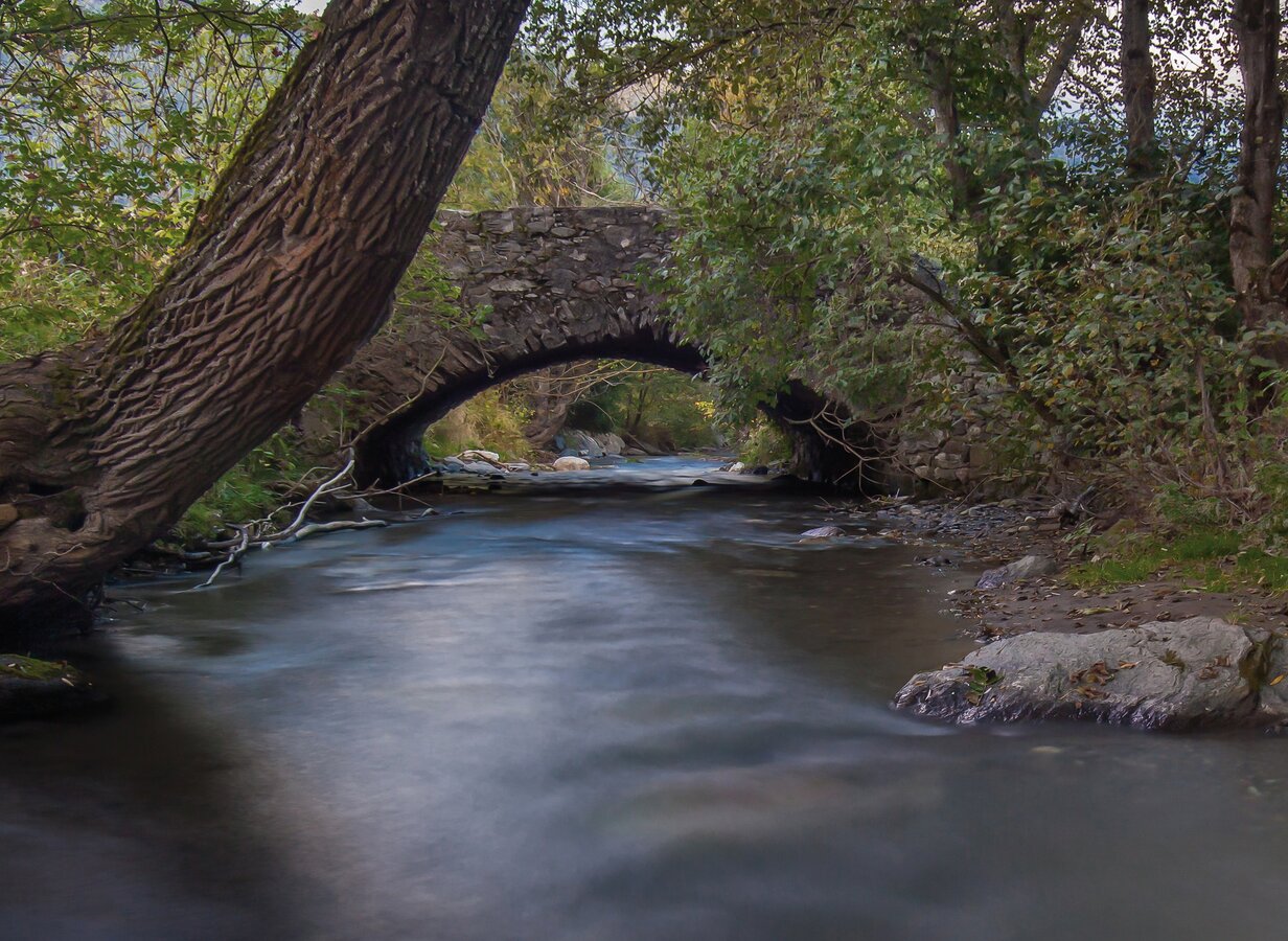
Römerbrücke Oberzeiring | © Erlebnisregion Murtal | Markus Beren
2/4
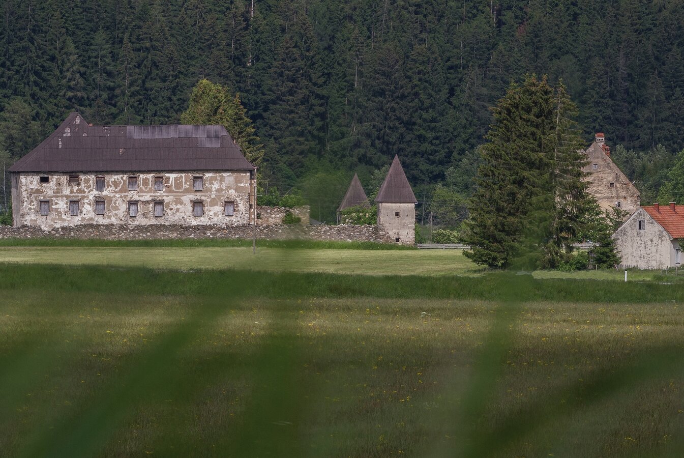
Schloss Hanfelden | © Erlebnisregion Murtal | Markus Beren
3/4

Haigl's Hofschenke | © Tourismusverband Pölstal- Haigl's Hofschenke | Bianca Poier
4/4

What the weather will be like Pöls-Oberkurzheim (790m)
Today, 14.10.2026
Rain and rain showers will end around noon. Dry with a chance of sunny spells afterwards.Morning

7°C
sr.Regenwahrscheinlichkeit
95%
sr.Windstärke
5 km/h
Noon

15°C
sr.Regenwahrscheinlichkeit
70%
sr.Windstärke
5 km/h
Night

9°C
sr.Regenwahrscheinlichkeit
45%
sr.Windstärke
5 km/h
Tomorrow, 15.10.2026
Early clouds will clear to leave the region with a dry and sunny day.Morning
5°C
sr.Regenwahrscheinlichkeit
0%
sr.Windstärke
0 km/h
Noon

16°C
sr.Regenwahrscheinlichkeit
0%
sr.Windstärke
5 km/h
Night

10°C
sr.Regenwahrscheinlichkeit
0%
sr.Windstärke
5 km/h
Forecast
16.10.2026
4°C
17°C
17.10.2026
3°C
16°C
18.10.2026
6°C
15°C
