


Gamskögel, the demanding tour in the Hintertriebental
The tour in numbers
Level of difficulty
challenging
Route
10,9 km
Time
4:00 h
Uphill
1169 hm
Downhill
1169 hm
Highest point
2375 m
The peaks of the Gamskögel tower high in the Hintertriebental valley. After the forest on flat paths, the gentle alpine meadows of the Mödringalm follow. At the end, the steep summit gully awaits us,
The proud peaks of the Gamskögel greet us at the starting point of the tour, at the Bergerhube, 1,198m. A good level of fitness for over 1000 meters in altitude and good hairpin bend technique are essential for this ski tour.
We hike along narrow paths in flat forest terrain to the beautifully situated Mödringalm. Leaving the forest behind us, the imposing Gamskögel peaks appear in front of us.
Crossing at the foot of the rugged rocks, past the Königin, we reach the start of the gully that takes us to the summit. This is where our hairpin bend skills are tested! Once we have conquered the gully, we have already reached the summit! We are standing on the highest point of the Triebener Tauern!
Best season
January
February
March
April
May
June
July
August
September
October
November
December
More information
From Vienna (approx. 2.5–3 hours):
-
Take the A2 towards Graz.
-
At 161-St. Michael junction, change to the S36 towards Judenburg.
-
Exit at Judenburg-Ost.
-
Continue on the B114 towards Trieben/Hohentauern.
-
In Trieben, turn into the Triebental valley.
-
Follow the road to the end of the valley to the Bergerhube (parking available).
From Graz (approx. 1.5–2 hours):
-
Take the A9 towards Linz/Salzburg.
-
Exit at 100-Trieben.
-
Continue on the B114 towards Judenburg.
-
In Trieben, turn into the Triebental valley.
-
Follow the road to the end of the valley to the Bergerhube (parking available).
From Salzburg (approx. 2.5–3 hours):
-
Take the A10 towards Villach.
-
At exit 63-Altenmarkt, change to the B320 towards Radstadt/Schladming.
-
Continue via Schladming to Liezen.
-
Join the A9 towards Graz.
-
Exit at 100-Trieben.
-
Continue on the B114 towards Judenburg.
-
In Trieben, turn into the Triebental valley.
-
Follow the road to the end of the valley to the Bergerhube (parking available).
Bergerhube parking lot, fee required!
From the Bergerhube, we choose the path either via the large meadow (south of the Bergerhube) or the marked path towards Gamskögel. At the end of the meadow you meet the marked path again. Follow this path and take care not to take the wrong path at the turn-off to Kettentörl (keep right towards Gamskögel).
At around 1400 m, pay attention to the avalanche paths of the Kleiner Griesstein. You reach this area, which is easy to recognize, when you leave the forest at about 1400m and before you reach the forest road.
Leave the forest road at the hairpin bend, continue south along the small slope and reach the Mödringhütte, 1467m. Now follow the summer path to the Mödrigalm.
At around 1650m, leave this and head southwest through the forest and alder belt towards the imposing walls of the Gamskögel. At around 1800m, you cross under the walls, over the alder-covered slopes in a westerly direction. The route leads through the wide gully between Königin and Gamskögel. At the end of this gully we reach a plateau at 2,060m.
Now we have the long summit gully ahead of us. We reach the ridge in many hairpin bends. At the top, the terrain is flatter again and we quickly reach the summit. The descent follows the ascent route.
Equipment for Ski Touring
- Touring skis with skins, bindings, and compatible ski touring boots
- Crampons (ski crampons) for icy sections
- Adjustable ski poles with winter baskets
- Backpack with ski attachment system
- Layering system: functional underwear, mid-layer, insulating jacket, wind- & waterproof shell
- Touring pants, gaiters if needed
- Helmet (recommended for descents and rocky terrain)
- Gloves (spare pair recommended), hat, headband, buff
- Ski goggles, sunglasses, and sun protection
- Water bottle or thermos, high-energy snacks
- First aid kit, bivy sack, personal medication
- Headlamp, mobile phone with emergency numbers, map or GPS
Essential safety gear in alpine terrain:
For ski touring, an avalanche transceiver, probe, and shovel are
mandatory. Equally important are proper training in their use and up-to-date
information on weather and avalanche conditions.
For ski touring, up-to-date weather and avalanche information is vital:
- Mountain weather Styria (including Murtal): wetter.ORF – Bergwetter Steiermark
- Avalanche bulletin Austria: lawine.at
- Emergency numbers: Mountain Rescue 140 | EU Emergency Number 112
Don't miss the Bergerhube, soup and pastries!
Unfortunately, this tour cannot be reached by public transport.
- Recommendation: Travel by car or organize a carpool.
Guided tours, avalanche seminars and ski technique courses for ski tourers:
Gundula Tackner
Alpine school on the Tauern
ÖK 130 Schitourenparadies Steiermark, Günter und Luise AuferbauerSchitouren Obersteiermark, 50 traumhafte Touren, Paul und Peter Sodamin
Map & downloads
Gallery
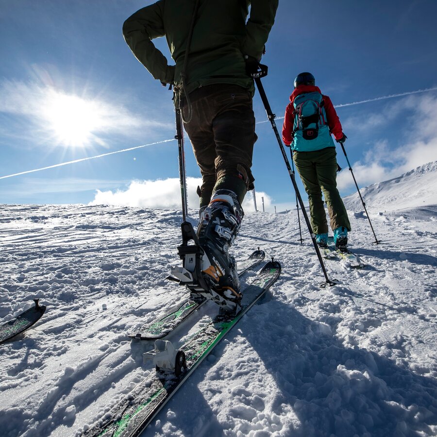
Skitouren | © Erlebnisregion Murtal | Tom Lamm Steiermark
1/2
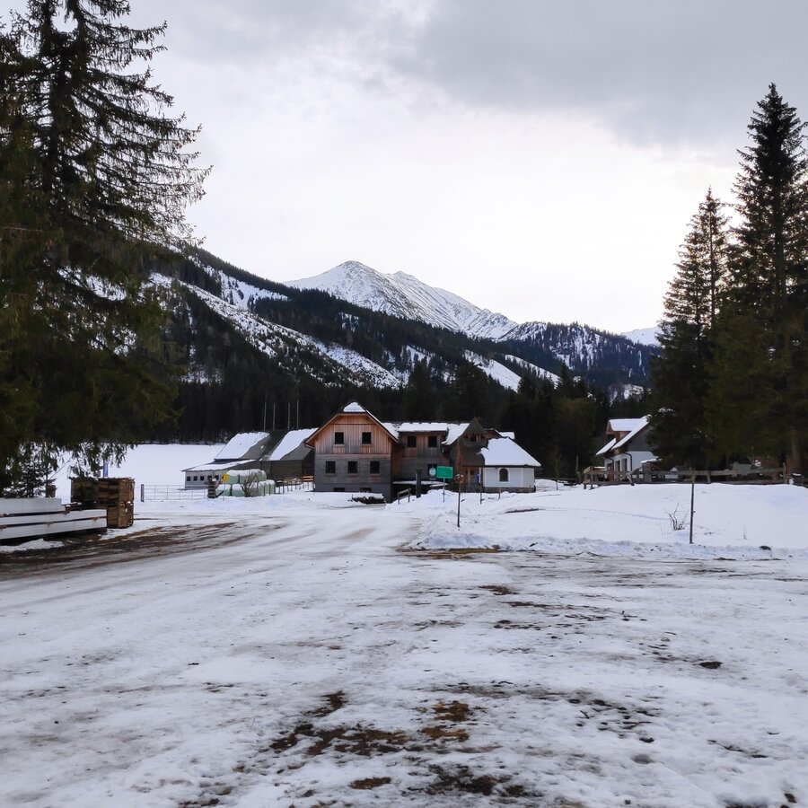
Großer Parkplatz bei der Bergerhube | © WEGES OG | WEGES OG
2/2

What the weather will be like Hohentauern (1272m)
Today, 26.10.2026
Snow showers continuing into the afternoon, then clouds breaking up.Morning

1°C
sr.Regenwahrscheinlichkeit
95%
sr.Windstärke
15 km/h
Noon
6°C
sr.Regenwahrscheinlichkeit
60%
sr.Windstärke
15 km/h
Night

1°C
sr.Regenwahrscheinlichkeit
5%
sr.Windstärke
5 km/h
Tomorrow, 27.10.2026
Sunny and cloudy periods will alternate throughout the day.Morning
0°C
sr.Regenwahrscheinlichkeit
0%
sr.Windstärke
5 km/h
Noon

9°C
sr.Regenwahrscheinlichkeit
0%
sr.Windstärke
5 km/h
Night
3°C
sr.Regenwahrscheinlichkeit
0%
sr.Windstärke
5 km/h
Forecast
28.10.2026
2°C
10°C
29.10.2026
0°C
9°C
30.10.2026

-1°C
8°C
