


Across the Summits in the West of Graz
Accessible by public transport- Public bus (within 15 minutes walking distance from starting point)
Characteristics
SkillThe tour in numbers
Level of difficulty
medium
Route
16,0 km
Time
6:00 h
Uphill
630 hm
Downhill
650 hm
Highest point
757 m
A long but well-structured summit traverse across Plabutsch and Buchkogel in western Graz, with forest trails, striking viewpoints and several places to stop for refreshments.
Description EN
The route starts in Gösting. Following the Kernstockweg, it crosses several elevations along the western edge of Graz through the Plabutsch and Buchkogel area. The climb to Fürstenstand, the highest point in Graz, initially leads through shady woodland. Whether taking the steeper or more moderate option, both routes lead to wide views across the Graz Basin and the surrounding countryside.
Passing the transmission mast, the route continues towards Mühlberg and descends along natural forest trails to Gaisbergsattel. Via Thalerseestraße and through the forest, the trail continues to St. Johann und Paul, with its church, playground and viewpoint. The route then climbs again to Buchkogel and Rudolfswarte. The final section descends through sunny paths and shady woodland to Straßgang.
Best season
January
February
March
April
May
June
July
August
September
October
November
December
More information
It is recommended to arrive by public transport! Here are the coordinates for arrival by car.
Paid parking near the starting point.
Paid parking near the starting point.
From Gösting bus stop, Fürstenstand trail 2 climbs to Fürstenstand. At the transmission mast, follow the marked trail towards Gaisbergsattel. Forestry roads lead to Thalerseestraße, then along the road to Gasthof Dorrer. The Ölbergweg opposite leads back into the forest.
The trail continues to St. Johann und Paul, with its church and viewpoint, then climbs to Buchkogel and Rudolfswarte. Via Gasthof Orthacker, the route continues to Florianiberg, with an optional detour to Gasthof Luderbauer.
Trail 2 then descends to Maria im Elend church and continues into Straßgang to the bus stop.
Hiking or mountain boots, hiking poles if needed
Daypack with rain cover
Water bottle, lunch box and snacks
Light rain poncho and/or umbrella
Sun protection
First-aid kit
Mobile phone/GPS device
In winter: microspikes and hiking poles
Daypack with rain cover
Water bottle, lunch box and snacks
Light rain poncho and/or umbrella
Sun protection
First-aid kit
Mobile phone/GPS device
In winter: microspikes and hiking poles
Several access and descent options make it easy to shorten the hike: at Mühlberg to the line 7 terminus, at Gasthof Dorrer with regional bus connections, at Gaisbergsattel with a descent to Thalersee (city bus 48), or at St. Johann und Paul with a descent to Neupauerweg stop (city bus 33).
Getting there: Take bus routes 40, 48 or 65 to Gösting.
Return: Take city bus line 32 and 62 from Straßgang.
Return: Take city bus line 32 and 62 from Straßgang.
Free hiking maps and information:
Graz Region Tourist Board
Herrengasse 16
8010 Graz
T: +43 316 80750, info@regiongraz.at
Graz Region Tourist Board
Herrengasse 16
8010 Graz
T: +43 316 80750, info@regiongraz.at
Map & downloads
Gallery

Kronprinz Rudolf Viewing Tower on Buchkogel | © Harry Schiffer Photodesign | Harry Schiffer
1/6
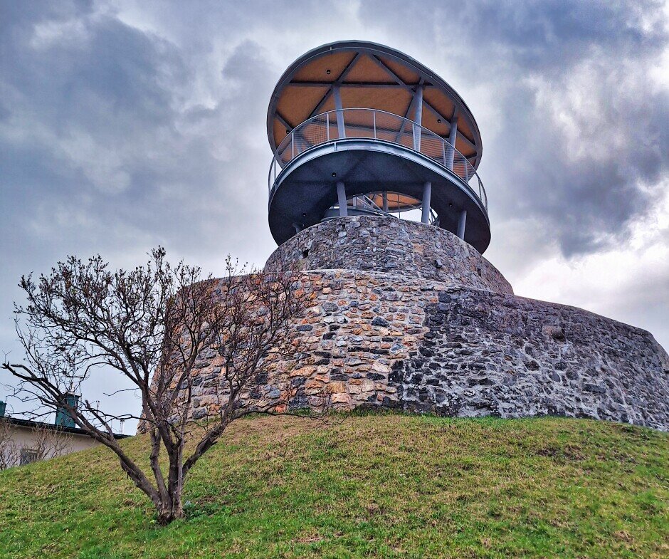
Fürstenstand Viewing Tower | © Region Graz | Weges OG
2/6

View across the Grazer Bergland | © Mias Photoart | Michaela Pfleger
3/6

Sankt Johann und Paul Church | © Region Graz | Harry Schiffer
4/6

View from Buchkogel | © Region Graz | Harry Schiffer
5/6

Florianikirche on Buchkogel | © Region Graz | Harry Schiffer
6/6

What the weather will be like Graz (350m)
Today, 16.10.2026
Early clouds will clear to leave the region with a dry and sunny day.Morning

8°C
sr.Regenwahrscheinlichkeit
0%
sr.Windstärke
5 km/h
Noon
17°C
sr.Regenwahrscheinlichkeit
0%
sr.Windstärke
5 km/h
Night

11°C
sr.Regenwahrscheinlichkeit
0%
sr.Windstärke
5 km/h
Tomorrow, 17.10.2026
Dry and partly sunny throughout the day, with cloudy periods from time to time.Morning
6°C
sr.Regenwahrscheinlichkeit
0%
sr.Windstärke
0 km/h
Noon

17°C
sr.Regenwahrscheinlichkeit
0%
sr.Windstärke
5 km/h
Night
12°C
sr.Regenwahrscheinlichkeit
0%
sr.Windstärke
5 km/h
Forecast
18.10.2026
8°C
18°C
19.10.2026
7°C
17°C
20.10.2026
8°C
15°C

