


From Krautwasch to Gleinalm
Accessible by public transport- Hiking taxi
Characteristics
SkillThe tour in numbers
Level of difficulty
medium
Route
17,3 km
Time
5:30 h
Uphill
660 hm
Downhill
660 hm
Highest point
1599 m
One of the finest hikes in the Gleinalm area leads from Krautwasch across the Gleinalm, with the option to continue to Speikkogel. The mountain church, alpine hut and wide-ranging views make this a true highlight.
The Gleinalm is a meeting point for pilgrims, long-distance hikers and day visitors. The ascent from the former Krautwasch inn leads via Brendlalm to the Gleinalm hut, rewarding hikers with impressive mountain scenery and wide-ranging views. In summer, the famous Lipizzaner mares and their foals can be seen on Brendlalm. Dogs are not allowed here.
From the hut, the hike can be extended to Speikkogel. Without the summit detour, the hike takes around 5:30 hours with 660 metres of elevation gain. Including Speikkogel, allow around 7 hours and 1,055 metres of elevation gain. The summit ascent is particularly rewarding on clear days thanks to its exceptional views.
The Gleinalm hut is open and serviced during the summer months.
Best season
January
February
March
April
May
June
July
August
September
October
November
December
More information
Car:
Drive through Stübingtal to Geistthal. After the former Abraham inn, turn right and continue via Sattelbauer to Krautwasch.
Alternatively, drive via Übelbach and Neuhof towards Krautwasch.
Parking is available on the right side of the road, shortly before the former Krautwasch inn.
Drive through Stübingtal to Geistthal. After the former Abraham inn, turn right and continue via Sattelbauer to Krautwasch.
Alternatively, drive via Übelbach and Neuhof towards Krautwasch.
Parking is available on the right side of the road, shortly before the former Krautwasch inn.
The Gleinalm hiking region is one of the foothills of the Eastern Alps and, with its gentle mountain ridges, is one of the most beautiful hiking areas in green Styria.
For those who enjoy walking, we recommend the high-altitude hike from the closed Krautwasch inn, over the Tiefensattel saddle up to the Gleinalm refuge. The starting point is the Krautwasch inn, which has been closed for years. From here, the trail leads uphill through the forest, partly on a forest road, past the Walzkogelhütte. You soon leave the forest road and walk through forest and clearings to the Kalkkreuz (1364 m). Immediately afterwards you come out into the open with a wonderful view of the mountain ranges to the west. In the section of forest that follows, you will see more than 25 anthills over a 20-minute walk. After a crossroads at the Tiefsattel (1349 m), you cross the summer pastures of the Lippizaner horses from the Piber stud farm south of the Ochsen-Kogel. At the Sandebenkreuz cross, the path branches off to the right and you walk moderately uphill through forest for approx. 20 minutes to the Gleinalmschutzhaus and the Maria Schnee pilgrimage church (1586 m). The descent follows the same route.
From the former Krautwasch inn, the marked trail initially climbs through the forest, partly following a forest road, and passes the Walzkogelhütte. The route soon leaves the forest road and continues through woodland and clearings to Kalkkreuz (1,364 m). Shortly afterwards, the trail opens up to reveal views of the mountain ranges to the west. In another forest section, more than 25 anthills can be spotted along a stretch of around 20 minutes.
After the trail junction at Tiefsattel (1,349 m), the route crosses the summer pastures of the Lipizzaner horses from Piber Stud Farm south of Ochsenkogel. At Sandebenkreuz, turn right and continue moderately uphill through the forest to the Gleinalm hut and Maria Schnee pilgrimage church (1,586 m).
From the hut, the hike can be extended to Speikkogel (1,986 m). The highest summit in the area can be reached in a little over an hour and offers far-reaching views in clear weather. The descent follows the same route.
Sturdy hiking or mountain boots
Enough water and food, as there are no refreshment options for long sections of the route
Sun, rain and cold-weather protection, windproof layer recommended for Speikkogel
First-aid kit
Hiking poles recommended
Enough water and food, as there are no refreshment options for long sections of the route
Sun, rain and cold-weather protection, windproof layer recommended for Speikkogel
First-aid kit
Hiking poles recommended
Speikkogel (1,986 m) is the highest summit in the area and can be reached from the Gleinalm hut in just over an hour. The hut is an ideal base for an overnight stay and multi-day hiking tours. From here, the route can be extended in several directions, for example towards Fensteralm, Plotscherbauer and Übelbach or Rossbachkogel, Terenbachalm and Gaberl.
Note: Due to the Lipizzaner pastures, dogs are not permitted on parts of the route.
Note: Due to the Lipizzaner pastures, dogs are not permitted on parts of the route.
Train:
S1 from Graz to Bruck an der Mur to Peggau-Deutschfeistritz railway station, continue with Steiermärkische Landesbahn to Übelbach (Mon-Sat). Continue by flux shared taxi to Krautwasch (GU 1835).
S1 from Graz to Bruck an der Mur to Peggau-Deutschfeistritz railway station, continue with Steiermärkische Landesbahn to Übelbach (Mon-Sat). Continue by flux shared taxi to Krautwasch (GU 1835).
Free hiking map and information:
Graz Region Tourist Board
Herrengasse 16, 8010 Graz
T +43 316 80750
info@regiongraz.at
Graz Region Tourist Board
Herrengasse 16, 8010 Graz
T +43 316 80750
info@regiongraz.at
Map & downloads
Gallery
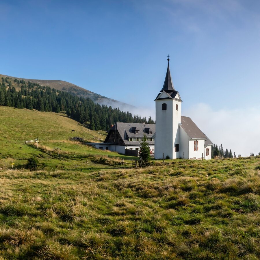
Maria Schnee & Gleinalm Schutzhaus (c) TV Region OberGraz-J. Lunghammer | © Region Graz | J. Lunghammer
1/6
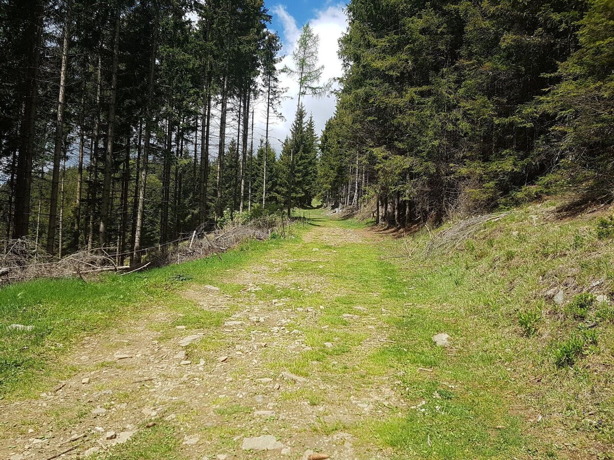
Forest trail to the Gleinalm Hut | © Region Graz | Meike Brucher
2/6
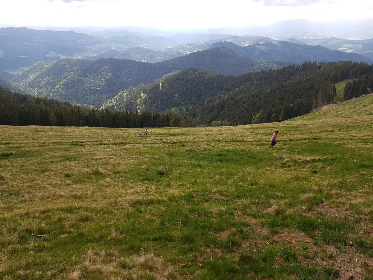
View from the Gleinalm | © Region Graz | Meike Brucher
3/6
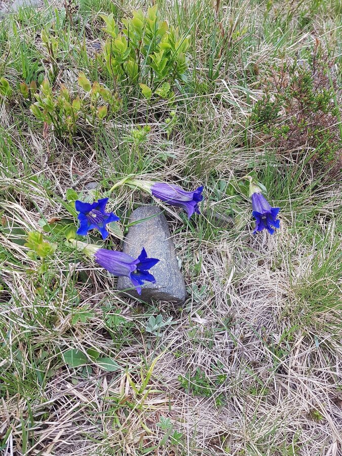
Gentian on the Gleinalm | © Region Graz | Meike Brucher
4/6
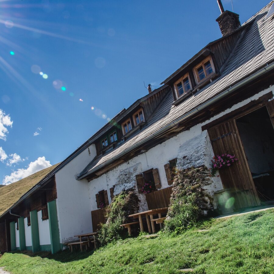
Brendlstall (c) TV Region OberGraz-Mias PhotoArt | © Region Graz | Mias Photoart
5/6
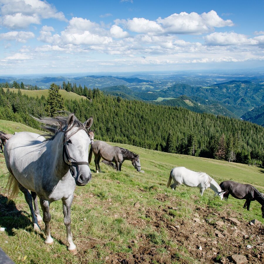
Lipizzanerweiden (c) TV Region OberGraz-Mias PhotoArt | © Region Graz | Mias PhotoArt
6/6

What the weather will be like Geistthal-Södingberg (391m)
Today, 11.10.2026
Partly sunny in the morning, gradually becoming cloudy in the afternoon.Morning

8°C
sr.Regenwahrscheinlichkeit
80%
sr.Windstärke
5 km/h
Noon

15°C
sr.Regenwahrscheinlichkeit
20%
sr.Windstärke
5 km/h
Night
11°C
sr.Regenwahrscheinlichkeit
60%
sr.Windstärke
0 km/h
Tomorrow, 12.10.2026
Showers will die away soon to leave a bright day with plenty of sunshine.Morning

8°C
sr.Regenwahrscheinlichkeit
55%
sr.Windstärke
0 km/h
Noon
13°C
sr.Regenwahrscheinlichkeit
25%
sr.Windstärke
5 km/h
Night

8°C
sr.Regenwahrscheinlichkeit
5%
sr.Windstärke
0 km/h
Forecast
13.10.2026
3°C
15°C
14.10.2026
3°C
16°C
15.10.2026
6°C
17°C

