


Stage 26 From Glacier to Wine North Route Anger - Pöllau
Characteristics
SkillThe tour in numbers
Level of difficulty
medium
Route
15,7 km
Time
5:00 h
Uphill
500 hm
Downhill
550 hm
Highest point
922 m
If the first 25 stages of the hiking route "From Glacier to Wine" lead through mountain regions with peaks and alpine pastures, this stage is, in a way, the start into the fertile hill country of Eastern Styria and the Thermen- & Vulkanland. Eastern Styria is often affectionately called the Garden of Austria because of the variety of culinary products. This impression is also conveyed by this stage, which leads from the historic town of Anger on the northern edge of the apple country, the largest apple-growing area in Austria, into the Pöllauer Tal Nature Park. However, the tour still requires a certain basic level of fitness, because between the Feistritztal and the Pöllauer Tal there are several hundred meters of elevation to overcome, for which you will be rewarded at the latest in Pöllau with all its culinary producers.
This stage of the hiking route "From Glacier to Wine" leads from one culinary specialty to the next. In apple country, there are around five million apple trees that cover the hills along the Apple Road. The reason why the apple is omnipresent here between Anger and St. Ruprecht an der Raab is quite simple: the climate. In the north, we are shielded by the Fischbach Alps, which we passed through on the previous stages, and in the south, the Pannonian climate is already making itself felt, allowing the fruit to thrive in the best possible way. At the end of our stage, in the Pöllauer Tal Nature Park, the world revolves around the pear, or more precisely, the stag pear. It is actually an autumn pear and has absolutely nothing to do with the ruminating antler bearer. Sugar-sweet and highly aromatic in taste, the stag pear is at home in almost every garden in the Pöllauer Tal Nature Park. Whether enjoyed fresh, pressed into juice, fermented into must, boiled down into jelly, distilled into noble brandy or as Kletze: The Hirschbirne is a true original in the truest sense, which every visitor to the Pöllauer Tal Nature Park must have tasted - in whatever form.
Best season
January
February
March
April
May
June
July
August
September
October
November
December
More information
Detaillierte Informationen zur Anreise finden Sie hier.
In Anger there are several parking spaces available around the town center.
From the center of the market town of Anger, we first hike eastwards past the outdoor pool to the tracks of the Feistritztalbahn, which we cross. Leaving the settlement area of Anger, the route continues slightly uphill through the so-called fairytale forest and on to the Berggenuss Holzerbauer (Tel. +43 3177 2293), which is known for its fish specialties as well as its other specialty days. A few meters after the Berggenuss Holzerbauer, we reach a short section of forest again, where the path initially turns off to the right. After leaving this forest, we come to a crossroads on a small local road, where we keep left and follow the rarely used road for just over 2 km. Between two farms, we branch off to the left to reach the highest point of the stage at 929 m above sea level via a pleasant field path.
Now leaving the settlement area of Anger, the further route leads ever so slightly uphill through the so-called fairy tale forest with its romantic mill popular with families to the trout inn Holzerbauer (Tel. +43 3177 2293), which in addition to its - nomen est omen - fish specialties is also known for its other specialty days. A few meters after the Forellgasthof we again reach a short stretch of forest, where the path first turns right. After leaving this forest we reach a crossroads at a small municipal road, where we keep to the left and now follow the rarely used road for a little more than 2 km. Between two farms we turn left to reach the highest point of the stage at 929 m above sea level via a pleasant dirt road.
Alternating between idyllic houses and farms and fields, through shady forests and across meadows, we now hike downhill towards Pöllau, the center of the Pöllauer Tal Nature Park. On the opposite side of the valley, we are greeted and accompanied by the pilgrimage church of Pöllauberg, which is on the program for the next stage of the hiking route "From Glacier to Wine". On this section of the stage we also encounter the signposting of the Hirschbirnweg, a beautifully laid out hiking trail dedicated entirely to the culinary flagship product of the Pöllauer Tal Nature Park, the stag pear. On the last few meters to the beautiful market square with the impressive Pöllau Castle, which is also called the "Styrian St. Peter's Cathedral" due to its shape, we still come to the castle park, which used to be the recreation area of the Augustinian canons and today is open to all and not only invites you to linger, but is also home to an "open-air classroom". Located in the western, slightly elevated part of the park, it offers a magnificent view of Pöllau Castle with the Pöllau Parish Church and the Pöllauberg Pilgrimage Church. A root show garden right next to it offers a deep insight into root system and soil life. At the Hirschbirn hirsch'n information station we learn more about the Pöllauer Hirschbirne and the nature park - the other Hirschbirn hirsch'n stations at businesses in the region are also worth a visit.
But now it's time to get to know the culinary delights - available in the numerous restaurants, Buschenschänken and cafés. For example, let's enjoy tempting pastries and cakes as well as genuine Pöllau gingerbread in the sweet corner, in the stylish courtyard of the Ebner confectionery. The master butcher Buchberger and the butcher Ritter provide with their delicious meat and sausage specialties for real treats. In the farm store you can taste the culinary diversity of the region and take it home with you. With the Genuss-Land map of the GenussRegion Pöllauer Hirschbirne we can find many more shopping tips. With all these delicacies we can strengthen ourselves perfectly for the next stage to Hartberg.
Emergency call mountain rescue: 140
Tips when reporting an emergency – Answer these six WH questions: What happened? How many people are injured? Where did the accident happen (are there GPS coordinates)? Who is reporting the incident (callback number)? When did the accident happen? What is the weather like at the site of the incident?
Proper backpack packing makes many things easier: Pack heavy things first. The water bottle should always be within reach in a side pocket. All the things that are often needed, such as sunglasses, camera or hiking map, belong on top. An emergency kit, including blister plasters, belongs in every rucksack and it is always advisable to dress in layers.
In the Thermen- & Vulkanland region of Styria, Eastern Styria and Southern and Western Styria, the GenussCard opens the door to over 200 excursion destinations when you stay overnight in one of the approximately 100 GenussCard partner establishments. Countless of these GenussCard excursion destinations, ranging from culinary manufactories to bathing lakes and museums, are located directly on the hiking route "From Glacier to Wine".
Accessible by train and bus.
Detailed information about arriving by ÖBB (Austrian Federal Railways) can be found at www.oebb.at or on the Verbundlinie Steiermark website www.busbahnbim.at
With Verbundlinie’s BusBahnBim route planner app, planning your journey has never been easier: simply enter towns and/or addresses, stop names or points of interest to check all bus, train and tram connections in Austria. The app is available free of charge for smartphones – on Google Play and in the App Store
Steiermark Tourismus
Tel. +43 316 4003
If you would like to hire a tour operator, simply book with Steiermark Touristik, the official travel agency of Steiermark Tourismus:
Tel. +43 316 4003 450,
The Steiermark Touren app, available free of charge on Google Play and the App Store (Android, iOS), offers detailed first-hand information: brief facts (length, duration, difficulty, ascent and descent/elevation gain, ratings), map, route descriptions, altimeter, compass, peak finder, navigation along the tour. You can also create your own personal lists of favourite tours and sites, store tours and destinations offline, use social media channels, and much more.
Gratis Pocket Card Wanderroute "Vom Gletscher zum Wein" finden Sie auf www.steiermark.com
Kompass WK221 Grazer Bergland, Fischbacher Alpen, Joglland, Oststeirisches Raabtal, Wechsel www.kompass.at
Freytag & Berndt WK21 Grazer Bergland · Schöckl · Teichalm · Stubenbergsee www.freytagberndt.at
Rother Wanderführer "Vom Gletscher zum Wein": auf 160 Seiten mit 80 Farbabbildungen 60 Höhenprofile, 60 Wanderkärtchen im Maßstab 1:75.000, zwei Übersichtskarten, GPS-Tracks zum Download, Format 11,5 x 16,5 cm, kartoniert mit Polytex-Laminierung, ISBN 978-3-7633-4550-2, www.rother.de
Map & downloads
Gallery
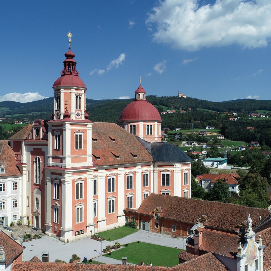
Pöllau parish church and Pöllauberg pilgrimage church in Eastern Styria | © Oststeiermark Tourismus | Hans-Jürgen Pailer
1/7
Wanderroute "Vom Gletscher zum Wein" | Weitwanderweg Steiermark | © Steiermark - Das Grüne Herz
2/7
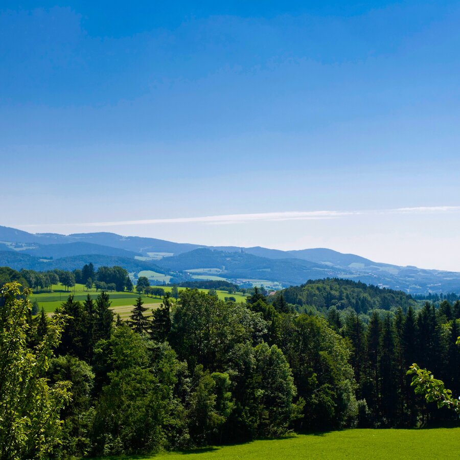
Blick in den Naturpark Pöllauer Tal | © Steiermark Tourismus | Leo Himsl
3/7
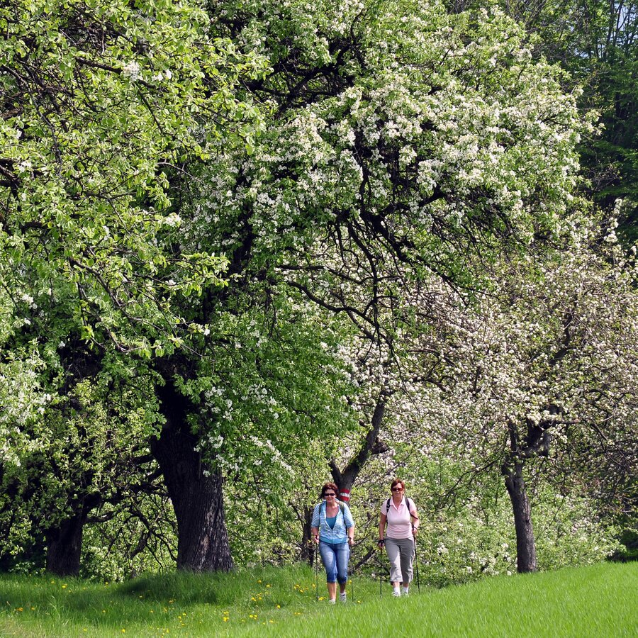
Unterwegs im Hirschbirnland Pöllauer Tal | © Steiermark Tourismus | Gery Wolf
4/7
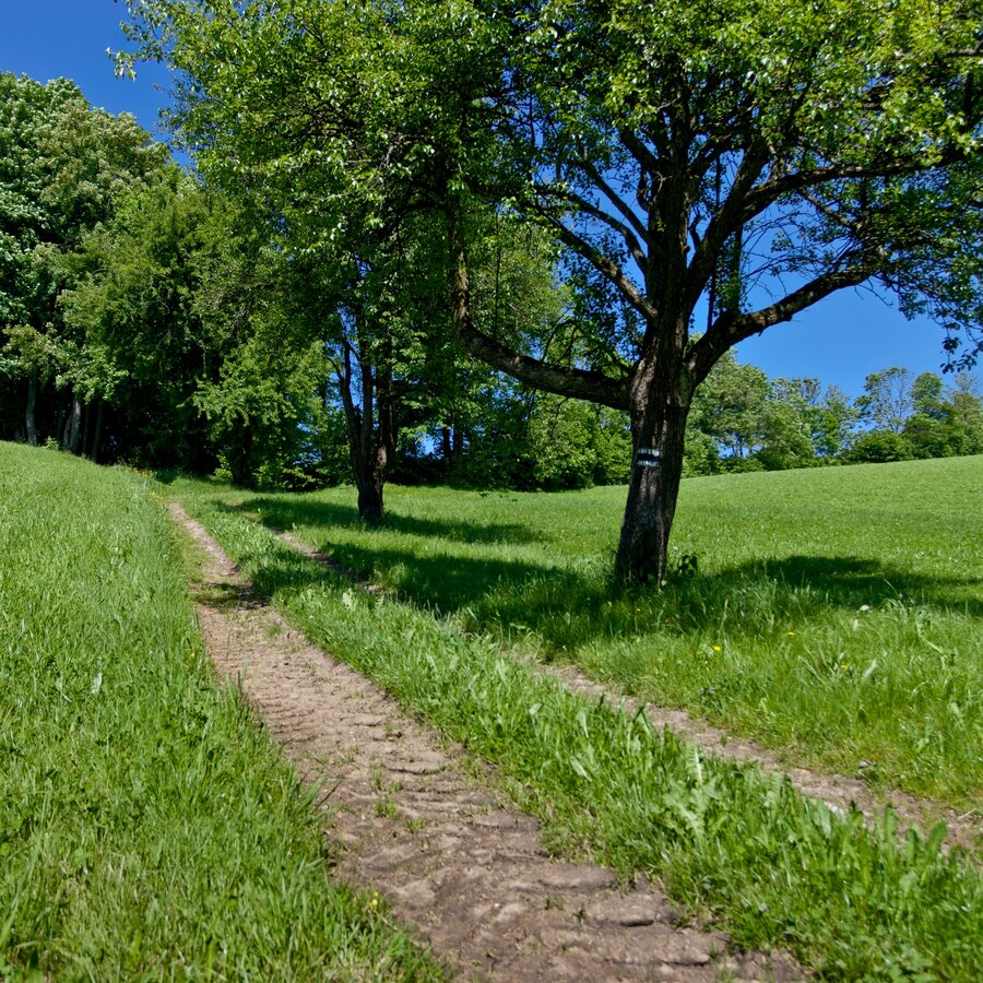
Unterwegs in der Oststeiermark | © Steiermark Tourismus | Leo Himsl
5/7
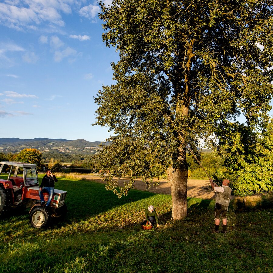
Hirschbirnernte im Naturpark Pöllauer Tal in der Oststeiermark | © Steiermark Tourismus | Tom Lamm
6/7
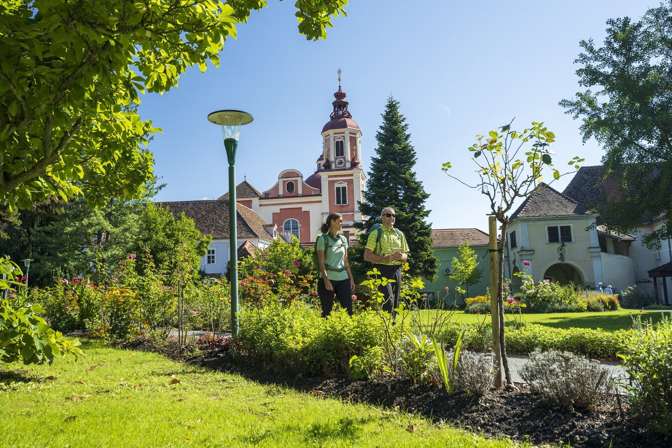
poellau_steiermark-tourismus-_-pixelmaker.at.jpg | © Seiermark Tourismus | pixelmaker.at
7/7

What the weather will be like Anger (471m)
Today, 25.10.2026
Mostly cloudy through the day with a chance of occasional sunny spells.Morning

2°C
sr.Regenwahrscheinlichkeit
0%
sr.Windstärke
5 km/h
Noon

10°C
sr.Regenwahrscheinlichkeit
5%
sr.Windstärke
5 km/h
Night

7°C
sr.Regenwahrscheinlichkeit
50%
sr.Windstärke
5 km/h
Tomorrow, 26.10.2026
Early clouds will clear to leave the region with a dry and sunny day.Morning
4°C
sr.Regenwahrscheinlichkeit
25%
sr.Windstärke
5 km/h
Noon
13°C
sr.Regenwahrscheinlichkeit
5%
sr.Windstärke
10 km/h
Night

6°C
sr.Regenwahrscheinlichkeit
0%
sr.Windstärke
5 km/h
Forecast
27.10.2026
1°C
13°C
28.10.2026
1°C
14°C
29.10.2026
5°C
13°C
