


Joglland Roas
Characteristics
SkillThe tour in numbers
Route
70,8 km
Uphill
2688 hm
Downhill
2367 hm
A journey through Joglland
In four easy daily stages, which can also be completed individually, the route crosses the whole of Joglland and ends high up on the alpine pastures of the Fischbach Alps.
Of course, Peter Rosegger's forest home is also “touched upon”, as it is inextricably linked to Joglland.
Of course, Peter Rosegger's forest home is also “touched upon”, as it is inextricably linked to Joglland.
Best season
January
March
March
April
May
June
July
August
September
October
November
December
More information
By car:
From Graz: take the A2 to the Hartberg exit, then the B50 and B54 via Grafendorf to Rohrbach; continue via Koglerau and Bruck to Festenburg
From Vienna: take the A2 to the Pinggau exit, then the B54 towards Hartberg to Rohrbach a. d. Lafnitz; continue via Koglerau and Bruck to Festenburg
Parking is available at the Festenburg, in the village of Festenburg and in the village of Bruck an der Lafnitz.
From Graz: take the A2 to the Hartberg exit, then the B50 and B54 via Grafendorf to Rohrbach; continue via Koglerau and Bruck to Festenburg
From Vienna: take the A2 to the Pinggau exit, then the B54 towards Hartberg to Rohrbach a. d. Lafnitz; continue via Koglerau and Bruck to Festenburg
Parking is available at the Festenburg, in the village of Festenburg and in the village of Bruck an der Lafnitz.
Day 1: Festenburg - Lafnitztal - Mönichwald, walking time approx. 4 hours
Day 2: Romai - Schlucht - St. Jakob i. W. - Wenigzell, walking time 5 hours
Day 3: Wildwiese viewing platform - Strallegg - Ratten, walking time approx. 6 hours
Day 4: Pretul - Stuhleck (1,783 m, highest point of the entire hike) - Rettenegg,
Walking time approx. 5 hours
A continuation to the Hochwechsel is possible as a 5th day stage
! The paths have their own signposting.
Day 2: Romai - Schlucht - St. Jakob i. W. - Wenigzell, walking time 5 hours
Day 3: Wildwiese viewing platform - Strallegg - Ratten, walking time approx. 6 hours
Day 4: Pretul - Stuhleck (1,783 m, highest point of the entire hike) - Rettenegg,
Walking time approx. 5 hours
A continuation to the Hochwechsel is possible as a 5th day stage
! The paths have their own signposting.
- Experience points:
- Festenburg baroque castle
- Mönichwald flower trail,
- Europapark St. Jakob im Walde
- Ratten brass band museum
- Rettenegg planet trail
- Strallegg flower trail
Recommended equipment
Emergency call: 112
Emergency call mountain rescue: 140 (if possible, please provide GPS data)
Rescue: 144
Fire department: 122
Police: 133
A few tips on correct and fair behavior in the forest: (Source: www.bundesforste.at )
Hikers should avoid visiting the forest approx. 1.5 hours before sunrise and after sunset, as wild animals are particularly active at this time.
Plastic bottles, handkerchiefs, cigarette butts etc. have no place in the forest! Please make sure that you do not leave any garbage in the forest.
Camping and making fires is strictly forbidden in the forest!
In principle, every person in the forest is allowed to collect 2 kg of mushrooms and berries per day for their own use. It is only prohibited if the forest owner expressly forbids it.
Emergency call: 112
Emergency call mountain rescue: 140 (if possible, please provide GPS data)
Rescue: 144
Fire department: 122
Police: 133
A few tips on correct and fair behavior in the forest: (Source: www.bundesforste.at )
Hikers should avoid visiting the forest approx. 1.5 hours before sunrise and after sunset, as wild animals are particularly active at this time.
Plastic bottles, handkerchiefs, cigarette butts etc. have no place in the forest! Please make sure that you do not leave any garbage in the forest.
Camping and making fires is strictly forbidden in the forest!
In principle, every person in the forest is allowed to collect 2 kg of mushrooms and berries per day for their own use. It is only prohibited if the forest owner expressly forbids it.
- Small rucksack with water bottle (+ provisions)
- Sturdy footwear
- Appropriate clothing - preferably several layers - “onion principle”
- Rain and sun protection
- Hiking poles as required
- Cell phone
- Small first aid kit
- Route description
- Before starting the hike, check where you can stop for refreshments, including opening times, or pack suitable food.
Timetables and travel information can be found at the Austrian Federal Railways (ÖBB) or at the Verbundlinien. For local transportation we recommend the SAM-Sammeltaxi Oststeiermark.
You can find information about the region, places to stop and stay overnight, excursion destinations, etc. here:
Eastern Styria Tourism Association
Joglland-Waldheimat office
8255 St. Jakob im Walde
Tel.: 03336/20255
www.joglland.at
www.oststeiermark.com
Current weather
Mobility Eastern Styria with shared taxi SAM Find out about maps, hiking brochures and other tour tips at the tourist office. You can also order information material on our website from the comfort of your own home.
Eastern Styria Tourism Association
Joglland-Waldheimat office
8255 St. Jakob im Walde
Tel.: 03336/20255
www.joglland.at
www.oststeiermark.com
Current weather
Mobility Eastern Styria with shared taxi SAM Find out about maps, hiking brochures and other tour tips at the tourist office. You can also order information material on our website from the comfort of your own home.
Map & downloads
Gallery

Aerial view of Festenburg Castle_Festenburg_Eastern Styria | © Archiv Stift Vorau | Archiv Stift Vorau
1/10

Parish Church_Mönichwald_East Styria | © TV Mönichwald | TV Mönichwald
2/10
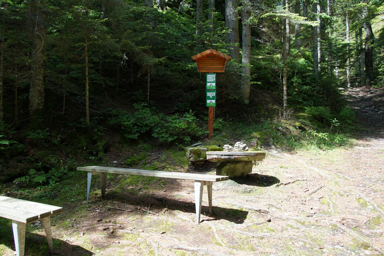
Romai Waterfall Rest Area_St. Jakob im Walde_Eastern Styria | © Oststeiermark Tourismus | Jasmin Perhofer
3/10

Romai Gorge waterfall_St. Jakob im Walde_Eastern Styria | © Oststeiermark Tourismus | Jasmin Perhofer
4/10

Barefoot Park Wenigzell_Station bark_Eastern Styria | © Barfußpark Wenigzell | Bernhard Bergmann
5/10

Strallegg_parish church_East Styria | © Oststeiermark Tourismus | Christa Pollhammer
6/10

Wildwiese observation tower with hikers_Miesenbach_East Styria | © Bernhard Bergmann | Bernhard Bergmann
7/10

Viewpoint Wildwiese_outlook_Eastern Styria | © Aussichtswarte Wildwiese | Karl Ranger
8/10

recreationallake Ratten_lake_Eastern Styria | © Freizeitsee Ratten | Gasthof Albert
9/10

View of Pretul_Stuhleck_Rettenegg_Eastern Styria | © Oststeiermark Tourismus | Lucas-Vollmann-Oswald
10/10

What the weather will be like St. Lorenzen am Wechsel (725m)
Today, 30.09.2026
Dry and sunny throughout the day with hardly any clouds.Morning

10°C
sr.Regenwahrscheinlichkeit
0%
sr.Windstärke
5 km/h
Noon
20°C
sr.Regenwahrscheinlichkeit
0%
sr.Windstärke
15 km/h
Night
14°C
sr.Regenwahrscheinlichkeit
0%
sr.Windstärke
5 km/h
Tomorrow, 01.10.2026
Dry and bright with plenty of sunshine, clouds will be rare.Morning
11°C
sr.Regenwahrscheinlichkeit
0%
sr.Windstärke
5 km/h
Noon
20°C
sr.Regenwahrscheinlichkeit
0%
sr.Windstärke
15 km/h
Night

12°C
sr.Regenwahrscheinlichkeit
0%
sr.Windstärke
5 km/h
Forecast
02.10.2026
8°C
20°C
03.10.2026
9°C
20°C
04.10.2026
8°C
20°C

