


Walk to the Gsollalm
Accessible by public transport- Public bus (within 15 minutes walking distance from starting point)
Characteristics
SkillThe tour in numbers
Level of difficulty
easy
Route
2,7 km
Time
1:30 h
Uphill
270 hm
Downhill
270 hm
Highest point
1201 m
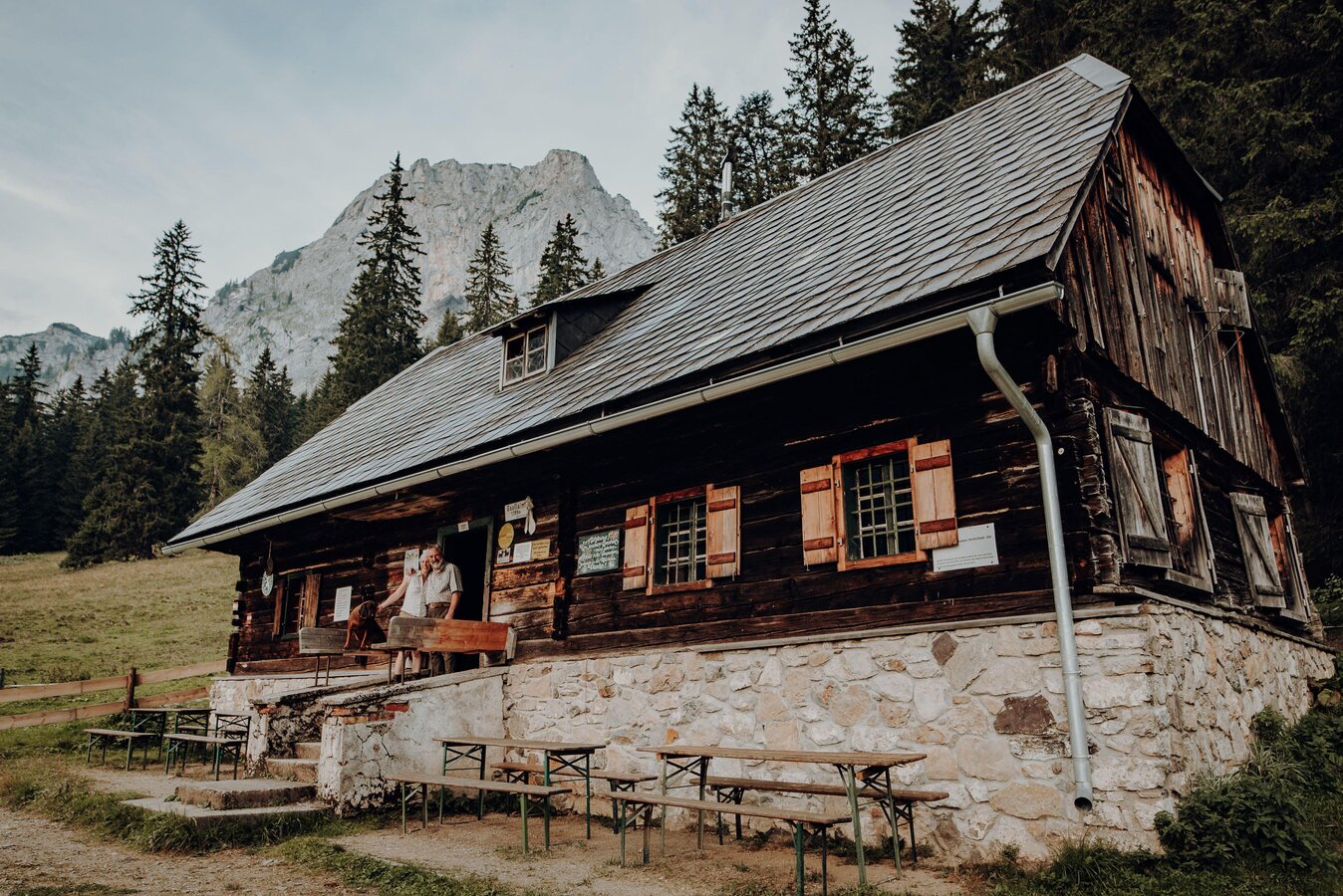
A leisurely family walk from the Gsollkehre to the idyllically situated Gsollalm at the foot of the Frauenmauer.
The walk from Gsollkehre to Gsollalm is a short, family-friendly route through the stunning mountain landscape around Eisenerz.
From Gsollkehre on the B115, the footpath leads steadily uphill to the Gsollalm, situated at 1,201 metres above sea level. The route runs mainly along a forest track through woodland and alpine pastures, making it particularly suitable for a leisurely walk.
After around 45 minutes, you’ll reach the Gsollalm at the foot of the striking Frauenmauer. The alpine hut is not only a popular destination but also a starting point for numerous further mountain hikes in the western Hochschwab.
During the opening season (15. Juni - 15.September), it’s well worth stopping for refreshments at the rustic alpine hut. Among other things, traditional alpine snacks made with regional and home-made produce are served.
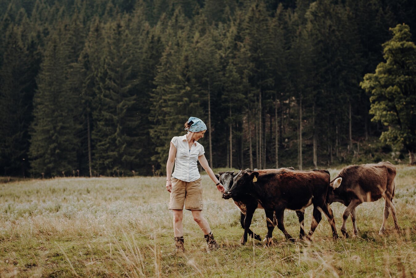
During the alpine grazing season, the Gsollalm is home to suckler cows and young cattle. You should keep a safe distance from grazing animals and refrain from feeding them.
From Gsollkehre on the B115, the footpath leads steadily uphill to the Gsollalm, situated at 1,201 metres above sea level. The route runs mainly along a forest track through woodland and alpine pastures, making it particularly suitable for a leisurely walk.
After around 45 minutes, you’ll reach the Gsollalm at the foot of the striking Frauenmauer. The alpine hut is not only a popular destination but also a starting point for numerous further mountain hikes in the western Hochschwab.
During the opening season (15. Juni - 15.September), it’s well worth stopping for refreshments at the rustic alpine hut. Among other things, traditional alpine snacks made with regional and home-made produce are served.
During the alpine grazing season, the Gsollalm is home to suckler cows and young cattle. You should keep a safe distance from grazing animals and refrain from feeding them.
Best season
January
February
March
April
May
June
July
August
September
October
November
December
More information
From the south – Graz:
Take the A9 Pyhrn motorway towards Linz as far as the Traboch junction. Continue on the B115 through Trofaiach and Vordernberg, over the Präbichl towards Eisenerz. Just before Eisenerz, you’ll find the Gsoll hairpin bend on the B115.
From the north – Liezen:
Take the A9 towards Graz as far as the Traboch junction. Continue along the B115 through Trofaiach and Vordernberg, over the Präbichl towards Eisenerz, until you reach the Gsoll hairpin bend.
From the east – Vienna/Bruck an der Mur:
Take the S6 to Leoben, then follow the B115 via Trofaiach, Vordernberg and the Präbichl towards Eisenerz. The starting point is at the Gsoll hairpin bend before Eisenerz.
From the west – Judenburg/Murtal:
Take the S36 towards St. Michael, continue towards Leoben and take the B115 to Trofaiach. Continue via Vordernberg and the Präbichl towards Eisenerz
Parking is available at the Gsollkehre on the B115 between Eisenerz and Präbichl. This is where hiking trail no. 833 to the Gsollalm begins. Please follow the parking regulations and note that the area is closed in winter from 1 November to 15 April.
Take the A9 Pyhrn motorway towards Linz as far as the Traboch junction. Continue on the B115 through Trofaiach and Vordernberg, over the Präbichl towards Eisenerz. Just before Eisenerz, you’ll find the Gsoll hairpin bend on the B115.
From the north – Liezen:
Take the A9 towards Graz as far as the Traboch junction. Continue along the B115 through Trofaiach and Vordernberg, over the Präbichl towards Eisenerz, until you reach the Gsoll hairpin bend.
From the east – Vienna/Bruck an der Mur:
Take the S6 to Leoben, then follow the B115 via Trofaiach, Vordernberg and the Präbichl towards Eisenerz. The starting point is at the Gsoll hairpin bend before Eisenerz.
From the west – Judenburg/Murtal:
Take the S36 towards St. Michael, continue towards Leoben and take the B115 to Trofaiach. Continue via Vordernberg and the Präbichl towards Eisenerz
Parking is available at the Gsollkehre on the B115 between Eisenerz and Präbichl. This is where hiking trail no. 833 to the Gsollalm begins. Please follow the parking regulations and note that the area is closed in winter from 1 November to 15 April.
The starting point is the car park at the Gsoll hairpin bend on the B115 between Eisenerz and Präbichl.
From the car park, the walk follows the signposted trail no. 833 towards the Gsollalm. The route leads steadily uphill along a forest track through the Gsoll valley.
In some places, there are signposted or clearly recognisable shortcuts via forest paths. For a more leisurely route – particularly if you have a pushchair – you can follow the forest track all the way.
After about 45 minutes’ walk, you’ll reach the Gsollalm, situated at an altitude of 1,201 metres. The return journey follows the same route back to the Gsollkehre.
From the car park, the walk follows the signposted trail no. 833 towards the Gsollalm. The route leads steadily uphill along a forest track through the Gsoll valley.
In some places, there are signposted or clearly recognisable shortcuts via forest paths. For a more leisurely route – particularly if you have a pushchair – you can follow the forest track all the way.
After about 45 minutes’ walk, you’ll reach the Gsollalm, situated at an altitude of 1,201 metres. The return journey follows the same route back to the Gsollkehre.
Having the right kit is essential for a safe and enjoyable hike. Sturdy footwear with a good tread, clothing suitable for the weather and plenty of drinks are all part of the basic kit.
Packing your rucksack correctly also makes things much easier: heavy items should be stowed as close to your body as possible. Your water bottle should be easily accessible at all times. Items you’ll need frequently whilst out and about – such as sunglasses, a hiking map or a camera – should be kept within easy reach at the top of your rucksack.
No hiking rucksack should be without emergency kit, including blister plasters. When it comes to clothing, the ‘layering’ system is recommended so you can adapt quickly to changing temperatures and weather conditions.
Mountain rescue emergency number: 140.
When making an emergency call, provide as much detail as possible by answering the six ‘W’ questions:
What has happened?
How many people are injured?
Where did the accident happen? If possible, provide GPS coordinates.
Who is reporting the accident? Give a callback number.
When did the accident happen?
What are the weather conditions at the scene of the accident?
Packing your rucksack correctly also makes things much easier: heavy items should be stowed as close to your body as possible. Your water bottle should be easily accessible at all times. Items you’ll need frequently whilst out and about – such as sunglasses, a hiking map or a camera – should be kept within easy reach at the top of your rucksack.
No hiking rucksack should be without emergency kit, including blister plasters. When it comes to clothing, the ‘layering’ system is recommended so you can adapt quickly to changing temperatures and weather conditions.
Mountain rescue emergency number: 140.
When making an emergency call, provide as much detail as possible by answering the six ‘W’ questions:
What has happened?
How many people are injured?
Where did the accident happen? If possible, provide GPS coordinates.
Who is reporting the accident? Give a callback number.
When did the accident happen?
What are the weather conditions at the scene of the accident?
With the Verbundlinie’s BusBahnBim app, checking timetables has never been easier: you can search for all bus, train and tram connections in Austria by entering locations and/or addresses, stops or key points. The app is available free of charge for smartphones (Android, iOS) – on Google Play and in the App Store.
Map & downloads
Gallery
Gsollalm | © GenussReich | Freilichtmomente
1/2
Almwirtin Isabella | © GenussReich | Freilichtmomente
2/2

What the weather will be like Eisenerz (711m)
Today, 02.10.2026
Dry and partly sunny throughout the day, with cloudy periods from time to time.Morning

8°C
sr.Regenwahrscheinlichkeit
0%
sr.Windstärke
0 km/h
Noon

19°C
sr.Regenwahrscheinlichkeit
0%
sr.Windstärke
5 km/h
Night
12°C
sr.Regenwahrscheinlichkeit
0%
sr.Windstärke
0 km/h
Tomorrow, 03.10.2026
Some clouds in the morning, lateron much sunshine and hardly any cloudsMorning
4°C
sr.Regenwahrscheinlichkeit
0%
sr.Windstärke
0 km/h
Noon

19°C
sr.Regenwahrscheinlichkeit
0%
sr.Windstärke
10 km/h
Night
10°C
sr.Regenwahrscheinlichkeit
0%
sr.Windstärke
0 km/h
Forecast
04.10.2026
3°C
21°C
05.10.2026
7°C
20°C
06.10.2026
7°C
22°C
