


Marterlweg Route 2 (blue)
Accessible by public transport- Train (within 15 minutes walking distance from starting point)
- Public bus (within 15 minutes walking distance from starting point)
Characteristics
SkillThe tour in numbers
Level of difficulty
medium
Route
11,7 km
Time
3:15 h
Uphill
166 hm
Downhill
185 hm
Highest point
784 m
The Marterlweg comprises 4 different routes and is located in the Erzberg-Leoben region.
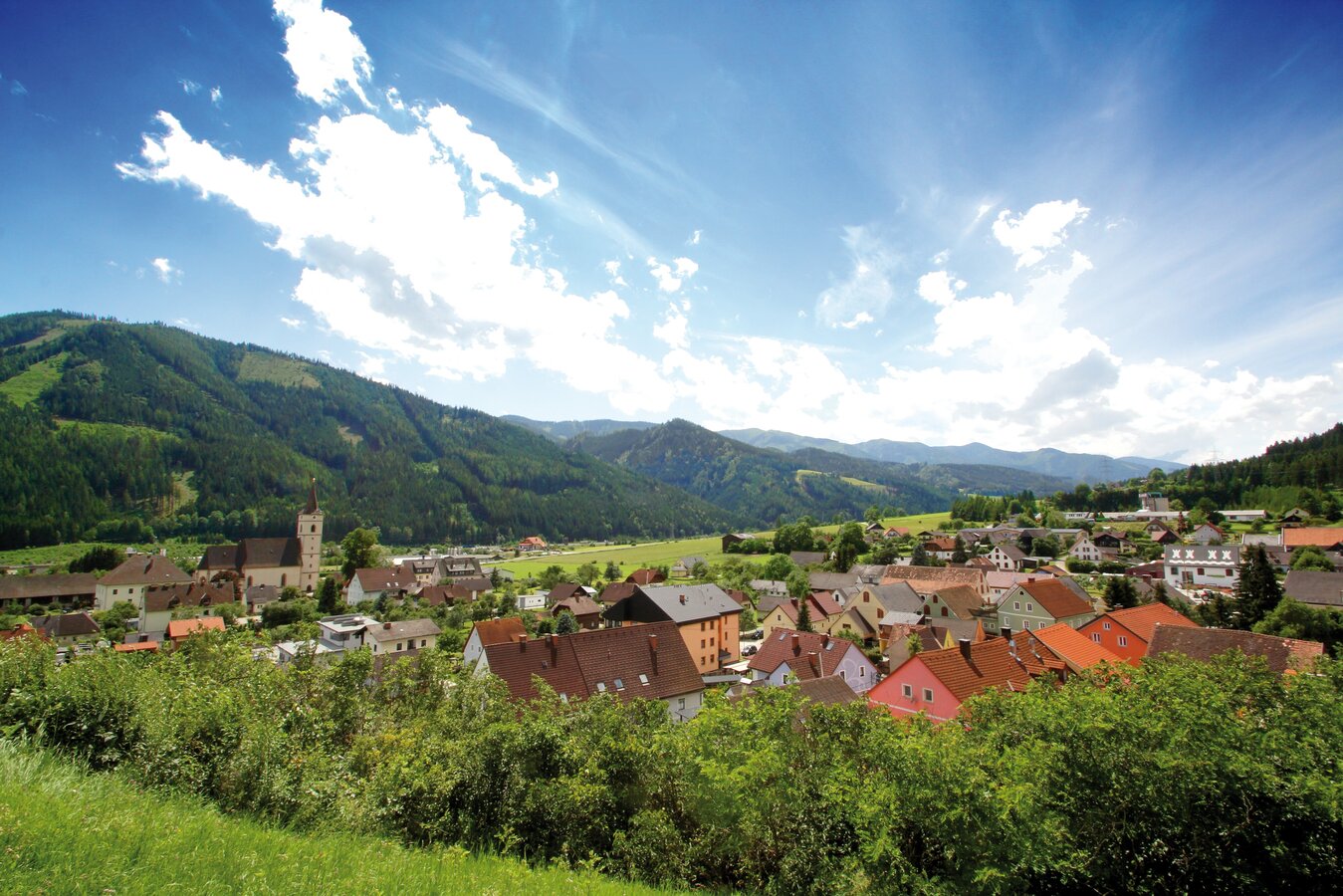
The Marterlweg in the municipality of Kammern im Liesingtal, Styria, is extremely interesting from both a scenic and a cultural point of view.
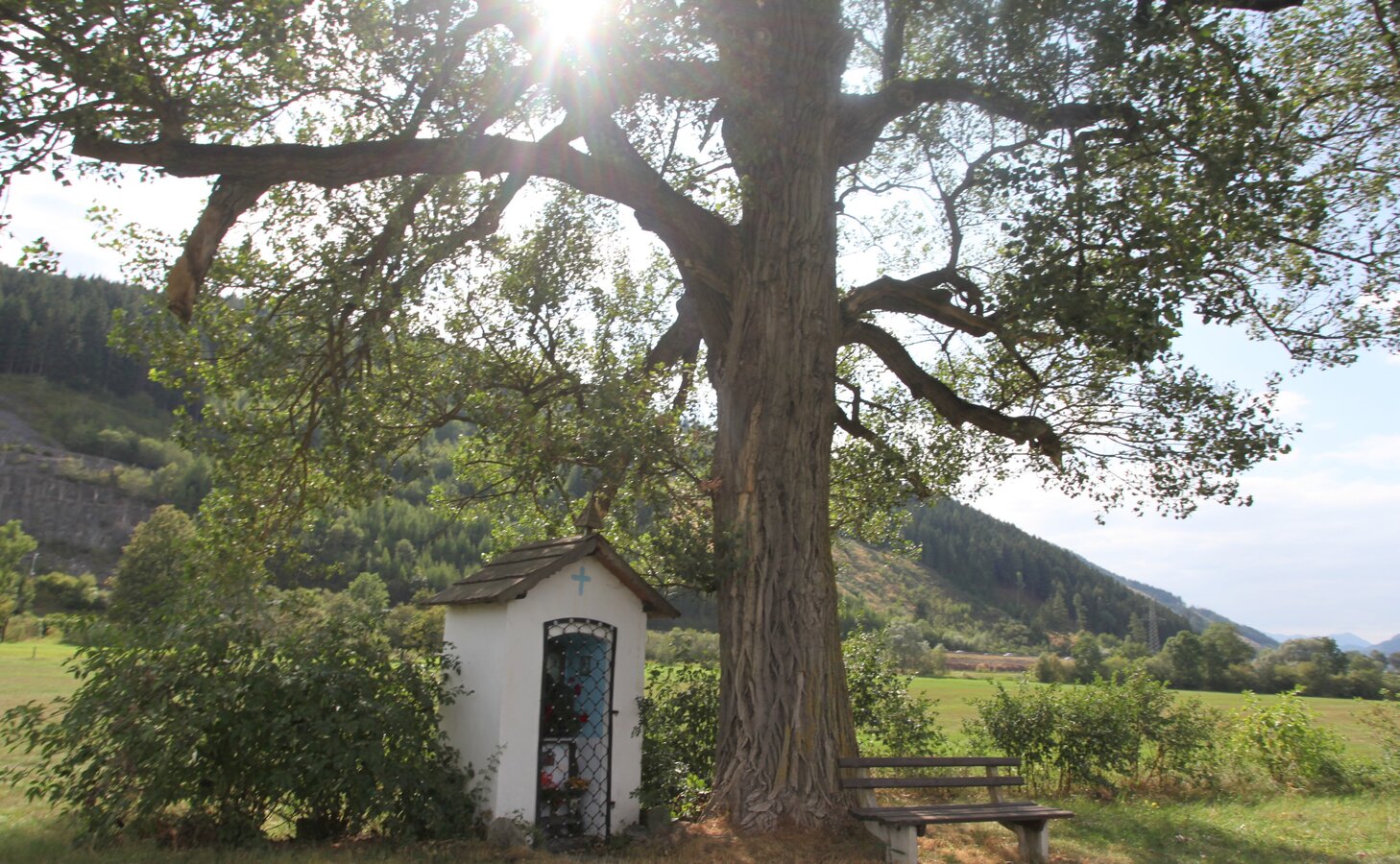
Each wayside shrine tells its own story and is usually located along the path or on private property. The wayside shrines are lovingly tended by their owners throughout the year.
Route 2 (blue) is a challenging stage and leads along the Panormaweg (the Panorama Trail is a forest trail) with magnificent views of the lower Liesing Valley. It passes by the Urlichskirche Seiz as well as the largest Marterl, the Anna Chapel (31), with strong roots in Kammerner's history and distinct historical association life.
On the route there is also a drinking fountain directly at the Rüsthaus in Seiz, under the Ulrichskirche (25).
Best season
January
February
March
April
May
June
July
August
September
October
November
December
More information
Arrival details by car are available here.
There are plenty of parking spaces for cars and buses at Kammern's market square. Parking in the town centre is free of charge and it is recommended to stop off at one of the two restaurants Gasthaus Judmayer or Restaurant Purgar after returning from the tour.
Arrival details by bike are available here.
There are plenty of parking spaces for cars and buses at Kammern's market square. Parking in the town centre is free of charge and it is recommended to stop off at one of the two restaurants Gasthaus Judmayer or Restaurant Purgar after returning from the tour.
Under the title "Marterlweg", we find a 52-kilometre-long hiking trail that leads past 48 wayside shrines, crosses and wayside shrines and is divided into 4 individual tours.
Each of the wayside shrines tells its own story and is usually located at the edge of the path or on private property. The wayside shrines are lovingly cared for by their owners all year round.
Route 2 (blue) is a challenging stage and leads along the Panormaweg (the Panorama Trail is a forest trail) with magnificent views of the lower Liesing Valley. It passes by the Urlichskirche Seiz as well as the largest Marterl, the Anna Chapel (31), with strong roots in Kammern's history and its distinct historical association life.
From the market square, you can already see the first wayside shrine hidden on the ascent of the Kalvarienbergweg on the house wall (14). Via the Kalvarienbergweg past the war memorial (16) on the Kalvarienbergweg, which invites you to a beautiful view into the centre of Kammern, you continue towards Thorman-Etz (20). Here there is a wonderful view into the lower Liesing valley towards Traboch. Continue along the path, past green meadows, through Dirnsdorf - another district of Kammern - and then leisurely down towards Seiz. When you reach the B113 main road, turn left in the direction of Rüsthaus Seiz. There is also a drinking fountain here and you can refill your water supply.
A detailed description of the wayside shrines/crosses can be found in the Marterlweg map, which is also available online or can be taken free of charge at the market square.
Description of the wayside shrines and wayside shrines
A visit to the Museumshof Kammern, directly at the market place Kammern, rounds off a hike along the Marterlweg.
Planning your desired tour properly in advance is a must.
Emergency call rescue: 144
Emergency reporting tip - give answers to six important questions: What happened? How many injured? Where did the accident happen (possibly GPS coordinates)? Who reported the accident (call-back number)? When did the accident happen? Weather at the accident site?
Proper backpacking makes many things easier: Pack heavy things first. The water bottle should always be within easy reach in a side pocket. All things that are often needed, such as sunglasses, camera or hiking map, belong on top. An emergency kit including blister plasters belongs in every rucksack and it is always advisable to put on different layers of clothing.
Travelling to Kammern by train or by bike (Rastlandradweg R15) is the environmentally friendly and stress-free alternative to travelling by car.
With the BusBahnBim app of the Verbundlinie, timetable information has never been easier: all bus, train and tram connections in Austria can be queried by entering locations and/or addresses, stops or important points. The app is available as a free app for smartphones (Android, iOS) - on Google Play and in the App Store.
Tourismusverband Erzberg-Leoben
Homanngasse 12
8700 Leoben
Phone: +43 3842 48148
office@erzberg-leoben.at
Homanngasse 12
8700 Leoben
Phone: +43 3842 48148
office@erzberg-leoben.at
Map & downloads
Gallery
c_k.wassler_kammern_marterlweg_53.jpg | © TVB Erzberg-Leoben | Katharina Wassler
1/3

marterlweg_kammern_c_tv_erzberg-leoben_i_m._mandl_22.JPEG | © TVB Erzberg-Leoben | M.Mandl
2/3
c_k.wassler_kammern_marterlweg_5.jpg | © TVB Erzberg-Leoben | Katharina Wassler
3/3

What the weather will be like Kammern im Liesingtal (671m)
Today, 22.10.2026
At first rain and rain showers, then the skies will clear in the afternoon.Morning

6°C
sr.Regenwahrscheinlichkeit
95%
sr.Windstärke
15 km/h
Noon

12°C
sr.Regenwahrscheinlichkeit
80%
sr.Windstärke
10 km/h
Night

5°C
sr.Regenwahrscheinlichkeit
0%
sr.Windstärke
5 km/h
Tomorrow, 23.10.2026
The day starts sunny, but will be partly cloudy in the afternoon.Morning
0°C
sr.Regenwahrscheinlichkeit
0%
sr.Windstärke
0 km/h
Noon

12°C
sr.Regenwahrscheinlichkeit
0%
sr.Windstärke
5 km/h
Night

6°C
sr.Regenwahrscheinlichkeit
5%
sr.Windstärke
5 km/h
Forecast
24.10.2026
0°C
8°C
25.10.2026
-1°C
11°C
26.10.2026
3°C
14°C
