


Grete-Klinger-Steig
The tour in numbers
Route
16,3 km
Time
8:30 h
Uphill
1270 hm
Downhill
1270 hm
Highest point
2003 m
The Grete-Klinger-Steig is located in the Erzberg-Leoben region and offers impressive views to the sure-footed mountaineer.
The via ferrata with the name Grete-Klinger-Steig leads from the Fahnenköpfl high above Vordernberg (great view) over the Vordernberger Mauer to the Vordernberger Zinken and offers on this section of the trail beautiful, longer via ferrata passages and great hiking sections directly on the ridge.The insurances were renewed in 2003 and are still in good condition.
Between the insurances and in the last section of the trail there is always walking terrain, but this should not tempt you to not take the Grete-Klinger-Steig seriously. Expect but steep secured sections and passages on sharp ridge edge.
Best season
January
February
March
April
May
June
July
August
September
October
November
December
More information
From the bus stop Schwabergweg or from the parking lot at the Krumpenloipe (if you arrive by car) you first walk about 1.5 h to the Hirn Alm. (If you arrive by car, you can also park your car here).
From the Hirn Alm the trail first leads northeast through a meadow hollow (unmarked) past a wooden hut until a forest road crosses, here you meet inconspicuous markings. Follow the marked path or later the marked trail in a southeasterly direction to the Barbara cross (about 45 minutes from Hirnalm). From the Barbarakreuz, head north until after about 20-30 minutes you reach the first insurances of the Grete-Klinger Steig in the forest and the marked trail continues to the Fahnenköpfl (1658m), after which it continues quite airy to the steepest part of the climb, an insured passage on an approximately 25m high rock structure in the ridge. After this point it goes steadily up and down, in places secured over the Vordernberg walls. The insurances finally cease and the rocky and rugged terrain, partly overgrown with dwarf pines, gives way to the more gently formed ridge of the Vordernberger Zinken, the highest point of the round tour described here.
Descent: From the summit, descend in a northwesterly direction and cross under the southern precipices of the Grüblzinken, slightly ascending, to the Rottörl. From the Rottörl now in a southeasterly direction down to the Krumpenalm, past a charming little waterfall back to the Hirnalm.
Emergency call mountain rescue: 140
Emergency reporting tip - provide answers to the six W questions: What happened? How many injured? Where did the accident happen (possibly GPS coordinates)? Who is reporting (callback number)? When did the accident happen? Weather at the accident site?
B/C, medium/difficult - surefootedness!Via ferrata set (also advisable for experienced climbers) and possibly a rockfall helmet.
Proper backpacking makes many things easier: pack heavy things first. The water bottle should always be within easy reach in a side pocket. All things that are often needed such as sunglasses, camera or hiking map belong on top. An emergency kit including blister plaster belongs in every backpack and a clothing according to the "onion system" is always recommended!
Beautiful footage of the Grete Klinger Steig can be found in the YouTube video by @Zwerg am Berg.
Mit der BusBahnBim App der Verbundlinie ist eine Fahrplanauskunft so einfach wie noch nie: Alle Verbindungen mit Bus, Bahn und Straßenbahn in Österreich können durch die Eingabe von Orten und/oder Adressen, Haltestellen bzw. wichtigen Punkten abgefragt werden. Erhältlich ist die App als Gratis-App für Smartphones (Android, iOS) – auf Google Play und im App Store
If you prefer the market town of Vordernberg as the starting point for this tour, you can also reach the Barbara Cross from the Vordernberg train station along a marked trail.
Individual secured sections on the Grete-Klinger-Steig can also be bypassed on the left on paths.
A jewel in the middle of Styria
more info under:
Tourismusverband Erzberg-Leoben
Homanngasse 12
8700 Leoben
Phone: +43 3842 48148
office@erzberg-leoben.at
Map & downloads
Gallery

Hirnalm in der Krumpen | © TV HerzBergLand | Markus Leitner
1/7

Hirnalm in der Krumpen | © TV HerzBergLand | Markus Leitner
2/7
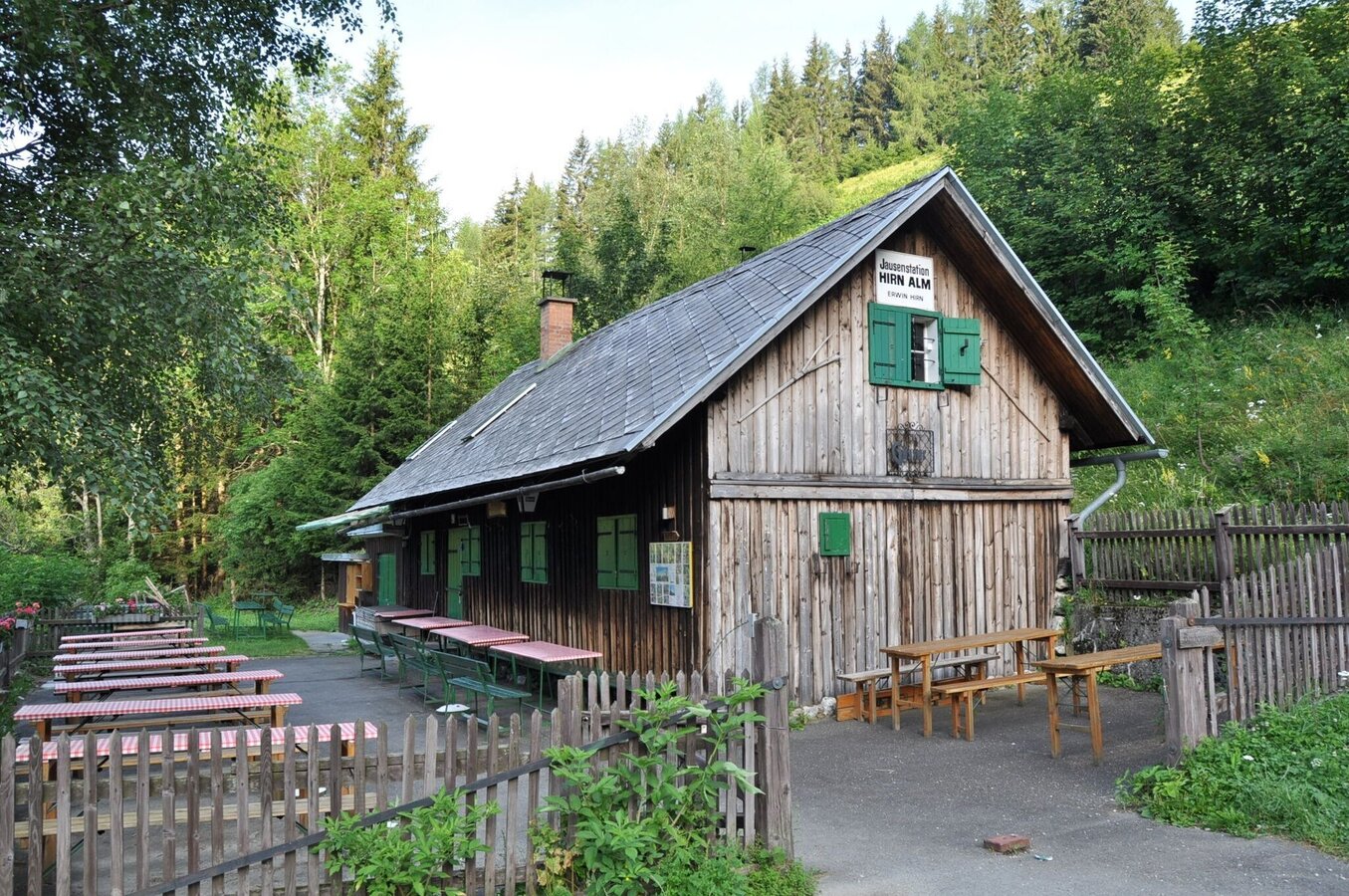
Hirnalm in der Krumpen | © TV HerzBergLand | Markus Leitner
3/7

Grete Klinger Steig | © Tourismusverband ERZBERG LEOBEN | @austrianeye
4/7

Grete Klinger Steig | © Tourismusverband ERZBERG LEOBEN | dagi_on_tour
5/7

Grete Klinger Steig | © Tourismusverband ERZBERG LEOBEN | @jr_stebl
6/7

Grete Klinger Steig | © Tourismusverband ERZBERG LEOBEN | mountain_story_s
7/7

What the weather will be like Trofaiach (658m)
Today, 16.10.2026
Some clouds in the morning, lateron much sunshine and hardly any cloudsMorning

6°C
sr.Regenwahrscheinlichkeit
0%
sr.Windstärke
5 km/h
Noon

15°C
sr.Regenwahrscheinlichkeit
0%
sr.Windstärke
5 km/h
Night
8°C
sr.Regenwahrscheinlichkeit
0%
sr.Windstärke
0 km/h
Tomorrow, 17.10.2026
Partly sunny in the morning, gradually becoming cloudy in the afternoon.Morning

4°C
sr.Regenwahrscheinlichkeit
0%
sr.Windstärke
0 km/h
Noon
16°C
sr.Regenwahrscheinlichkeit
0%
sr.Windstärke
5 km/h
Night
10°C
sr.Regenwahrscheinlichkeit
0%
sr.Windstärke
0 km/h
Forecast
18.10.2026
6°C
16°C
19.10.2026
5°C
16°C
20.10.2026
6°C
15°C
