


TAU - path of the vineyards (TAU - Weg der Riede)
Characteristics
SkillThe tour in numbers
Level of difficulty
medium
Route
17,7 km
Time
5:00 h
Uphill
420 hm
Downhill
420 hm
Highest point
417 m
A hiking trail for all senses through forests, vineyards and across meadow areas. We get to know the cultivated areas around Tieschen in a wonderful way.
If you are looking for a hike that leads through the hilly landscape of the Thermen- & Vulkanland, has pleasant resting and viewing places and also passes by TAU vintners, then the "TAU - Weg der Riede" is just right. This hiking trail leads around Tieschen and takes you to the home of 12 TAU winegrowers. TAU - the sign of St. Francis - was the name-giving for the special wine and for the path. During the breaks you can use the sun loungers in the vineyards, or the bottle peepers - very original telescopes - in the vineyards. The path is marked in such a way that it is basically hikable in both directions and also has shortcut possibilities. Those who undertake this hike during the bathing season can cool off after the tour in the open-air swimming pool in Tieschen and then stop at a Buschenschank for a good snack and a TAU wine. Information about the Tau winegrowers can be found on the homepage www.tauwein.at.
Best season
January
February
March
April
May
June
July
August
September
October
November
December
More information
from Vienna: A2 to exit Fürstenfeld, continue on 319 to Großwilfersdorf and L454 and L207 to Fehring and L204 via Kapfenstein and St.Anna am Aigen to Tieschen
from Graz: A9 to exit Gersdorf, continue on the B69 to Unterpurkla and the B66, L259 and L235 to Tieschen
Detailed information on how to get here can be found here.
Several parking spaces in the center of Tieschen
from Graz: A9 to exit Gersdorf, continue on the B69 to Unterpurkla and the B66, L259 and L235 to Tieschen
Detailed information on how to get here can be found here.
Several parking spaces in the center of Tieschen
We start at the market square in Tieschen and walk past the church slightly uphill. After a few minutes we continue on a gravel road to the waypoint Feichterwald. We go to the right and follow the asphalt road that passes above the JUFA Tieschen and subsequently reach the village of Jörgen. Through the small village we follow the hiking trail slightly uphill. In the forest we pass a basalt quarry natural stage and follow the idyllic forest road slightly uphill or evenly there through the forest. From the forest road we turn right into a path that leads to the rock grave and subsequently downhill to an asphalt road. Immediately afterwards, turn right, pass a self-service station (Waldschenke Königsberg) and continue uphill through the forest. A longer stretch of trail follows through the forest or along the edge of the forest until we reach the station "TAU-Ried Königsberg - Bodenständig" and the lookout station, which is only a few meters away from the trail. From now on it goes continuously downhill. Through the village of Pichla near Radkersburg, further downhill until we reach the valley floor. We cross a narrow bridge. Then we keep to the right and hike slightly uphill, passing by a striking wooden construction. Continuing uphill on the "Alter Bauernsteig" we come to a road, keep to the right and follow the signs to the Buschenschank Hopfer. Shortly after, we turn right to get to the station "TAU-Ried Aunberg - Gemeinschaft" or the observation and rest area. Back at the asphalt road, we soon go left through the forest and across meadows downhill. We cross an asphalt road and shortly after reach the Fruttner Bach. A bit upstream, then past elderberry fields, continue through a forest to Größing. Through the sparsely populated area, the path leads along the asphalt road, past the snack station or store "Steintal-Alpaka", slightly uphill and subsequently flat. Soon we see a fork on the right, which leads us through the vineyards and to the station "TAU-Ried Hochstrandl/Pum - Qualität". The resting and viewing place convinces with the photo motif of the oversized bottle and glass. Back through the vineyards we reach the district of Pum and hike past the horse paddock into the forest. From now on we go downhill again, along the asphalt road and through vineyards (please always close the gate), until we reach the station "TAO-Ried Patzenberg - Verwurzelt in Tieschen" or the landscape picture frame. Continue along a forest road until we cross an asphalt road. Here you have the option to turn left and shorten the hike. The main trail leads to the right, past the self-service station of the Bischof Winery, further along the asphalt road until we see the turnoff on the left. It goes through the forest for a while until we reach another asphalt road. From now on, the trail continues along the road without exception. It goes continuously downhill and continues along the valley floor until we reach the Patzen bridge. Continue straight on, past a chapel and the Sorger winery, and you will soon reach the road, which you follow to the left into the center of Tieschen and back to our starting point.
Emergency call mountain rescue: 140
ambulance: 144
European emergency call: 112
firefighters: 122
police: 133
Tips when reporting an emergency – Answer these six WH questions: What happened? How many people are injured? Where did the accident happen (are there GPS coordinates)? Who is reporting the incident (callback number)? When did the accident happen? What is the weather like at the site of the incident?
Proper backpack packing makes many things easier: Pack heavy things first. The water bottle should always be within reach in a side pocket. All the things that are often needed, such as sunglasses, camera or hiking map, belong on top. An emergency kit, including blister plasters, belongs in every rucksack and it is always advisable to dress in layers.
A free hiking map is available at the overview board on the market square in Tieschen, where, among other things, the TAU vintners are also listed with contact details.
Detailed information about arriving by ÖBB (Austrian Federal Railways) can be found at www.oebb.at or on the Verbundlinie Steiermark website www.busbahnbim.at
With Verbundlinie’s BusBahnBim route planner app, planning your journey has never been easier: simply enter towns and/or addresses, stop names or points of interest to check all bus, train and tram connections in Austria. The app is available free of charge for smartphones – on Google Play and in the App Store
Konditorei Prahsl, Tel.: +43 3475 2386, 8355 Tieschen 98, www.konditorei-prahsl.at
Tourist Office Thermen- & Vulkanland
Gästeinfo Bad Radkersburg
Hauptplatz 14
8490 Bad Radkersburg
Tel: +43 3382 55 100-90
badradkersburg@thermen-vulkanland.at
www.thermen-vulkanland.at
freytag & berndt WK 412 Southeast Styrian Hills, Volcano Country, Bad Gleichenberg, Bad Radkersburg
Hiking maps are available at the guest information Bad Radkersburg. - Hiking map Tieschen You will find an overview board at the market place in Tieschen with a hiking map withdrawal box!
Map & downloads
Gallery

Aussichtsplattform | © Thermen- & Vulkanland | Weges OG
1/18

Nette Rastmöglichkeit in Tieschen | © Thermen- & Vulkanland | Weges OG
2/18
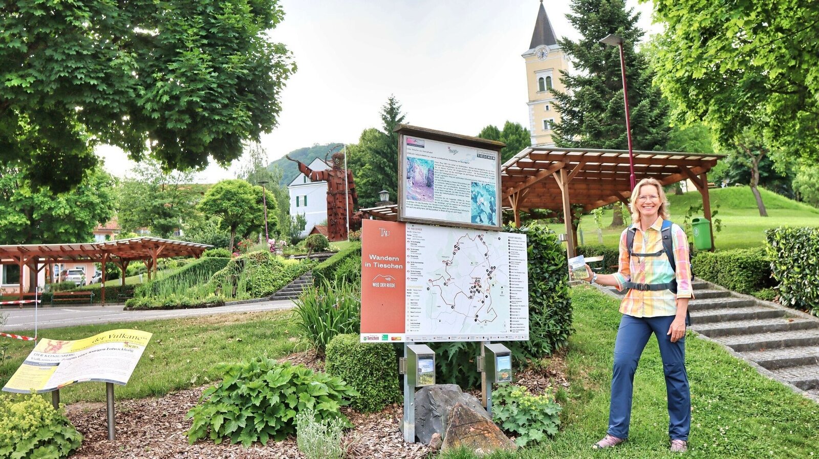
Ausgangspunkt der Wanderung in Tieschen | © Thermen- & Vulkanland | Weges OG
3/18

Stimmung am Weg | © Thermen- & Vulkanland | Weges OG
4/18

Der Weg führt durch den Wald | © Thermen- & Vulkanland | Weges OG
5/18

Felsengrab | © Thermen- & Vulkanland | Weges OG
6/18

Aussicht am Weg | © Thermen- & Vulkanland | Weges OG
7/18

Der Wanderweg führt teilweise durch Weingärten | © Thermen- & Vulkanland | Weges OG
8/18

Kirche in Pichla | © Thermen- & Vulkanland | Weges OG
9/18

Brücke im Tal | © Thermen- & Vulkanland | Weges OG
10/18

Aussichtsplatzerl | © Thermen- & Vulkanland | Weges OG
11/18

Immer wieder führt der Weg durch kühle Wälder mit Hohlwegen | © Thermen- & Vulkanland | Weges OG
12/18

Gemütliche Rast beim Alpakahof Steintal | © Thermen- & Vulkanland | Weges OG
13/18

Blick auf den Königsberg | © Thermen- & Vulkanland | Weges OG
14/18

Landschaftsrahmen | © Thermen- & Vulkanland | Weges OG
15/18

Der Weg ist eindeutig beschildert | © Thermen- & Vulkanland | Weges OG
16/18

Kapelle in Patzen | © Thermen- & Vulkanland | Weges OG
17/18

Portrait of the TAU winemakers | © Verein TAU Winzer
18/18

What the weather will be like Tieschen (260m)
Today, 09.10.2026
Sunny and cloudy periods will alternate throughout the day.Morning

12°C
sr.Regenwahrscheinlichkeit
65%
sr.Windstärke
5 km/h
Noon
15°C
sr.Regenwahrscheinlichkeit
15%
sr.Windstärke
5 km/h
Night

12°C
sr.Regenwahrscheinlichkeit
5%
sr.Windstärke
0 km/h
Tomorrow, 10.10.2026
Fair or bright in the beginning, cloudy towards the end of the day.Morning

8°C
sr.Regenwahrscheinlichkeit
5%
sr.Windstärke
0 km/h
Noon
16°C
sr.Regenwahrscheinlichkeit
25%
sr.Windstärke
5 km/h
Night
12°C
sr.Regenwahrscheinlichkeit
45%
sr.Windstärke
5 km/h
Forecast
11.10.2026
9°C
19°C
12.10.2026
6°C
16°C
13.10.2026
4°C
18°C
