


Talrunde Lassing
Characteristics
SkillThe tour in numbers
Level of difficulty
easy
Route
6,7 km
Time
1:30 h
Uphill
78 hm
Downhill
73 hm
Highest point
767 m
A leisurely stroll for all ages
This leisurely hike along side roads and country lanes takes you through all the different facets of Lassing, close to the valley. From the swimming lake to the lively village square with its café, Lassing invites you to take a relaxing stroll.
Best season
January
February
March
April
May
June
July
August
September
October
November
December
More information
From Lassing Lake, we walk toward the village of Lassing and on to the hamlets of Treschnitz, Wieden, and Moos. There, we cross the road and hike back to the lake.
Sturdy hiking boots or good trekking shoes
Hiking backpack
Water bottle
First aid kit including blister plasters
Hiking map and smartphone
Snacks
Sunglasses
Sunscreen
You should also be well prepared for changeable weather.
Packing your backpack correctly makes things much easier:
Pack heavy items first. Your water bottle should always be easily accessible in a side pocket. Everything you need frequently, such as sunglasses, your smartphone, or hiking map, should be packed on top.
Hiking backpack
Water bottle
First aid kit including blister plasters
Hiking map and smartphone
Snacks
Sunglasses
Sunscreen
You should also be well prepared for changeable weather.
Packing your backpack correctly makes things much easier:
Pack heavy items first. Your water bottle should always be easily accessible in a side pocket. Everything you need frequently, such as sunglasses, your smartphone, or hiking map, should be packed on top.
Gesäuse Tourism Association
Hauptstraße 35, 8911 Admont, Austria
t: +43 3613 2116010
www.gesaeuse.at
Email: info@gesaeuse.at
Hauptstraße 35, 8911 Admont, Austria
t: +43 3613 2116010
www.gesaeuse.at
Email: info@gesaeuse.at
Map & downloads
Gallery
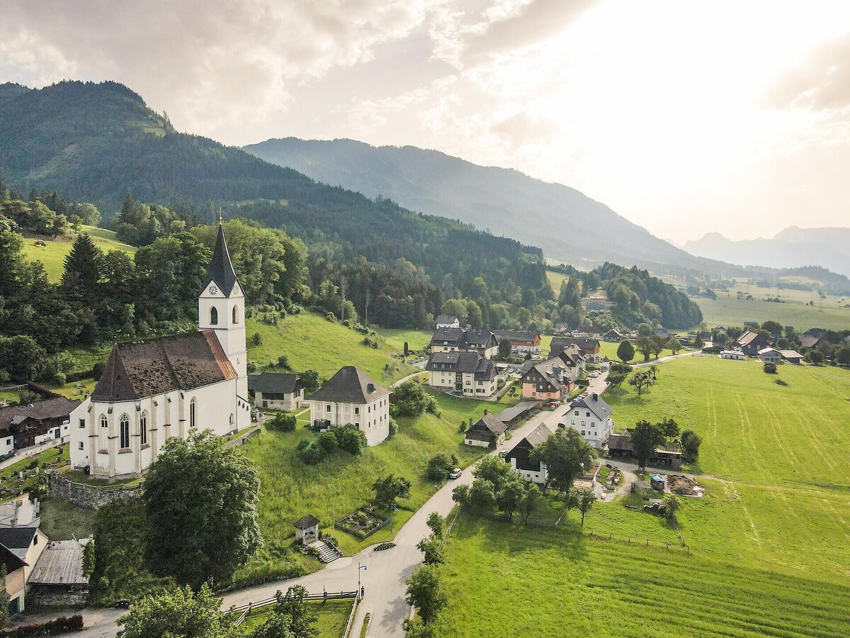
Ortsansicht von Lassing | Thomas Sattler
1/2
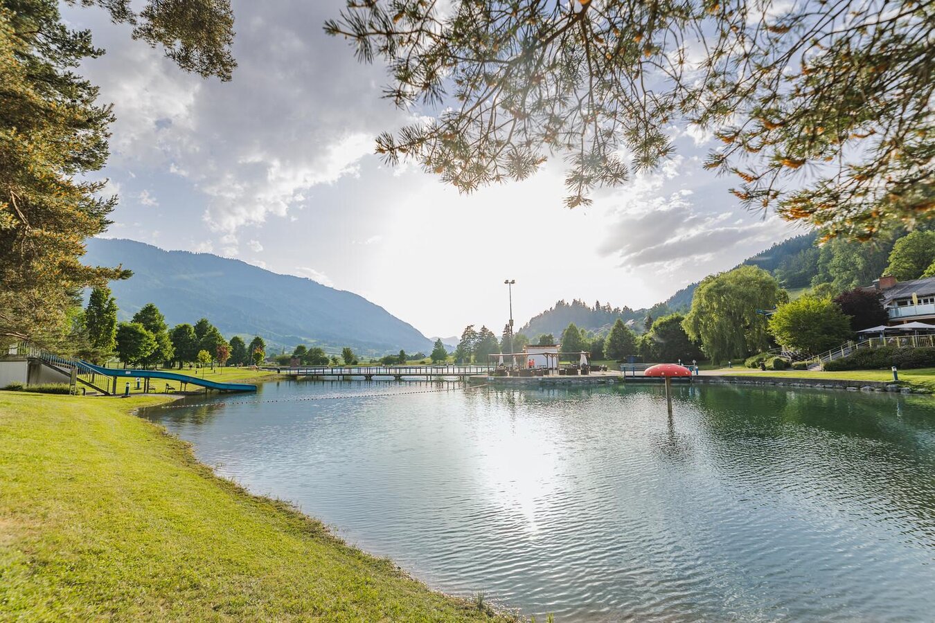
Beliebter Badesee in Lassing | © Thomas Sattler | Thomas Sattler
2/2

What the weather will be like Lassing (774m)
Today, 24.10.2026
The rain will end in the early afternoon, and the skies will break up afterwards.Morning

3°C
sr.Regenwahrscheinlichkeit
95%
sr.Windstärke
5 km/h
Noon
7°C
sr.Regenwahrscheinlichkeit
80%
sr.Windstärke
10 km/h
Night

3°C
sr.Regenwahrscheinlichkeit
15%
sr.Windstärke
5 km/h
Tomorrow, 25.10.2026
Mostly cloudy through the day with light rain now and then.Morning
-1°C
sr.Regenwahrscheinlichkeit
10%
sr.Windstärke
0 km/h
Noon
8°C
sr.Regenwahrscheinlichkeit
65%
sr.Windstärke
5 km/h
Night
7°C
sr.Regenwahrscheinlichkeit
80%
sr.Windstärke
5 km/h
Forecast
26.10.2026
0°C
11°C
27.10.2026

-1°C
12°C
28.10.2026
1°C
11°C
