


Closed
Le 03 Himbergereck West
Accessible by public transport- Train (within 15 minutes walking distance from starting point)
Characteristics
SkillThe tour in numbers
Level of difficulty
challenging
Route
11,3 km
Time
2:15 h
Uphill
796 hm
Downhill
115 hm
Highest point
1271 m
The Himbergereck WestLE03 mountain bike route in Leoben is a challenging ride that is ideal for experienced cyclists. It offers varied climbs, technical sections and impressive views of the surrounding mountain landscape.
Standardised MTB signposting in the town of Leoben
The tour begins at the Miners’ Memorial in Leoben-Seegraben. There is also an information board here to help with navigation.
The route connects to the existing LE02 route (Himbergereck East). The trail leads along forest roads and woodland paths up to the Himbergereck (1,345 m). The climb is continuous and requires a good level of fitness.
The descent involves technical sections and requires riding skill. The route leads back to the starting point at the Miners’ Memorial.
Translated with DeepL.com (free version)
The tour begins at the Miners’ Memorial in Leoben-Seegraben. There is also an information board here to help with navigation.
The route connects to the existing LE02 route (Himbergereck East). The trail leads along forest roads and woodland paths up to the Himbergereck (1,345 m). The climb is continuous and requires a good level of fitness.
The descent involves technical sections and requires riding skill. The route leads back to the starting point at the Miners’ Memorial.
Translated with DeepL.com (free version)
Best season
January
February
March
April
May
June
July
August
September
October
November
December
More information
The route is signposted throughout with the official MTB sign LE03.
The mountain bike tour starts at the miners’ memorial in the Seegraben district of Leoben. From there, the route leads uphill along a forest track towards Himbergereck. The climb is continuous but easily rideable and initially passes through shaded sections of woodland. After about a third of the route, it joins the MTB route LE02 (Himbergereck East).
The route continues uphill along well-maintained forest tracks with occasional views of the valley. The highest point of the route, the Himbergereck at around 1,345 metres, is reached via a strenuous but technically straightforward section. Once at the top, a panoramic view of the surrounding mountains opens up.
The descent begins with a short, steep section that requires good riding technique. The route then continues downhill towards Leoben over varied terrain – mostly forest tracks, with some root-covered sections. After a final stretch through the woods, you reach the settlement of Seegraben once more and return to the starting point at the Miners’ Memorial.
The mountain bike tour starts at the miners’ memorial in the Seegraben district of Leoben. From there, the route leads uphill along a forest track towards Himbergereck. The climb is continuous but easily rideable and initially passes through shaded sections of woodland. After about a third of the route, it joins the MTB route LE02 (Himbergereck East).
The route continues uphill along well-maintained forest tracks with occasional views of the valley. The highest point of the route, the Himbergereck at around 1,345 metres, is reached via a strenuous but technically straightforward section. Once at the top, a panoramic view of the surrounding mountains opens up.
The descent begins with a short, steep section that requires good riding technique. The route then continues downhill towards Leoben over varied terrain – mostly forest tracks, with some root-covered sections. After a final stretch through the woods, you reach the settlement of Seegraben once more and return to the starting point at the Miners’ Memorial.
Bike & Equipment
Mountain bike (with knobbly tyres and good brakes)
Helmet (compulsory!)
Bike tools, spare inner tube, pump
Protective gear & clothing
Gloves, cycling glasses, weatherproof clothing
Sturdy shoes with good grip
Food & Safety
Water bottle or hydration pack
Snacks/energy bars
First-aid kit, mobile phone with GPS or GPX file
Optional (but recommended)
Rain jacket
Insect repellent
Light (for early or late rides)
With this kit, you’ll be well prepared for the moderately difficult, unspoilt circular route through the Erzberg-Leoben woodland area!
Mountain bike (with knobbly tyres and good brakes)
Helmet (compulsory!)
Bike tools, spare inner tube, pump
Protective gear & clothing
Gloves, cycling glasses, weatherproof clothing
Sturdy shoes with good grip
Food & Safety
Water bottle or hydration pack
Snacks/energy bars
First-aid kit, mobile phone with GPS or GPX file
Optional (but recommended)
Rain jacket
Insect repellent
Light (for early or late rides)
With this kit, you’ll be well prepared for the moderately difficult, unspoilt circular route through the Erzberg-Leoben woodland area!
Map & downloads
Gallery
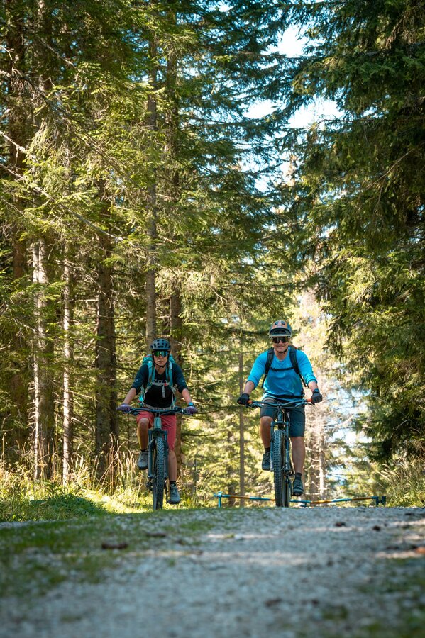
Erzberg-Leoben-STG-12.jpg | © STG/ Jesse Streibl | TVB Erzberg-Leoben
1/1

What the weather will be like Leoben (542m)
Today, 23.10.2026
The day starts sunny, but will be partly cloudy in the afternoon.Morning

1°C
sr.Regenwahrscheinlichkeit
0%
sr.Windstärke
0 km/h
Noon

12°C
sr.Regenwahrscheinlichkeit
0%
sr.Windstärke
5 km/h
Night

7°C
sr.Regenwahrscheinlichkeit
0%
sr.Windstärke
0 km/h
Tomorrow, 24.10.2026
Rain at daybreak, then slowly drying up and partly sunny during the day.Morning

4°C
sr.Regenwahrscheinlichkeit
80%
sr.Windstärke
5 km/h
Noon

10°C
sr.Regenwahrscheinlichkeit
55%
sr.Windstärke
5 km/h
Night
5°C
sr.Regenwahrscheinlichkeit
20%
sr.Windstärke
5 km/h
Forecast
25.10.2026
1°C
11°C
26.10.2026
3°C
14°C
27.10.2026
2°C
15°C
