


Seven Springs Trail Ratschendorf (Sieben-Quellen-Weg Ratschendorf)
Characteristics
SkillThe tour in numbers
Level of difficulty
easy
Route
14,8 km
Time
3:45 h
Uphill
34 hm
Downhill
34 hm
Highest point
248 m
The Seven Springs Trail Ratschendorf leads to various water power places in southern southeastern Styria.
The focus of this circular hike is on various water power places. In Deutsch Goritz you should definitely take a look at the church, because its interior was painted by the Seckau painter Father Lukas (Hermann Reicht) in the Beuron style. The visitors of the church, who could not read, should understand the Bible on the basis of the pictures. The path leads through the church square to the Peter Spring. At the "Steirerquell" the thirst can be quenched right away. In the "Jaun", the wetland in the south of Deutsch Goritz, it is especially interesting in spring, because of the large occurrence of spring knotweed. The hike leads us to a place of cultural-historical importance at the "Wäsch", the place where hemp and flax used to be dried and the village farmers' laundry was washed. In the village square of Ratschendorf you can see a modern fountain. In the small wood "Hügelstaudach" there is one of the 34 Roman-period tumuli fields of the Radkersburg district.
Best season
January
February
March
April
May
June
July
August
September
October
November
December
More information
You can arrive by public transport. It is also possible to arrive by car via the A9 Phyrn freeway. Freeway exit: Vogau-Straß
You can find detailed information about the journey here.
Parking available
You can find detailed information about the journey here.
Parking available
We start our hike in front of the church of Deutsch Goritz, where you should take a look: The paintings inside, painted in the "Beuron style" by the Seckau painter Father Lukas (Hermann Reicht), were intended to bring the Bible closer to those who could not read. Therefore, the painting is also called "Bible for the poor". From here we walk in the direction of Weixelbaum and after 700m we turn left to the Peterquelle, where we can also taste the mineral water at a fountain. Across two streams and along field paths we reach Salsach. Here we can explore what the "tear of Salsach" is, and then walk along the road towards Deutsch Goritz. In the bend we turn left and immediately dive into the Jaun. This name refers to the wetland to the south of Deutsch Goritz (in spring there is a large occurrence of spring knotweed here), through which we hike via the "Wäsch" - where hemp and flax used to be dried and the village farmers' laundry was washed - to Ratschendorf.Here we can either return to the starting point via the road or begin the second loop of the hike. This first takes us north to Pechmann's old oil mill, a traditional cider tavern with an attached old-timer museum, where we can even look over the shoulder of the kernel oil presser. Afterwards we hike nicely flat between the ponds to the pilgrimage church Maria Helfbrunn. As the name suggests, the water from this spring helps with illnesses and therefore numerous pilgrims come here every year. Now we head east along the Helfbrunn terrace. This terrain edge dates back to the ice age, when a lot of loose material was deposited here. Interesting are also the many springs, which result from the fact that a layer of clay in the terrace does not allow the water to seep away and instead leads to these springs. Finally, we reach the grove Hügelstaudach, where there is a Roman-period tumulus field. Based on the results of the archaeological excavations, a museum has been established in the old cold store of Ratschendorf. The road then leads back to Ratschendorf and Deutsch Goritz.
Emergency call mountain rescue: 140
ambulance: 144
European emergency call: 112
firefighters: 122
police: 133
Tips when reporting an emergency – Answer these six WH questions: What happened? How many people are injured? Where did the accident happen (are there GPS coordinates)? Who is reporting the incident (callback number)? When did the accident happen? What is the weather like at the site of the incident?
Proper backpack packing makes many things easier: Pack heavy things first. The water bottle should always be within reach in a side pocket. All the things that are often needed, such as sunglasses, camera or hiking map, belong on top. An emergency kit, including blister plasters, belongs in every rucksack and it is always advisable to dress in layers.
A stop at the Helfbrunn pilgrimage church in Ratschendorf, which is an Austrian Marian pilgrimage site, is recommended.
Detailed information about arriving by ÖBB (Austrian Federal Railways) can be found at www.oebb.at or on the Verbundlinie Steiermark website www.busbahnbim.at
With Verbundlinie’s BusBahnBim route planner app, planning your journey has never been easier: simply enter towns and/or addresses, stop names or points of interest to check all bus, train and tram connections in Austria. The app is available free of charge for smartphones – on Google Play and in the App Store
Gemeinde Deutsch Goritz
Deutsch Goritz 16/1
8483 Deutsch Goritz
Tel.: +43 3474 70 50
tourismus@deutsch-goritz.at
www.deutsch-goritz.at
Volcanic Land Hiking Map "Man & Nature" 1:500.000 Styrian Volcanic Country Tel. +43 (0)3152/8575-710 www.spuren.at
freytag & berndt WK 412 Southeast Styrian Hills, Volcanic Country, Bad Gleichenberg, Bad Radkersburg
Kompass hiking guide "Styrian Volcano Country - On the trail of the volcanoes". Descriptions, route maps and elevation profiles ISBN 978-3-85026-096-1 www.kompass.at
Deutsch Goritz 16/1
8483 Deutsch Goritz
Tel.: +43 3474 70 50
tourismus@deutsch-goritz.at
www.deutsch-goritz.at
Volcanic Land Hiking Map "Man & Nature" 1:500.000 Styrian Volcanic Country Tel. +43 (0)3152/8575-710 www.spuren.at
freytag & berndt WK 412 Southeast Styrian Hills, Volcanic Country, Bad Gleichenberg, Bad Radkersburg
Kompass hiking guide "Styrian Volcano Country - On the trail of the volcanoes". Descriptions, route maps and elevation profiles ISBN 978-3-85026-096-1 www.kompass.at
Map & downloads
Gallery
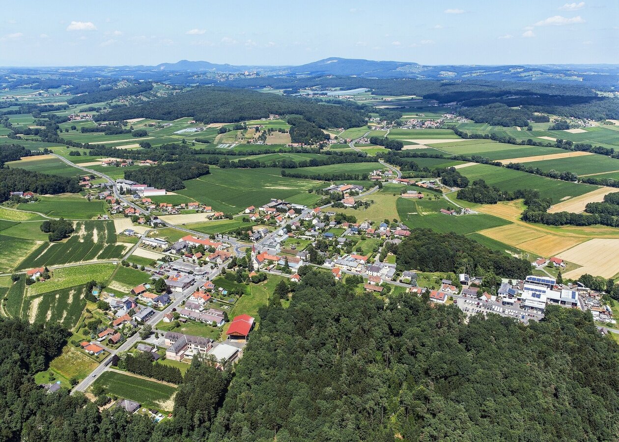
Luftansicht Deutsch Goritz | © Gemeinde Deutsch Goritz
1/3
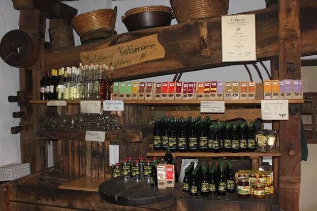
Pechmanns alte Ölmühle | © Pechmanns alte Ölmühle
2/3
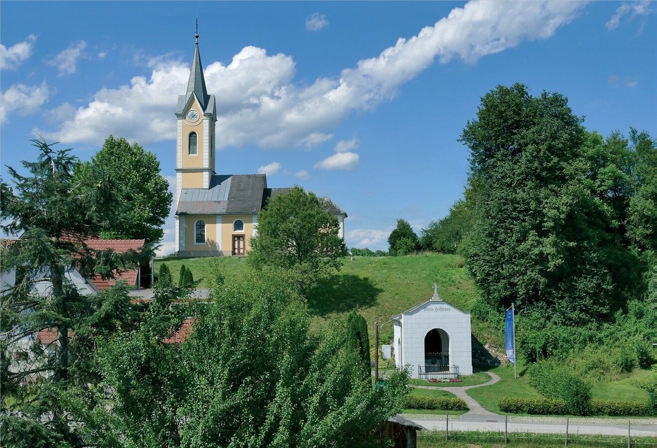
Blick auf die Wallfahrtskirche Maria Helfbrunn | © Diakon Johann Pock | Diakon Johann Pock
3/3

What the weather will be like Deutsch Goritz (243m)
Today, 24.10.2026
Heavy rain in the morning, drying up in the afternoon.Morning

6°C
sr.Regenwahrscheinlichkeit
90%
sr.Windstärke
5 km/h
Noon

10°C
sr.Regenwahrscheinlichkeit
60%
sr.Windstärke
5 km/h
Night

6°C
sr.Regenwahrscheinlichkeit
25%
sr.Windstärke
5 km/h
Tomorrow, 25.10.2026
Mostly cloudy through the day with a chance of occasional sunny spells.Morning

2°C
sr.Regenwahrscheinlichkeit
0%
sr.Windstärke
5 km/h
Noon

11°C
sr.Regenwahrscheinlichkeit
0%
sr.Windstärke
10 km/h
Night
8°C
sr.Regenwahrscheinlichkeit
25%
sr.Windstärke
5 km/h
Forecast
26.10.2026

3°C
15°C
27.10.2026
4°C
14°C
28.10.2026
3°C
14°C
