


Open
Von Altaussee auf den Losergipfel
Characteristics
SkillThe tour in numbers
Level of difficulty
medium
Route
16,0 km
Time
5:45 h
Uphill
1318 hm
Downhill
209 hm
Highest point
1835 m
Wonderful summit tour on Altaussee's local mountain.
This challenging mountain tour to the summit of the Loser offers spectacular panoramic views of the Salzkammergut and the Hohe Tauern. The trail leads to the summit of the Loser via the varied Kielerweg and the Augstalm. The descent leads via the famous Loser Fenster and the high alpine pastures of the Hochanger back down to the valley. A challenging but rewarding summit tour for experienced mountain hikers.
Best season
January
February
March
April
May
June
July
August
September
October
November
December
More information
The best way to plan your journey to Altaussee is with google.at/maps.
Paid parking is available at the Kur- und Amthaus, directly in the center.
Paid parking is available at the Kur- und Amthaus, directly in the center.
This impressive mountain tour leads from Altaussee to the Loser summit, Altaussee's striking local mountain. The route offers varied climbs, high alpine pastures and spectacular panoramic views as far as the Dachstein, the Hohe Tauern and the Tote Gebirge.
The hike starts at the parking lot in Altaussee. From here, follow the road to the right and turn left onto the access road just before the parish church. This leads uphill between farmsteads and houses to the north. Passing a private chapel on the lower right, you reach the end of the road.
The marked trail no. 254 to the Loserhütte or Loser summit begins here on the left. The trail leads through a coniferous forest to the so-called Kielerweg, which initially heads east, turns west again in the area of the Goldene Reidn and changes direction several times. After crossing a forest road, you reach the Loser Panoramastraße after around one kilometer. Cross this road before continuing to the Augstalm and the ascent to the Loser summit (trail no. 255).
The trail leads over the Loserboden, a cut between the Loser and Hochanger, below the Graskogel to the fork in the trail. Keep left here in the direction of the Loser summit.
⚠ Caution: The trail runs along steep rock faces at the start.
The last 500 meters lead over rocky terrain and grassy areas to the summit cross of the Loser. Here you can enjoy a magnificent panoramic view over the Salzkammergut, the Dachstein, the Hohe Tauern, the Bohemian Forest and the Tote Gebirge.
From the Loser summit, trail no. 256 continues in the direction of Hochanger. The trail initially runs steeply uphill through a slope covered with mountain pines to the high alpine pastures. You then descend through a rocky gully and along natural rocky ledges.
Shortly afterwards, you reach the Loserfenster - a huge rock opening created by nature, which offers an impressive view of the Gschwandtalm and Schönberg.
⚠ Be careful: here you are in the immediate vicinity of a steeply sloping wall.
The rest of the descent is steep and exposed in places. Continue over natural rock steps towards the Atterkogel before the path winds its way down into the valley. At the outflow of the Augstsee lake, the path leads downhill to the right to the large parking lot at the Loseralm. From here, continue right along the ski terrace for around 750 meters downhill to the Loserhütte.
The marked trail no. 254 then leads via the Augstalm back to the ascent trail, which you follow to the starting point in Altaussee.
The hike starts at the parking lot in Altaussee. From here, follow the road to the right and turn left onto the access road just before the parish church. This leads uphill between farmsteads and houses to the north. Passing a private chapel on the lower right, you reach the end of the road.
The marked trail no. 254 to the Loserhütte or Loser summit begins here on the left. The trail leads through a coniferous forest to the so-called Kielerweg, which initially heads east, turns west again in the area of the Goldene Reidn and changes direction several times. After crossing a forest road, you reach the Loser Panoramastraße after around one kilometer. Cross this road before continuing to the Augstalm and the ascent to the Loser summit (trail no. 255).
The trail leads over the Loserboden, a cut between the Loser and Hochanger, below the Graskogel to the fork in the trail. Keep left here in the direction of the Loser summit.
⚠ Caution: The trail runs along steep rock faces at the start.
The last 500 meters lead over rocky terrain and grassy areas to the summit cross of the Loser. Here you can enjoy a magnificent panoramic view over the Salzkammergut, the Dachstein, the Hohe Tauern, the Bohemian Forest and the Tote Gebirge.
From the Loser summit, trail no. 256 continues in the direction of Hochanger. The trail initially runs steeply uphill through a slope covered with mountain pines to the high alpine pastures. You then descend through a rocky gully and along natural rocky ledges.
Shortly afterwards, you reach the Loserfenster - a huge rock opening created by nature, which offers an impressive view of the Gschwandtalm and Schönberg.
⚠ Be careful: here you are in the immediate vicinity of a steeply sloping wall.
The rest of the descent is steep and exposed in places. Continue over natural rock steps towards the Atterkogel before the path winds its way down into the valley. At the outflow of the Augstsee lake, the path leads downhill to the right to the large parking lot at the Loseralm. From here, continue right along the ski terrace for around 750 meters downhill to the Loserhütte.
The marked trail no. 254 then leads via the Augstalm back to the ascent trail, which you follow to the starting point in Altaussee.
Emergency call mountain rescue: 140
Tip for reporting an emergency - give answers to the six W questions:
Please note the disclaimer!
Packing your rucksack properly makes many things easier:
Tip for reporting an emergency - give answers to the six W questions:
- What has happened?
- How many injured?
- Where did the accident happen? (possibly GPS coordinates)
- Who is reporting? (callback number)
- When did the accident happen?
- Weather at the scene of the accident?
Please note the disclaimer!
Packing your rucksack properly makes many things easier:
- Pack heavy items first.
- The water bottle should always be within easy reach in a side pocket.
- All items that are often needed, such as sunglasses, camera or hiking map, should be on top.
- Emergency equipment, including blister plasters, belongs in every rucksack and it is always advisable to dress according to the “onion system”!
A free Ausseerland hiking map is available to help you plan your hiking vacation in Ausseerland and can be conveniently ordered by post. The hiking map store also offers a large selection of detailed maps for other mountain tours in the region.
Tourist Office Ausseerland Salzkammergut
Information office Altaussee
Fischerndorf 61
8992 Altaussee
+43 3622 716 43
Send e-mail
Website
Information office Altaussee
Fischerndorf 61
8992 Altaussee
+43 3622 716 43
Send e-mail
Website
Map & downloads
Gallery
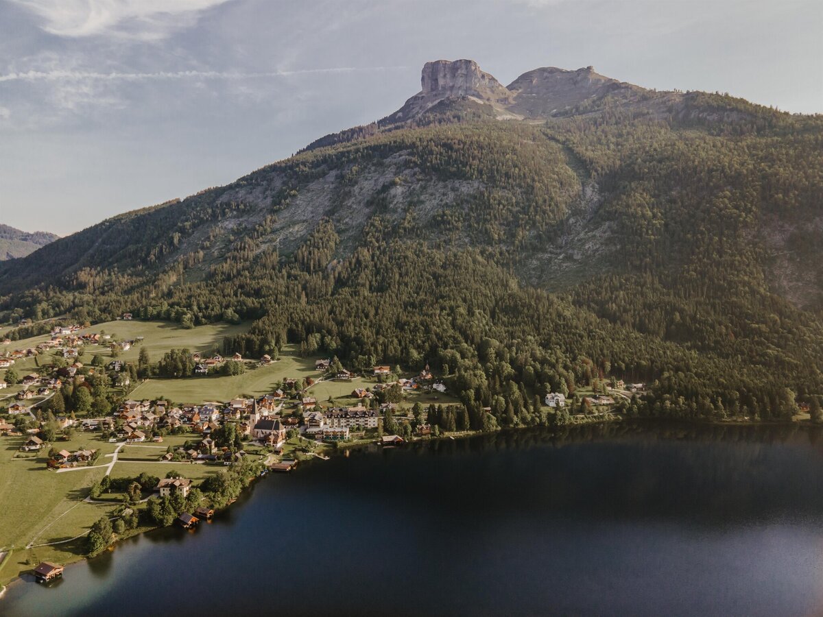
Altausseer See with village and Loser | © TVB Ausseerland Salzkammergut-Katrin Kerschbaumer | TVB Ausseerland Salzkammergut-Katrin Kerschbaumer
1/2
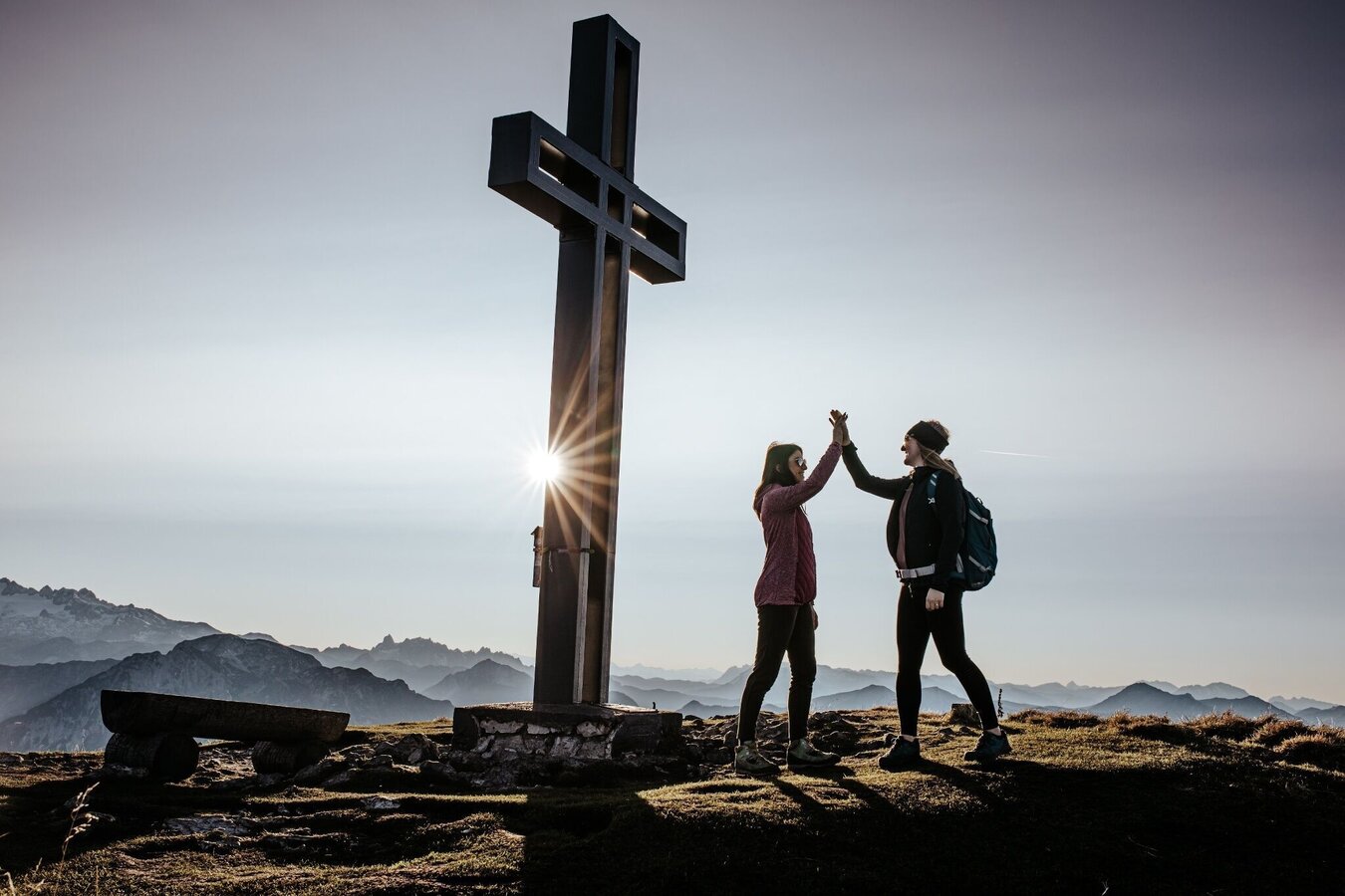
Ankunft am Losergipfel in Altaussee | © TVB Ausseerland Salzkammergut | Katrin Kerschbaumer
2/2

What the weather will be like Altaussee (727m)
Today, 21.09.2026
A fairly sunny day after some rain in the early morning.Morning

11°C
sr.Regenwahrscheinlichkeit
75%
sr.Windstärke
5 km/h
Noon

16°C
sr.Regenwahrscheinlichkeit
40%
sr.Windstärke
10 km/h
Night

12°C
sr.Regenwahrscheinlichkeit
5%
sr.Windstärke
5 km/h
Tomorrow, 22.09.2026
Rain and rain showers will end around noon. Dry with a chance of sunny spells afterwards.Morning

8°C
sr.Regenwahrscheinlichkeit
60%
sr.Windstärke
5 km/h
Noon

14°C
sr.Regenwahrscheinlichkeit
60%
sr.Windstärke
5 km/h
Night
9°C
sr.Regenwahrscheinlichkeit
35%
sr.Windstärke
5 km/h
Forecast
23.09.2026

5°C
17°C
24.09.2026
5°C
16°C
25.09.2026
8°C
17°C
