


Open
BergeSeen Trail 18: Bad Mitterndorf - Tauplitzalm
Characteristics
SkillThe tour in numbers
Level of difficulty
medium
Route
16,4 km
Time
5:10 h
Uphill
898 hm
Downhill
47 hm
Highest point
1652 m
Valley hike along side streets, forestry tracks and a path, then the route ascends to the Tauplitzalm over well-marked forest trails.
A beautiful transitional stage on the BergeSeenTrail from the valley floor in Bad Mitterndorf via Tauplitz to the panoramic Tauplitzalm. A mix of asphalt, forest, and mountain trails with magnificent views of Grimming, Totes Gebirge, and Steirersee. The perfect combination of hiking experience, natural diversity, and gentle inclines for sure-footed hikers.
Best season
January
February
March
April
May
June
July
August
September
October
November
December
More information
The best way to plan your journey to Bad Mitterndorf is with google.com/maps.
Free parking is available at the Grimminghalle Bad Mitterndorf.
This varied hike in the Ausseerland region forms the 18th stage of the BergeSeen Trail and leads from the wide valley floor of the Hinterberg up to the panoramic Tauplitzalm, which lies at around 1,600 meters above sea level. The tour begins leisurely on side roads, forest paths, and field trails and climbs in the second section via well-marked forest and mountain trails up to the high plateau of Tauplitz. The stage combines winter sports culture with the experience of nature in one of the most beautiful hiking areas in the Totes Gebirge mountains.
Route description
The starting point is the bus stop below the parish church in Bad Mitterndorf. From there, head south via the Kirchenstiege to Koglergasse, through the underpass of the main road and on to the railroad crossing.
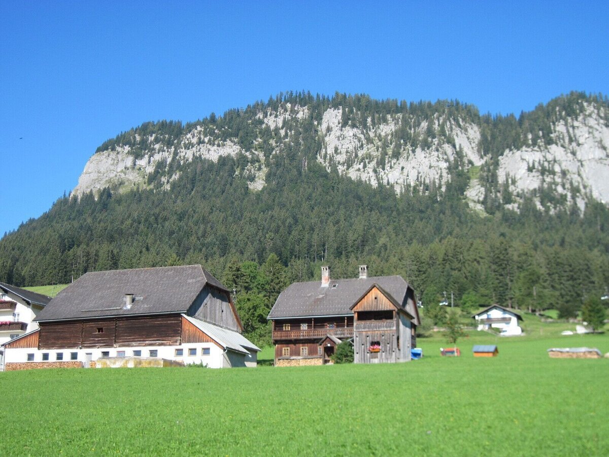
Take Neuhofenstraße to the junction at the heating plant, then through a small wooded area over the Zauchenbach stream. Continue along Hörmannweg and through flat woodland to the hamlet of Graben. From there, Krunglgrabenweg leads to Krungl (818 m).
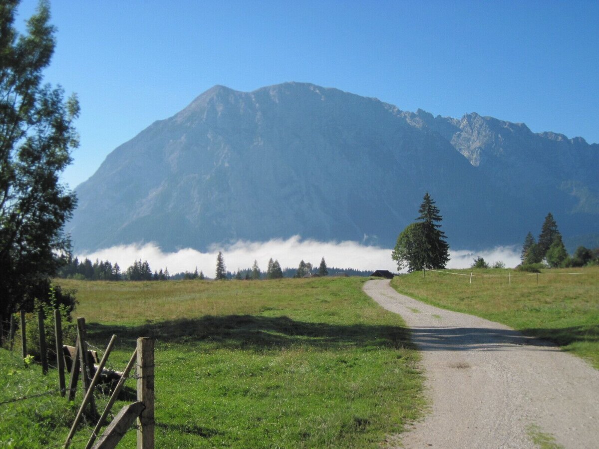
At Gasthaus Kanzler, turn right towards Tauplitz train station, following the signs for cycle path R19. Walk along a narrow asphalt road with views of the imposing Grimming mountain, past the Kulm ski jump, towards Tauplitz. There are two underpasses (railway and bypass), then take Furthleitenweg to the center of Tauplitz (896 m). Walking time: approx. 2:30 h
Pass Pötschnergasse to the valley station of the chairlift, then turn left onto Hollamweg and continue right onto Freibergweg. Where this turns right, continue straight ahead on a gravel road, past meadows to Gnanitzweg. Turn left there and after about 200 meters turn left onto hiking trail no. 275 (signposted: “Steirersee, Linzer Tauplitzhaus”).
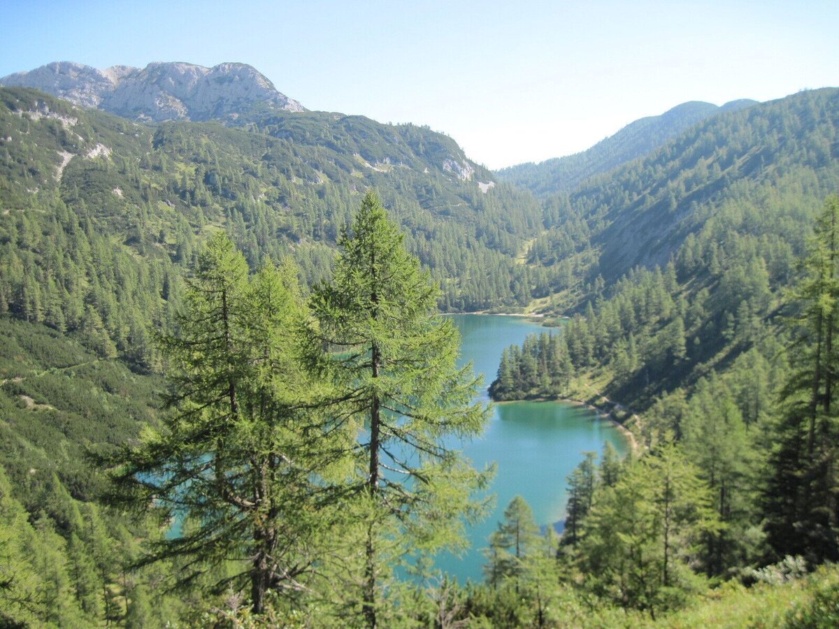
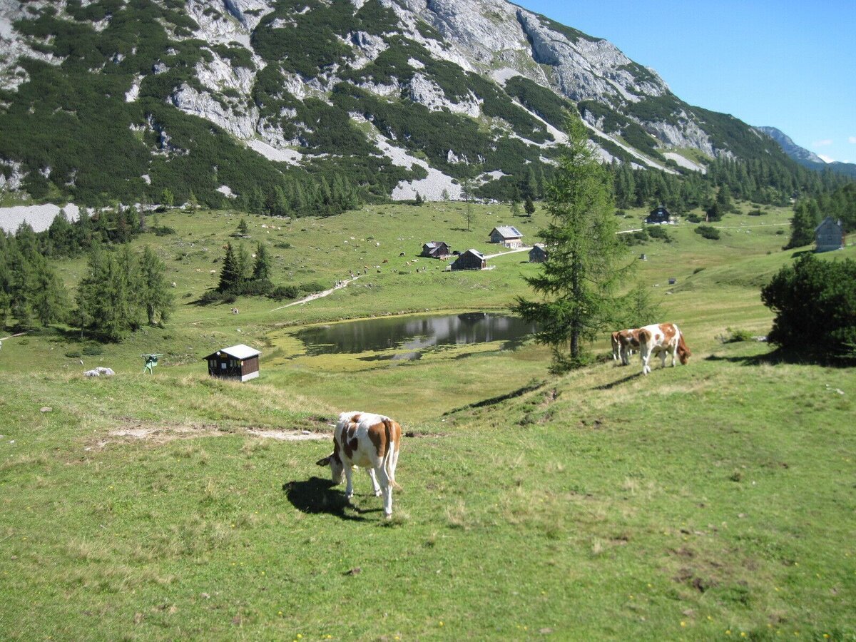
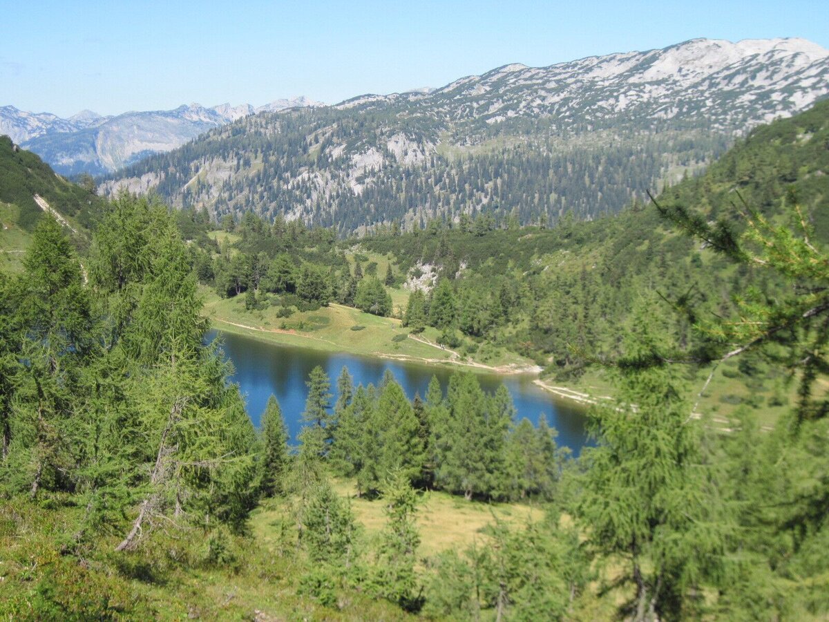
The trail leads through a forest ditch that becomes steeper to the Niederblas meadow and continues through mixed forest to Lahnergrube. Then through a sparse larch forest to the ridge between Mitterberg and Tauplitzalm (1,520 m). With a view of the Steirersee, the trail leads to the Steirerseehütten and continues on the gravel road to the Tauplitzalm mountain station (1,645 m).
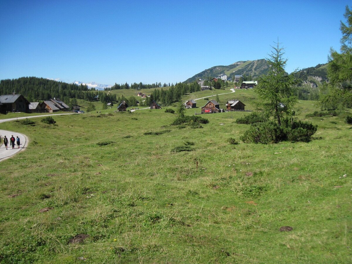
The Linzer Tauplitzhaus is on the left, and the paved road leads straight ahead to the Naturfreundehaus Tauplitzalm, about 500 m away. Here you cross the Styrian long-distance hiking trail “From Glacier to Wine” again. Walking time: approx. 2:30 h
- In alpine terrain, be aware of the danger of falling rocks.
- Through early summer, you may encounter steep snowfields or firn gullies – especially during icy conditions, there is an acute risk of falling and thus fatal injury!
- Due to storm damage, forestry work or construction work, individual trail sections may be difficult or impassable at times.
- Cows in the alpine meadows are often curious. Because they are nursing mothers, they develop a strong tendency to protect their calves. Therefore, move through cow pastures quietly, keep at least 20 metres of distance to the animals and never pet calves! In the case of threatening behaviour (pawing, stamping) slowly back away (do not turn your back). Keep dogs on a leash. They must not bark at or chase cows. In the case of an attack, the dog must be released from the leash.
For all stages, you will need hiking or mountain boots with treaded rubber soles as well as wind- and rainproof clothing. A change of clothes and a small first-aid kit should also be included in your backpack. The amount of provisions you should pack depends on the number of available rest stops. In any case, you should always take along plenty to drink. Telescopic poles are helpful, especially when walking downhill.
This stage is an ideal link between the valley and high mountain landscapes. Hiking in Ausseerland means diversity in nature, panoramic views, and trail characteristics. Further information on tour planning can be found in the free Ausseerland hiking map and in the hiking map shop.
Ausseerland Salzkammergut Tourism Association
Information Office Bad Mitterndorf
8983 Bad Mitterndorf No. 58
+43 3623 2444
Send email
Website
Map & downloads
Gallery
bergeseen trail 18: bad mitterndorf - tauplitzalm_img_23018971 | © Salzkammergut - BergeSeen | Salzkammergut Tourismus
1/6
bergeseen trail 18: bad mitterndorf - tauplitzalm_img_23018972 | © Salzkammergut - BergeSeen | Salzkammergut Tourismus
2/6
bergeseen trail 18: bad mitterndorf - tauplitzalm_img_23018973 | © Salzkammergut - BergeSeen | Salzkammergut Tourismus
3/6
bergeseen trail 18: bad mitterndorf - tauplitzalm_img_23018974 | © Salzkammergut - BergeSeen | Salzkammergut Tourismus
4/6
bergeseen trail 18: bad mitterndorf - tauplitzalm_img_23018975 | © Salzkammergut - BergeSeen | Salzkammergut Tourismus
5/6
bergeseen trail 18: bad mitterndorf - tauplitzalm_img_23018976 | © Salzkammergut - BergeSeen | Salzkammergut Tourismus
6/6

What the weather will be like Bad Mitterndorf (800m)
Today, 21.09.2026
Partly sunny during the day after light rain at daybreak.Morning

11°C
sr.Regenwahrscheinlichkeit
70%
sr.Windstärke
10 km/h
Noon

17°C
sr.Regenwahrscheinlichkeit
35%
sr.Windstärke
15 km/h
Night

12°C
sr.Regenwahrscheinlichkeit
10%
sr.Windstärke
5 km/h
Tomorrow, 22.09.2026
Rain and rain showers will end around noon. Dry with a chance of sunny spells afterwards.Morning
7°C
sr.Regenwahrscheinlichkeit
60%
sr.Windstärke
5 km/h
Noon

14°C
sr.Regenwahrscheinlichkeit
60%
sr.Windstärke
15 km/h
Night
9°C
sr.Regenwahrscheinlichkeit
45%
sr.Windstärke
5 km/h
Forecast
23.09.2026

4°C
18°C
24.09.2026
3°C
17°C
25.09.2026
6°C
17°C
