


The Goldlacken in Sattental valley
Characteristics
SkillThe tour in numbers
Level of difficulty
medium
Route
14,1 km
Time
6:00 h
Uphill
1110 hm
Downhill
1110 hm
Highest point
2324 m
A rewarding mountain hike in the beautiful Sattental valley. This tour combines stunning alpine pastures with beautiful mountain lakes and views of rugged cliffs and high peaks.
The Sattental is one of the southern side valleys of the Enns Valley, renowned for its beautiful alpine pastures. With the Perneralm, the Tagalm, and the Schladminger Alm, there are several mountain huts to explore on foot. On the way to the Goldlacken lakes, a stop at the first two is highly recommended. The Goldlacken can be reached by ascending from the head of the valley – initially through a dense forest of spruce and larch. About halfway up, the forest leaves the forest behind. Here, a detour to the Stierkarsee lake is possible, situated below the imposing Hochwildstelle mountain. The Goldlacken themselves lie at almost 2,400 meters and are often also called the "Little Klafferkessel."
Best season
January
February
March
April
May
June
July
August
September
October
November
December
More information
In Pruggern, exit the B320 Ennstal federal highway and continue towards Pruggererberg. At the Sattental turn-off, turn left and follow the road to the Sattental car park.
Sattental parking lot at the beginning of the Sattental alpine pasture area.
Sattental parking lot at the beginning of the Sattental alpine pasture area.
From the parking lot, hike to the head of the valley, past charming, rustic alpine huts, following the stream. Initially, the path leads along gravel tracks and alpine meadows, but soon crosses a large scree field to a small bridge where two mountain streams meet. The trail continues in the middle, climbing steeply through the high forest until you reach the treeline and a cirque. A short descent to the right leads to the Stierkarsee lake. We recommend this detour on the return journey. The lake lies nestled in the small valley basin, and its surrounding alpine meadows invite you to linger.
Trail #26 continues to the left, ascending over the ridge to the enticing Goldlacken – a collection of small lakes. Along the way, you'll be treated to magnificent views back into the Sattental valley and towards the Stierkarsee. Above the route, the imposing Hochwildstelle, the highest mountain within Styria, looms majestically.
Trail #26 continues to the left, ascending over the ridge to the enticing Goldlacken – a collection of small lakes. Along the way, you'll be treated to magnificent views back into the Sattental valley and towards the Stierkarsee. Above the route, the imposing Hochwildstelle, the highest mountain within Styria, looms majestically.
Weather changes, rapid drop in temperature, thunderstorms, wind, fog and snowfields are objective dangers and require the right behaviour on the way. Hut hosts are experienced mountain experts, they can give good tips about the weather and the route. Lack of equipment, overestimation of one's own abilities, carelessness, poor physical condition and a wrong assessment can lead to critical situations.
In case of thunderstorms: Avoid summits, ridges and ropes at all costs
In an emergency, please dial the following emergency numbers:
- 140 - Mountain Rescue
- 112 - Euro emergency call
The starting point is not accessible by public transport.
Tour at your own risk! No liability is assumed for any alpine dangers (weather, etc.) that may exist or occur.
Map & downloads
Gallery

Cottongrass at the Goldlacken | © Erlebnisregion Schladming-Dachstein | Schladming Dachstein
1/5
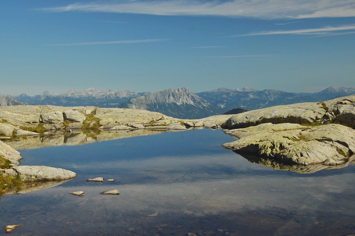
Goldlacken in the Sattental | © Erlebnisregion Schladming-Dachstein | Marlene Eggmayr
2/5

Goldlacken in the Sattental | © Erlebnisregion Schladming-Dachstein | Schladming Dachstein
3/5

Stierkarsee in Sattental | © Erlebnisregion Schladming-Dachstein | Schladming Dachstein - TVB Gröbminger Land
4/5

Goldlacken in the Sattental | © Erlebnisregion Schladming-Dachstein | Schladming Dachstein
5/5

What the weather will be like Michaelerberg-Pruggern (686m)
Today, 25.10.2026
Mostly cloudy and rain, which will increase more and more.Morning

2°C
sr.Regenwahrscheinlichkeit
10%
sr.Windstärke
5 km/h
Noon

7°C
sr.Regenwahrscheinlichkeit
65%
sr.Windstärke
5 km/h
Night

6°C
sr.Regenwahrscheinlichkeit
85%
sr.Windstärke
5 km/h
Tomorrow, 26.10.2026
Early clouds will clear to leave the region with a dry and sunny day.Morning
4°C
sr.Regenwahrscheinlichkeit
65%
sr.Windstärke
5 km/h
Noon
10°C
sr.Regenwahrscheinlichkeit
25%
sr.Windstärke
10 km/h
Night

4°C
sr.Regenwahrscheinlichkeit
0%
sr.Windstärke
0 km/h
Forecast
27.10.2026
-2°C
12°C
28.10.2026
1°C
11°C
29.10.2026

3°C
12°C
