


Stage 03 Hemma Pilgrimage Route Donnersbachwald-Oberwölz
Characteristics
SkillThe tour in numbers
Level of difficulty
challenging
Route
30,5 km
Time
10:00 h
Uphill
1033 hm
Downhill
1165 hm
Highest point
1995 m
Day three of our pilgrimage journey in the footsteps of Saint Hemma. This very long and demanding stage leads from Donnersbachwald to the highest point of the entire route at 1,998 metres above sea level. From the Glattjoch pass, the trail continues to our destination for the day: Oberwölz, the smallest town in Steiermark.
Saint Hemma, born in 980 as Countess of Friesach-Zeltschach, became widely known for her charity work and numerous foundations. Among other achievements, she founded the Benedictine monasteries of Gurk and Admont, the latter being home to the world’s largest monastic library.
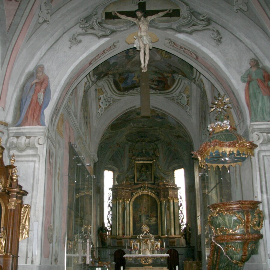
Oberwölz, today’s destination, was granted town status around 1300 and experienced economic prosperity during the 14th and 15th centuries. Much of its medieval character remains intact today, including the town walls, three town gates, and fortifications surrounding the historic centre. The parish church of Saint Martin is considered the oldest church in Oberwölz. Nearby stands the Hospital Church of Saint Sigismund, a purely Gothic church built in 1430 by Hans Jersleben. Due to limited space, its ground plan is slightly irregular. Among its valuable interior features is a magnificent high altar with an oversized crucifix. In the centre of the main square stands the Marian column, probably donated in 1717, featuring wooden statues of the Virgin Mary and the plague saints Rochus and Sebastian. Near the Schöttl Gate in the northern part of the square are the Austrian Brass Music Museum and the local heritage museum.
Oberwölz, today’s destination, was granted town status around 1300 and experienced economic prosperity during the 14th and 15th centuries. Much of its medieval character remains intact today, including the town walls, three town gates, and fortifications surrounding the historic centre. The parish church of Saint Martin is considered the oldest church in Oberwölz. Nearby stands the Hospital Church of Saint Sigismund, a purely Gothic church built in 1430 by Hans Jersleben. Due to limited space, its ground plan is slightly irregular. Among its valuable interior features is a magnificent high altar with an oversized crucifix. In the centre of the main square stands the Marian column, probably donated in 1717, featuring wooden statues of the Virgin Mary and the plague saints Rochus and Sebastian. Near the Schöttl Gate in the northern part of the square are the Austrian Brass Music Museum and the local heritage museum.
Best season
January
February
March
April
May
June
July
August
September
October
November
December
More information
Detailed information on how to get to Donnrsbachwald can be found here.
Parking is available in the village centre near the pavilion as well as at the valley station of the Riesneralm ski area.
From Donnersbachwald, we follow the main road around 4.5 kilometres further into the valley to the Hinterwald holiday village (1,066 m). Before the Lahrer Bridge, near the EGG Donnersbachwald power station, trail no. 936 begins, marked with red-white-red signs, leading to the Glattjoch Chapel and onwards down to Oberwölz. This ancient route across the Glattjoch was once used by mule traders.
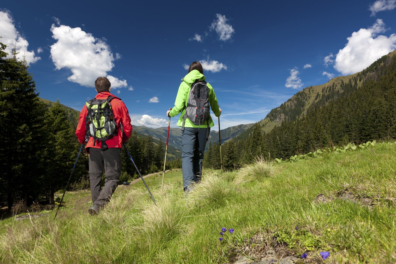
We stay on the marked trail, which initially follows a forest road alongside the Donnersbach stream to the Riedleralm and then to the Beireutalm. The route then turns left and continues steeply through forest and alpine meadows up to the Glattjoch pass (1,988 m), which we reach after around 4.5 hours and 12.5 kilometres.
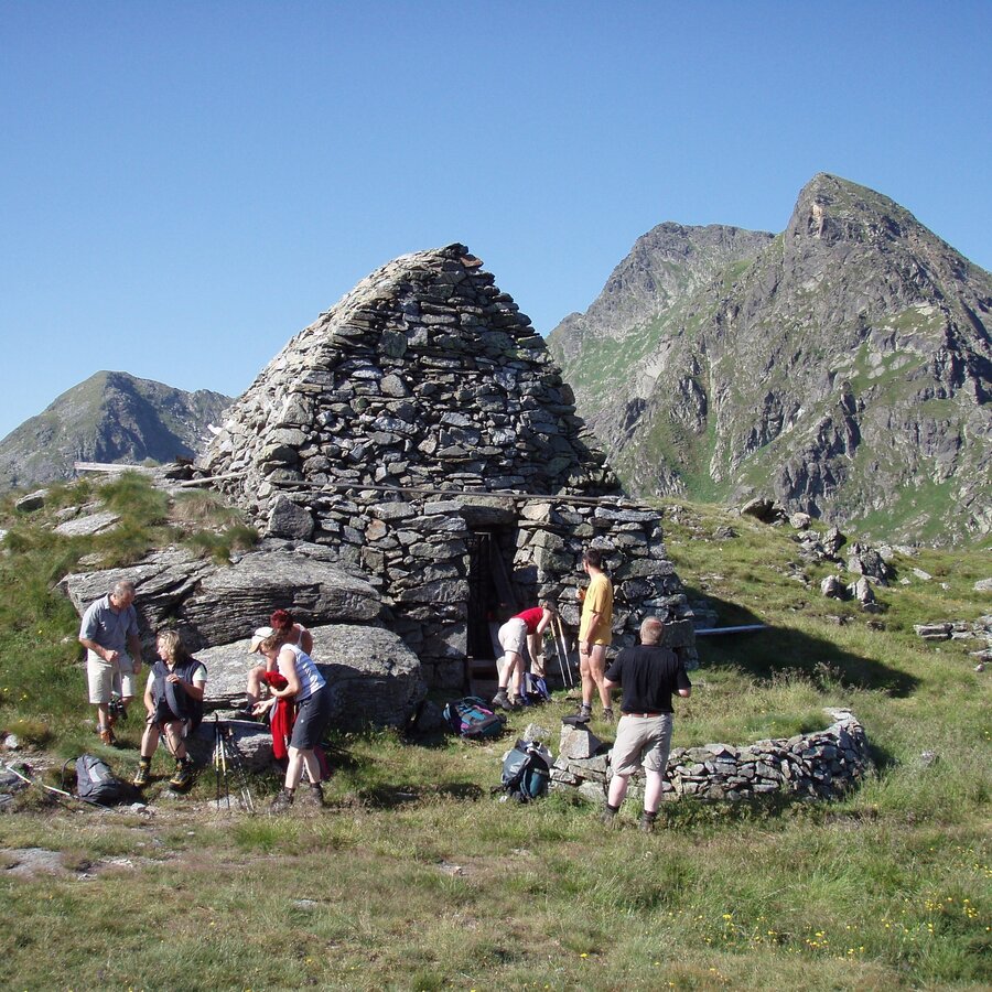
At the highest point of the pilgrimage trail, a magnificent panoramic view of the surrounding mountains opens up. The Glattjoch Chapel, dedicated to Saint Virgil, is the highest sacred building in Steiermark at 1,988 metres above sea level. This unique dry-stone structure in Central Europe is believed to be over 1,000 years old. In recent years, the chapel has been scientifically studied and fully restored. Every June, a mountain mass is celebrated here.
From the Glattjoch, the trail descends steeply into the Weberbach valley. Sure-footedness is essential on this narrow mountain path, as the alpine meadows are often wet. Shortly before reaching Kote (1,650 m), we cross the Weberbach stream by stepping over stones in the water. The route then continues through forested terrain to a forest road, which we follow downhill to the Schöttl Chapel (1,216 m).
From there, the road leads onwards until, after 16.5 kilometres and another 4.5 hours of walking, we arrive in Oberwölz. Entering through the Schöttl Gate from the north, we reach the smallest town in Steiermark, whose historic centre has largely preserved its medieval character.
We stay on the marked trail, which initially follows a forest road alongside the Donnersbach stream to the Riedleralm and then to the Beireutalm. The route then turns left and continues steeply through forest and alpine meadows up to the Glattjoch pass (1,988 m), which we reach after around 4.5 hours and 12.5 kilometres.
At the highest point of the pilgrimage trail, a magnificent panoramic view of the surrounding mountains opens up. The Glattjoch Chapel, dedicated to Saint Virgil, is the highest sacred building in Steiermark at 1,988 metres above sea level. This unique dry-stone structure in Central Europe is believed to be over 1,000 years old. In recent years, the chapel has been scientifically studied and fully restored. Every June, a mountain mass is celebrated here.
From the Glattjoch, the trail descends steeply into the Weberbach valley. Sure-footedness is essential on this narrow mountain path, as the alpine meadows are often wet. Shortly before reaching Kote (1,650 m), we cross the Weberbach stream by stepping over stones in the water. The route then continues through forested terrain to a forest road, which we follow downhill to the Schöttl Chapel (1,216 m).
From there, the road leads onwards until, after 16.5 kilometres and another 4.5 hours of walking, we arrive in Oberwölz. Entering through the Schöttl Gate from the north, we reach the smallest town in Steiermark, whose historic centre has largely preserved its medieval character.
Emergency
call mountain rescue: 140
Tips when
reporting an emergency – Answer these six WH questions: What happened? How
many people are injured? Where did the accident happen (are there GPS
coordinates)? Who is reporting the incident (callback number)? When did the
accident happen? What is the weather like at the site of the incident?
Proper backpack
packing makes many things easier: Pack heavy things first. The water bottle
should always be within reach in a side pocket. All the things that are often
needed, such as sunglasses, camera or hiking map, belong on top. An emergency
kit, including blister plasters, belongs in every rucksack and it is always
advisable to dress in layers.
Accessible by
train and bus: detailed information about arriving by ÖBB (Austrian Federal
Railways) can be found at www.oebb.at or
on the Verbundlinie Steiermark website www.busbahnbim.at
With
Verbundlinie’s BusBahnBim route planner app, planning your journey
has never been easier: simply enter towns and/or addresses, stop names or
points of interest to check all bus, train and tram connections in Austria. The
app is available free of charge for smartphones – on Google Play and in the App
Store
Steiermark Tourismus, Tel. +43 316 40030, www.steiermark.com
TV Schladming-Dachstein, Tel. +43 3687 23310, www.schladming-dachstein.at
TV Region Murau, Tel. +43 3532 2720, www.regionmurau.at
Monika Gschwandner-Elkins: Hemma Pilgerwege, ARGE Pilgern in Kärnten, 9020 Klagenfurt, Freytag&Berndt und Artaria KG, 2008Map & downloads
Gallery
224748-2220__hemma-pilgerweg__donnersbachwald_.jpg | © Steiermark Tourismus | Harry Schiffer
1/4
Glattjochkapelle | © Gemeinde Oberwölz
2/4
Pfarrkirche Donnersbachwald | © Gemeinde Donnersbachwald
3/4
Pfarrkirche hl. Martin | © Monika Gschwandner-Elkins | Monika Gschwandner-Elkins
4/4

What the weather will be like Irdning-Donnersbachtal (665m)
Today, 24.09.2026
Mostly cloudy through the day with a little sunshine and frequent rain.Morning

5°C
sr.Regenwahrscheinlichkeit
5%
sr.Windstärke
5 km/h
Noon

14°C
sr.Regenwahrscheinlichkeit
80%
sr.Windstärke
10 km/h
Night

10°C
sr.Regenwahrscheinlichkeit
80%
sr.Windstärke
5 km/h
Tomorrow, 25.09.2026
Early clouds will clear to leave the region with a dry and sunny day.Morning
6°C
sr.Regenwahrscheinlichkeit
5%
sr.Windstärke
5 km/h
Noon
16°C
sr.Regenwahrscheinlichkeit
0%
sr.Windstärke
0 km/h
Night

10°C
sr.Regenwahrscheinlichkeit
0%
sr.Windstärke
5 km/h
Forecast
26.09.2026
4°C
20°C
27.09.2026
4°C
22°C
28.09.2026
6°C
23°C
