


Roundway Raumberg
Accessible by public transport- Public bus (within 15 minutes walking distance from starting point)
Characteristics
SkillThe tour in numbers
Level of difficulty
easy
Route
6,7 km
Time
2:00 h
Uphill
200 hm
Downhill
200 hm
Highest point
825 m
From Irdning past the Capuchin monastery to Raumberg. Along the way there is also a small forestry trail.
INSTRUCTIVE AT THE SAME TIME. A walk from the town center to the monastery and on to Raumberg. Along a small forestry trail labe you with interesting facts before you make your way back to Irdning.
Best season
January
February
March
April
May
June
July
August
September
October
November
December
More information
Coming from Schladming or Liezen follow the B320 to Trautenfels. At the traffic circle turn off in the direction of Irdning, follow the road until you reach the Irdning Tourist Office (red building in the center of the village on the right-hand side).
Limited parking on the other side from the Municipal Office Irdning.
Limited parking on the other side from the Municipal Office Irdning.
Follow the signposted path to the Capuchin monastery, which has existed since 1711. Here it is worth taking a short detour inside the church and to the story square outside, before you continue along the slightly sloping path to the road to Donnersbach, cross it and after about 100 meters turn left uphill through a short section of forest to the Gumpenstein Research Institute and further to the Raumberg school. Continue through the village of Raumberg, past the small chapel, where after about 200m the asphalt path turns into a gravel path. Now the path goes slightly uphill again. At the next fork in the road, keep to the right and, just before the barrier, turn right again into the forest to the themed nature trail. Here you can learn a lot about native tree species. At the end of the forest you walk on the asphalt road back to the school and via the research center back to Irdning.
Way number: 6
- Turn back in good time if the weather deteriorates. If you get caught in a thunderstorm, stay away from individual trees. Wait out the storm, if possible in a crouching position.
- Stay on marked trails and remember to close pasture fences.In case of emergency, keep calm and call the mountain rescue on 140. If you have no reception, take out the sim card and dial 112.
- If you encounter cows: It is best to pass above the herd with at least 50 meters distance. Stay calm, don't make any frantic movements and don't run away. Do not imitate cow sounds and do not try to pet the animals. A stick and loud shouting can often make the animals turn back in an emergency.
- If you are a dog owner: Clarify before the hike if you have to cross a pasture. Keep your dog on a leash and make sure he stays calm. If a cow attacks, let the dog off the leash immediately. Never pick him up to defend him.
A short stop at the Capuchin monastery makes sense. The view into the church and the story square outside already invite you to pause, read and enjoy at the beginning of the hike.
With the bus940/941 to the bus stop ,,Irdning Busbahnhof'', here is also the tourism office-the start point.
The next trainstation ,,Stainach-Irdning'' is far away 5 kilometers.
Tourism information: www.schladming-dachstein.at
Tourism blog: www.derbergdastal.at
Tourist Office Schladming-Dachstein
Ramsauerstrasse 756
8970 Schladming
T: +43 3687 23310
info@schladming-dachstein.at
Garbage on meadows and paths can not smell mountain and valley. Please take it with you. Agriculture and forestry are important partners for Berg und Tal. They allow you to walk and drive on many of their paths. Be aware that only good cooperation will guarantee your recreational enjoyment in the future.
- GRIMMING-DONNERSBACHTAL Leisure Map (1:31.000). Available free of charge at tourist offices and lodging establishments.
- SCHLADMING-DACHSTEIN Hiking Map (1:50.000)
Map & downloads
Gallery
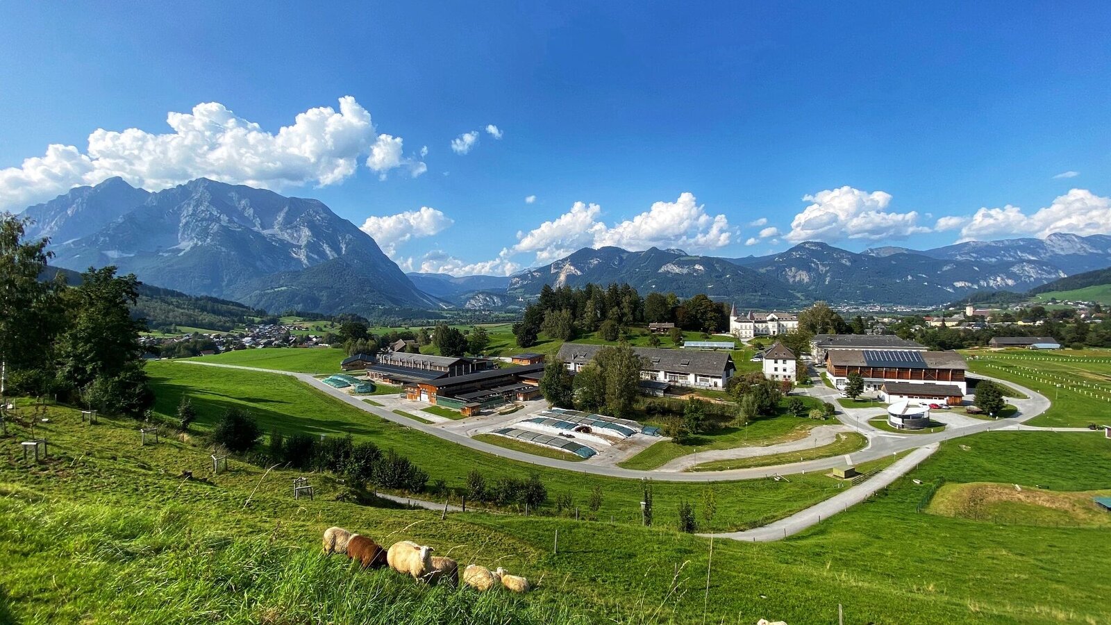
Raumberg agricultural school with Mt. Grimming and Gumpenstein Castle | © Clemens Egger | Clemens Egger
1/1

What the weather will be like Irdning-Donnersbachtal (665m)
Today, 26.10.2026
Showers will die away soon to leave a partly sunny day.Morning

4°C
sr.Regenwahrscheinlichkeit
70%
sr.Windstärke
5 km/h
Noon

9°C
sr.Regenwahrscheinlichkeit
40%
sr.Windstärke
5 km/h
Night

4°C
sr.Regenwahrscheinlichkeit
5%
sr.Windstärke
5 km/h
Tomorrow, 27.10.2026
Dry and sunny throughout the day with hardly any clouds.Morning

0°C
sr.Regenwahrscheinlichkeit
5%
sr.Windstärke
0 km/h
Noon
11°C
sr.Regenwahrscheinlichkeit
5%
sr.Windstärke
5 km/h
Night
5°C
sr.Regenwahrscheinlichkeit
0%
sr.Windstärke
0 km/h
Forecast
28.10.2026
2°C
12°C
29.10.2026
4°C
12°C
30.10.2026
2°C
11°C
