


Rotmandlspitze Summit Tour: from Ursprungalm to Eschachalm
Accessible by public transport- Public bus (within 15 minutes walking distance from starting point)
- Hiking bus (within 15 minutes walking distance from starting point)
Characteristics
SkillThe tour in numbers
Level of difficulty
challenging
Route
14,3 km
Time
6:30 h
Uphill
905 hm
Downhill
1295 hm
Highest point
2453 m
An alpine trail in the footsteps of the miners amidst the beautiful landscape of the Giglachsee Lakes.
A summit tour to the historic mining district in the Schladminger Tauern range with beautiful views to Giglachsee and Duisitzkarsee Lakes. This alpine tour takes you from Ursprungalm to picturesque Giglachseen lakes in the fjord-like Giglachkar cirque, Giglachseehütte and Ignaz-Mattis-Hütte chalets offering refreshments there. You continue on into Vetternkar cirque where you encounter the remains of miners' housing. From there, the alpine trail takes you up to the summit of Rotmandlspitze summit offering great views to Giglachkar and Vetternkar cirques with several lakes. From the summit you then head donwhill via Krukeckscharte ridge and Keinprechthütte chalet to Eschachalm in Obertal valley.
The points of interest are the historic roman route to Giglachseen Lakes, the remains of miner's housing in Vetternkar cirque and Rotmandlspitze summit as well as the many lakes of course. On the way to the valley from Keinprechthütte you also pass through the picturesque alp scenery of Neualm.
Best season
January
February
March
April
May
June
July
August
September
October
November
December
More information
We recommend to take the bus from Schladming to Ursprungalm in Preuneggtal valley, because the end point of the tour is in the Obertal Valley from where you can again take the bus back to Schladming. By car, take provincial highway L722 from Schladming to Rohrmoos (for about 6 kms) and then continue right on Hohenbergstraße road to Strickbrücke bridge in Preuneggtal valley. From here continue on the toll road to Ursprungalm.
Parking is available at the valley terminal of Planai cable-car in Schladming - buses to Ursprungalm leave from here. Parking is also available at the end of Ursprungalm toll road.
Parking is available at the valley terminal of Planai cable-car in Schladming - buses to Ursprungalm leave from here. Parking is also available at the end of Ursprungalm toll road.
From the hiking trail head at Ursprungalm chalet you take trail n° 771 to Preuneggsattel mountain saddle (approx. 1 hour) and the Giglachsee Lakes. From Giglachseehütte chalet you now follow trail n° 702 and pass by Ignaz-Mattis-Hütte chalet. You descend a little to the trail junction 702/776 at Tonnerhütte chalet.
From here you follow trail n° 702 slightly uphill into Vetternkar cirque until you reach the meinans of miners' houses. From here the trail starts to ascend steeper and leads up to Rotmandlspitze via several switchbacks. The summit is a quite broad ridge and from here you enjoy views into Giglach and Duisitzkar cirques.
Depending on the season there might be some snow fields or rubble stone fields leading to the Krukeckscharte mountain saddle. From there you descend to Keinprechthütte chalet via a steep trail. After some refreshment and snacks at Keinprechhütte you follow trail n° 774 to Neualm and further downhill to Eschachhütt'n Inn at Eschachalm from where you can take the bus back to Schladming.
The ascent from Vetternkar to Rotmandlspitze runs over very gravelled sections of path. Great caution is required here!
Changes in weather patterns, quick falls in temperature, thunderstorms, wind, fog and snow are some of the dangers that can be encountered on a hiking tour. Hosts of alpine huts and mountain refuges have a lot of experience in the mountains and can give good advice about weather and the trails. Poor equipment, overestimation of one's own capabilities, carelessness, poor personal constitution and/or wrong judgement can lead to critical situations. In case of thunderstorms: avoid summits, ridges and steel ropes.
GPS data and orientation
Available GPS data - just like hiking maps - is only a guidance for orientation and can never depict a trail exactly with all its details. Especially at dangerous spots it is essential to judge on site how to proceed.
In an emergency please call:
- 140 - for Alpine emergencies (all over Austria)
- 112 - European GSM emergency number
From Neualm you can make a detour via Duisitzkarsee Lake, which takes an additional hour.
With the Planai buses from Schladming (Planet-Planai, Lendplatz) or Rohrmoos (Rohrmoos-Zentrum) to Ursprungalm in Preuneggtal valley. From Eschachalm in Obertal valley take the bus back to Rohrmoos and Schladming.
- Buses of Planai-Hochwurzen-Bahnen: www.planaibus.at
Tourist information: www.schladming.com
Information about bus schedules: www.planaibus.at
360° drone images
Get yourself an overview with our 360° drone images:
- View over Giglachkar cirque: https://vonoben.schladming-dachstein.at/sommer/index.php?S=307
- Giglachseen and Kalkspitzen summits: https://vonoben.schladming-dachstein.at/sommer/index.php?S=308
- Lower Giglachsee Lake and Vetternkar cirque: https://vonoben.schladming-dachstein.at/sommer/index.php?S=309
- Via Rotmandlspitze: https://vonoben.schladming-dachstein.at/sommer/index.php?S=310
- Hiking map ‘Hiking WEST’ available at the information offices in the region.
- Schladming hiking map, 1:25,000, available at the Schladming information office.
- Hiking map Schladming-Dachstein, 1:50,000, available at the information offices in the region.
- Hiking guide Schladming-Dachstein by Herbert Raffalt, available at the information offices in the region.
Map & downloads
Gallery
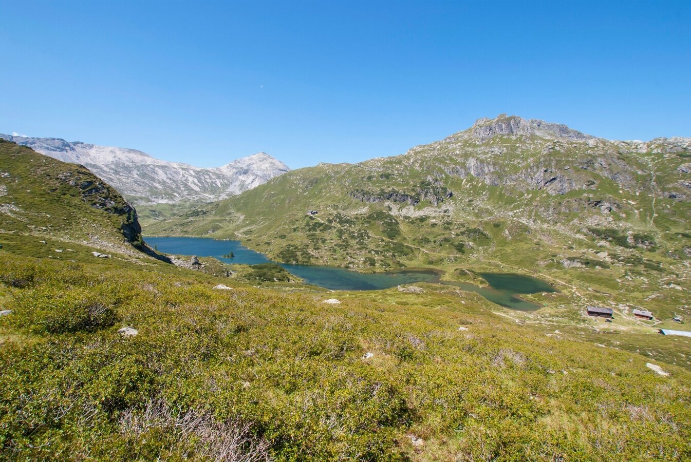
View from Vetternkar cirque towards Giglachsee Lakes | © Gerhard Pilz - www.gpic.at | Gerhard Pilz
1/6
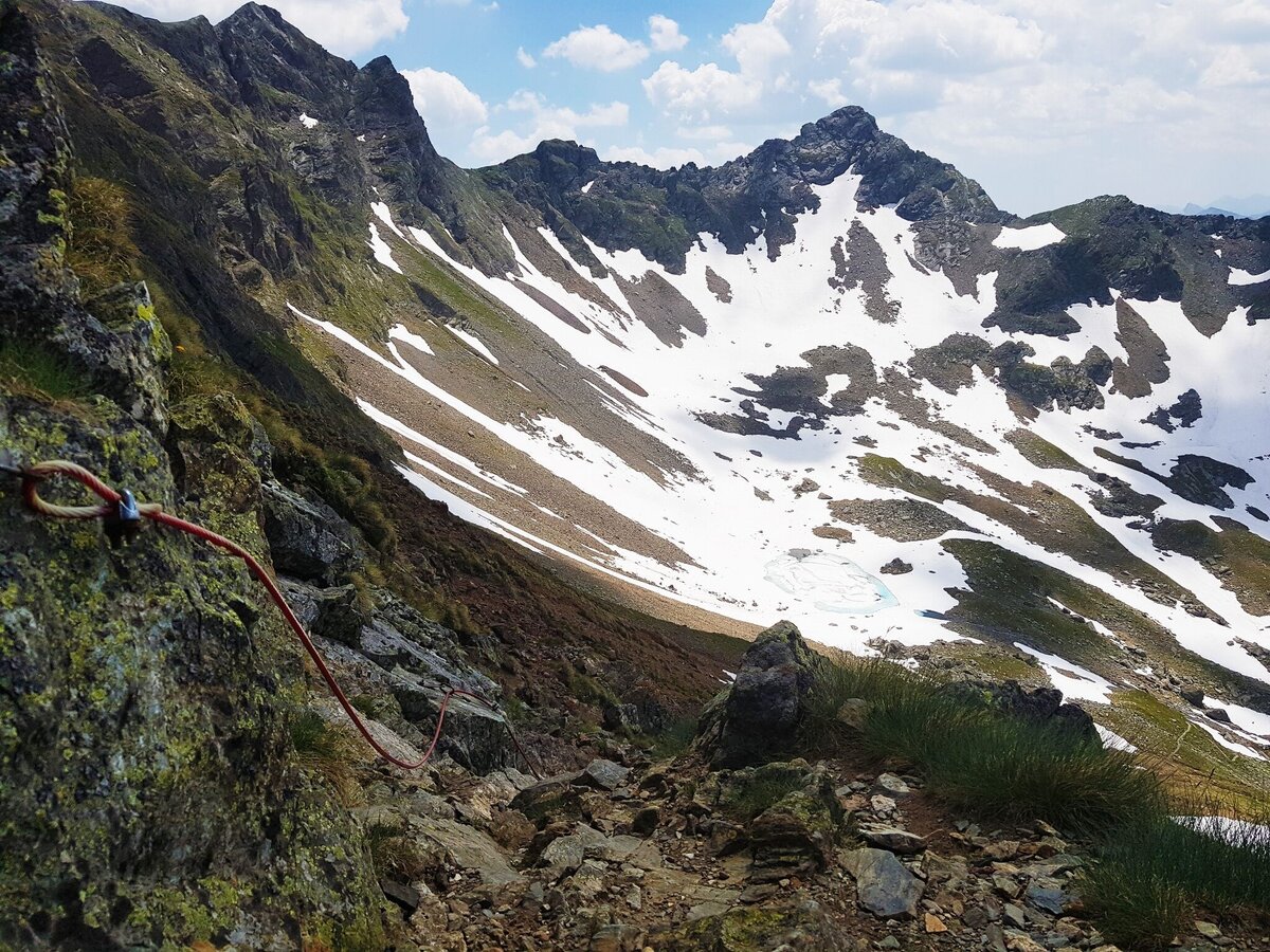
Section of trail #702 to Rotmandlspitze with steel rope | © Gerhard Pilz | Gerhard Pilz
2/6
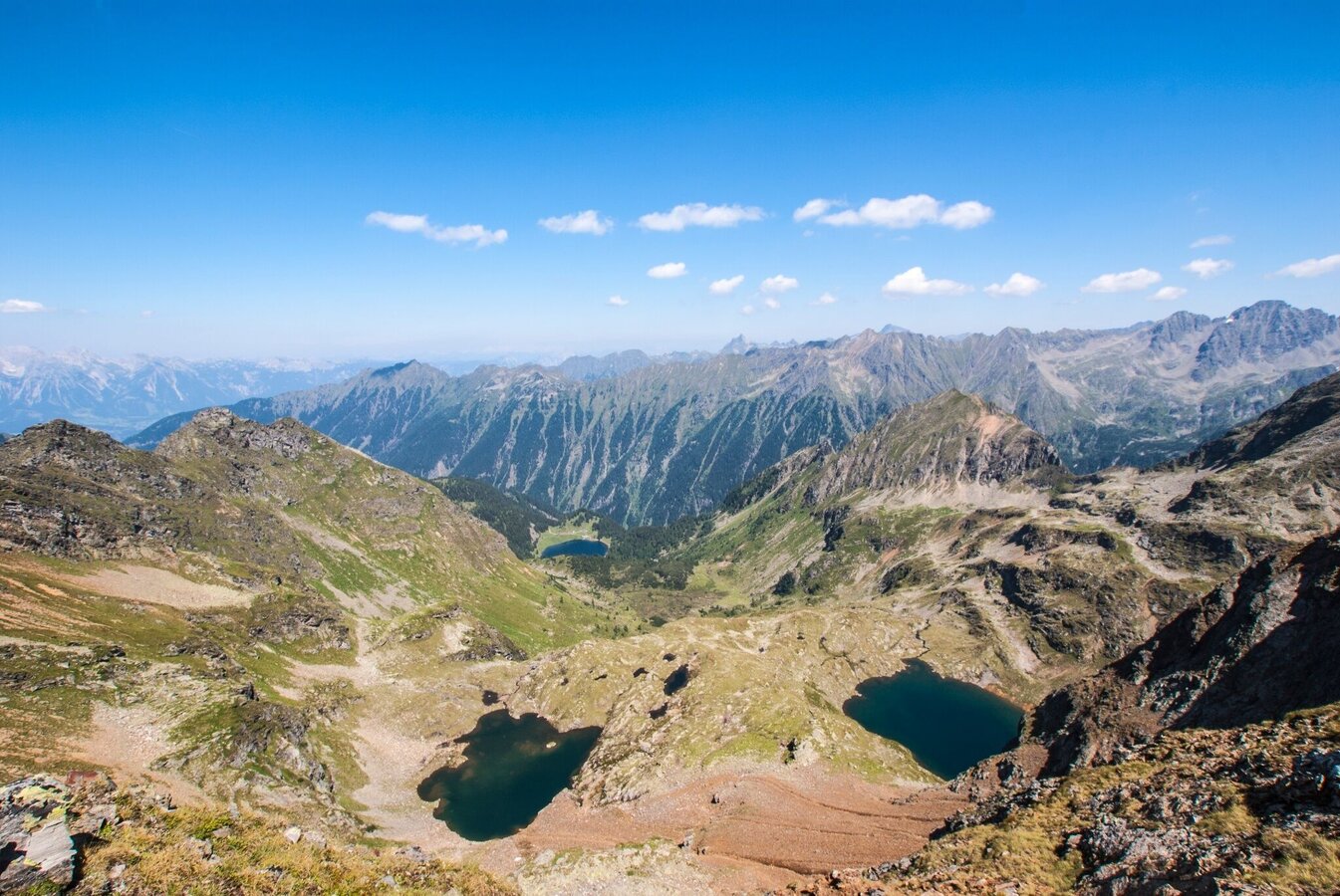
View from the trail into Duisitzkar cirque and the Buckelkarseen Lakes | © Gerhard Pilz - www.gpic.at | Gerhard Pilz
3/6
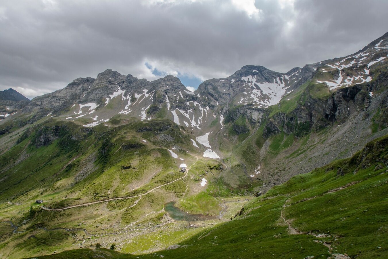
Keinprechthütte chalet is already in view | © Gerhard Pilz - www.gpic.at | Gerhard Pilz
4/6
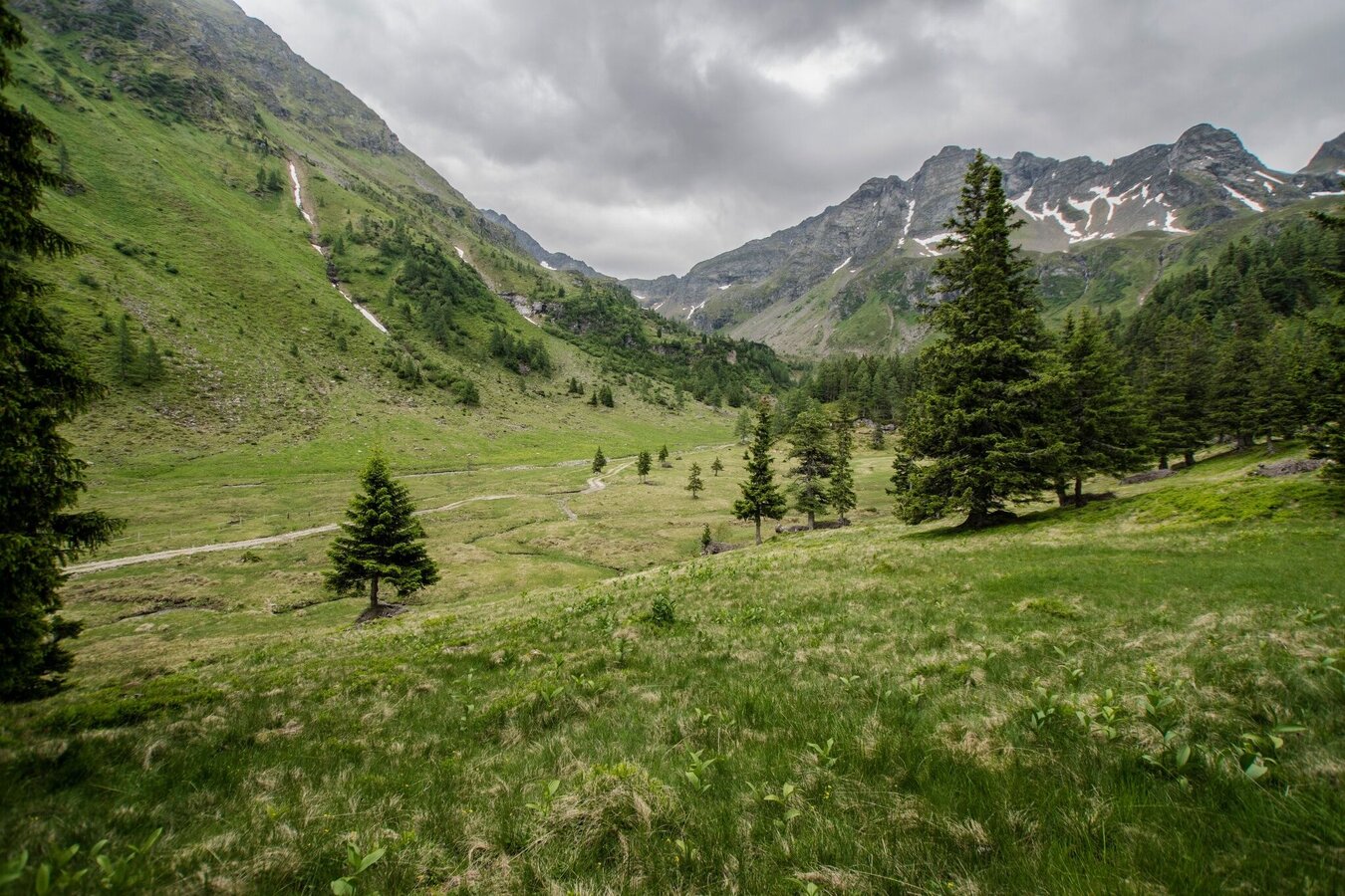
A last gaze into Neualmkar cirque in Obertal valley before descending to Eschachalm | © Gerhard Pilz - www.gpic.at | Gerhard Pilz
5/6
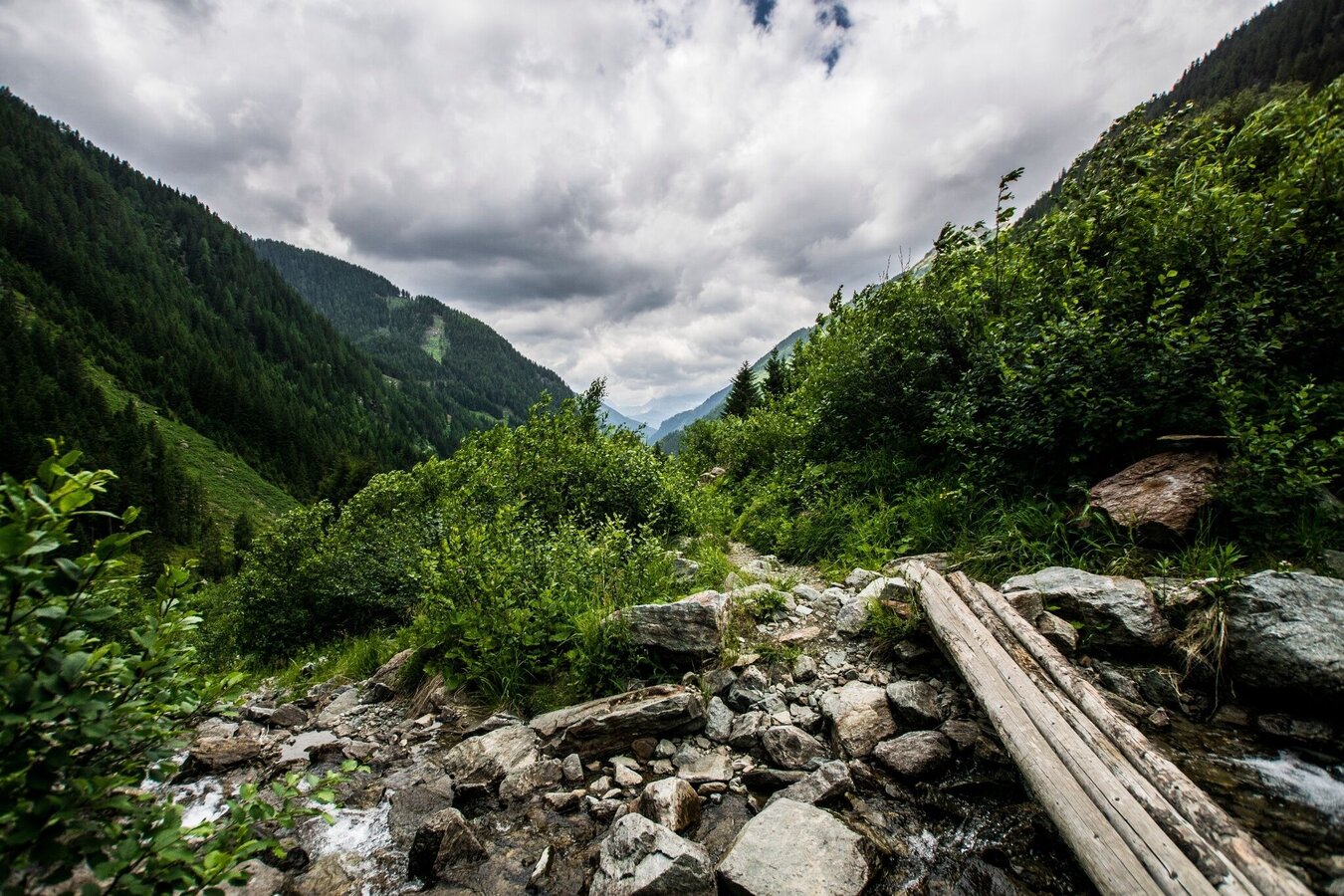
Almost at the end of the tour - view out of Obertal valley | © Gerhard Pilz - www.gpic.at | Gerhard Pilz
6/6

What the weather will be like Schladming (740m)
Today, 14.10.2026
Light rain until the early afternoon, then slowly becoming dry.Morning

7°C
sr.Regenwahrscheinlichkeit
80%
sr.Windstärke
5 km/h
Noon
15°C
sr.Regenwahrscheinlichkeit
80%
sr.Windstärke
5 km/h
Night

10°C
sr.Regenwahrscheinlichkeit
55%
sr.Windstärke
5 km/h
Tomorrow, 15.10.2026
Early clouds will gradually clear to leave the region with a dry and sunny day.Morning

5°C
sr.Regenwahrscheinlichkeit
0%
sr.Windstärke
0 km/h
Noon
15°C
sr.Regenwahrscheinlichkeit
0%
sr.Windstärke
5 km/h
Night

9°C
sr.Regenwahrscheinlichkeit
0%
sr.Windstärke
5 km/h
Forecast
16.10.2026
3°C
17°C
17.10.2026
3°C
15°C
18.10.2026

5°C
15°C
