


Closed
High-altitude cross-country trail at the Planneralm
Characteristics
SkillThe tour in numbers
Level of difficulty
medium
Route
2,8 km
Time
0:45 h
Uphill
95 hm
Downhill
91 hm
Highest point
1712 m
Challenging high-altitude cross-country trail in the highest mountain village of Styria.
The Planneralm high altitude cross country track is considered a selective and demanding cross-country ski run, which is prepared both classically and with a skating track, in a beautiful, quiet location. During the construction of this trail, care was taken not to interfere too much with nature. This results in some steeper climbs and above all descents.
Best season
January
February
March
April
May
June
July
August
September
October
November
December
More information
Coming from the B320, at the crossing Trautenfels in direction Irdning. Then in the direction of Donnersbach. In the village turn left towards Planneralm and follow the 12 km long toll-free mountain road.
Free of charge on the Planneralm.
Free of charge on the Planneralm.
- Cross-country skiing equipment with appropriate cross-country skis, poles and boots.
- Warm, breathable clothing.
- Gloves, hood
- Sunglasses
Equipment rental at Sport Scherz next to the lift ticket office and Sport Schöttl at the Plannereckbahn valley station.
Short but crisp trail, for those who do not have long time.
Tourism information: www.schladming-dachstein.at
Tourism blog: www.derbergdastal.at
Tourist Office Schladming-Dachstein
Ramsauerstrasse 756
8970 Schladming
T: +43 3687 23310
Garbage on meadows and paths can not smell mountain and valley. Please take it with you. Agriculture and forestry are important partners for Berg und Tal. They allow you to walk and drive on many of their paths. Be aware that only good cooperation will guarantee your recreational enjoyment in the future.
- Winter leisure card- in all info locations free of charge to pick up
Map & downloads
Gallery
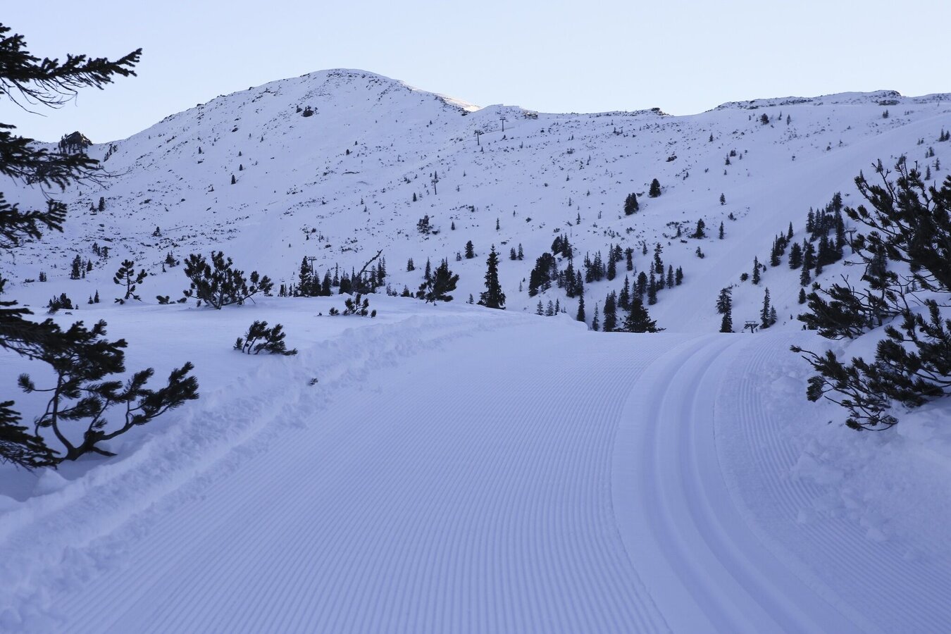
Planneralm Höhenloipe ganz frisch am Morgen. | © Erlebnisregion Schladming-Dachstein | Roland Gutwenger
1/1

What the weather will be like Irdning-Donnersbachtal (665m)
Today, 24.09.2026
Mostly cloudy through the day with a little sunshine and frequent rain.Morning

10°C
sr.Regenwahrscheinlichkeit
0%
sr.Windstärke
10 km/h
Noon

13°C
sr.Regenwahrscheinlichkeit
80%
sr.Windstärke
10 km/h
Night

10°C
sr.Regenwahrscheinlichkeit
85%
sr.Windstärke
5 km/h
Tomorrow, 25.09.2026
Early clouds will clear to leave the region with a dry and sunny day.Morning

6°C
sr.Regenwahrscheinlichkeit
10%
sr.Windstärke
5 km/h
Noon
16°C
sr.Regenwahrscheinlichkeit
5%
sr.Windstärke
0 km/h
Night

10°C
sr.Regenwahrscheinlichkeit
0%
sr.Windstärke
5 km/h
Forecast
26.09.2026
4°C
21°C
27.09.2026
4°C
22°C
28.09.2026
6°C
23°C
