


Großes Bärneck from Donnersbachwald
Characteristics
SkillThe tour in numbers
Level of difficulty
medium
Route
12,7 km
Time
5:00 h
Uphill
1040 hm
Downhill
1040 hm
Highest point
2071 m
From the summer parking lot, we hike along a forest road past the Mörsbachwirt, always heading towards the end of the valley. Alternating between paths and roads, we keep to the right shortly before reaching the Hintere Mörsbachalm. Becoming steeper, the path leads in an almost direct line towards the Silberkarspitz across alpine pastures located to the right of our destination. One traverse and a short steep ascent later, we stand at the highest point of the Mörsbachtal. The return journey is either via the ascent route or, as described here, via the Silberkarspitze and along the ridge over to the Gstemmerscharte. Via path 02/09, the route leads back down through blueberry and alpine rose bushes to the Hintere Mörsbachalm and along the already familiar path back to the summer parking lot.
Best season
January
February
March
April
May
June
July
August
September
October
November
December
More information
Coming from the B320, at the Trautenfels junction head towards Irdning. Then follow signs for Donnersbach, Donnersbachwald.
Shortly after the tennis court, turn right towards Mörsbachwirt and the summer car park.
Free gravel parking lot.
- Plan your tour in advance and take walking time, distance, elevation gain, potential hazards, and the weather forecast into account.
- The Alpine Association provides detailed information on "Safe Mountain Hiking". You can find comprehensive information at www.alpenverein.at.
- Many things are better together and safer in the mountains at the same time. Do not go alone if possible, and adapt the tour to the physical capabilities of your group.
- Let someone know where you are going and when you plan to be back. Also, sign in to hut or summit logbooks.
- Turn back in time if the weather deteriorates. If you get caught in a thunderstorm, do not stay on the summit or ridge and keep away from individual trees. Wait out the storm, preferably in a crouching position.
- Stay on the marked trails and remember to close pasture gates behind you.
- The way up is only half the battle. Stay alert, especially during descents, to get back down to the valley safely.
- In case of an emergency, stay calm and contact the mountain rescue service at 140. If you have no reception, remove the SIM card and dial 112.
- If you encounter cows: It is best to pass above the herd with a distance of at least 50 meters. Stay calm, do not make any sudden movements, and do not run away. Do not imitate cow sounds and do not try to pet the animals. In an emergency, the animals can often be made to turn back with a stick and loud shouting.
- If you are a dog owner: Clarify before the hike whether you have to cross a pasture. Keep your dog on a lead and make sure it stays calm. In the event of a cow attack, let the dog off the lead immediately. Never pick it up to defend it.
- Your weatherproof backpack should include: sun and rain protection, warm, windproof clothing, drinks and provisions, a small first-aid kit, a hiking map, and a fully charged mobile phone.
- Appropriate footwear goes without saying.
Ride your bike as far as the Hintere Mörsbachalm. There you will find a Bike&Hike station where you can conveniently park your bike.
This turns the way back into an energy-saving downhill roll.
- Tourist Information: www.schladming-dachstein.at
- Tourism Blog: www.derbergdastal.at
Schladming-Dachstein Tourist Office
Ramsauerstraße 756
8970 Schladming
T: +43 3687 23310
Litter on meadows and trails is something mountains and valleys cannot stand. Please take it with you. Agriculture and forestry are important partners for mountains and valleys. They allow you to walk and ride on many of their paths. Be aware that only a good partnership ensures your leisure enjoyment in the future.
- GRIMMING-DONNERSBACHTAL Leisure Map (1:31,000). Available free of charge in tourist offices and accommodation establishments.
- SCHLADMING-DACHSTEIN Hiking Map (1:50,000)
- KOMPASS Hiking Map 68, Ausseerland-Ennstal 1:50,000, Hiking, Cycling, Ski Touring
Map & downloads
Gallery
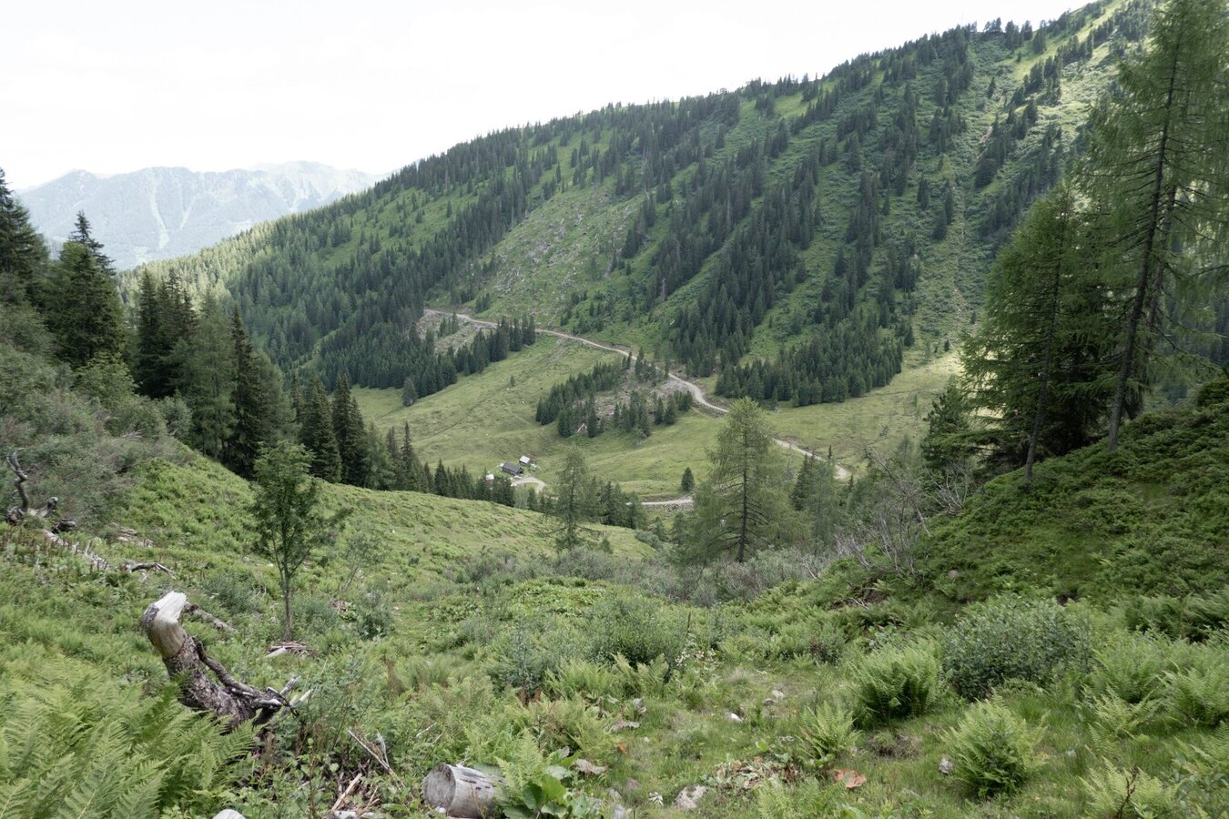
Auf halbem Weg von der Gstemmerscharte zur Hinteren Mörsbachalm | © Erlebnisregion Schladming-Dachstein | Roland Gutwenger
1/1

What the weather will be like Irdning-Donnersbachtal (665m)
Today, 22.09.2026
First variable with showers, becoming drier and brighter in the afternoon.Morning

8°C
sr.Regenwahrscheinlichkeit
95%
sr.Windstärke
15 km/h
Noon
15°C
sr.Regenwahrscheinlichkeit
55%
sr.Windstärke
10 km/h
Night

10°C
sr.Regenwahrscheinlichkeit
5%
sr.Windstärke
5 km/h
Tomorrow, 23.09.2026
Some clouds in the morning, lateron much sunshine and hardly any cloudsMorning

5°C
sr.Regenwahrscheinlichkeit
0%
sr.Windstärke
0 km/h
Noon

16°C
sr.Regenwahrscheinlichkeit
0%
sr.Windstärke
5 km/h
Night
10°C
sr.Regenwahrscheinlichkeit
0%
sr.Windstärke
5 km/h
Forecast
24.09.2026
4°C
17°C
25.09.2026
6°C
18°C
26.09.2026
4°C
20°C
