


Enns Loop Trail - Accessible Nature Experiences
Accessible by public transport- Public bus (within 15 minutes walking distance from starting point)
Characteristics
SkillThe tour in numbers
Level of difficulty
easy
Route
5,3 km
Time
1:00 h
Uphill
10 hm
Downhill
10 hm
Highest point
730 m
The Ennsrundweg invites you to enjoy a relaxed stroll through the beautiful river landscape of Schladming.
The Ennsrundweg is one of the most beautiful walking paths in Schladming. The circular tour leads predominantly along level paths and offers magnificent views of the Enns as well as the impressive mountain panorama of the region.
Best season
January
February
March
April
May
June
July
August
September
October
November
December
More information
Exit the B320 Ennstal main road at the "Schladming Ost" junction and follow signs to congress Schladming. The loop starts directly behind the congress center on the banks of the Enns.
Parking spaces at the congress center (subject to a fee) or at the Planai-Stadion at the valley station of the Planai-Seilbahn.
Parking spaces at the congress center (subject to a fee) or at the Planai-Stadion at the valley station of the Planai-Seilbahn.
From the starting point (Gollobsteg - pedestrian bridge), first follow the left bank of the Enns past the sports field and the dog meadow to the Lehenbrücke. This section is ideal for anyone who wants to enjoy a relaxed walk in nature. The path is almost flat and invites you to linger with its peaceful atmosphere.
For the return journey, take a short stretch along Untere Klausstraße. After just a few meters, turn left back onto the Ennsradweg and follow it along the railway tracks. The path then leads to Campingplatz Zirngast, where you turn into the Linke Ennsau. From there, a pleasant, level path leads back to the starting point.
For a safe tour, we recommend the following equipment:
- Weather-appropriate clothing: Ideally using the layering principle and breathable fabrics
- Water bottle: Especially for longer tours and on warm days
- Mobile phone: For emergencies and navigation
- Sunscreen, sunglasses
- First aid kit: If you are out for longer or in alpine terrain
- Small snacks for longer tours
The Citybus operates within Schladming. From Rohrmoos, take the Planai-Hochwurzen-Bahnen lines to Planet Planai; from Ramsau, use the Ramsauer Verkehrsbetriebe – ideally to the "Planet Planai" stop. From there, follow the yellow hiking signs for "Ennsrunde" to the starting point.
- Planai-Busse: www.planaibus.at
- Ramsauer Verkehrsbetriebe: www.rvb.at
- Postbus: www.postbus.at
You can get an overview with the help of our 360° images:
- View over the Untere Klaus: https://vonoben.schladming-dachstein.at/sommer/index.php?S=219
Summer leisure map WEST available in the information offices of the Schladming-Dachstein region.
Map & downloads
Gallery

Ennsrundweg in spring | © Erlebnisregion Schladming-Dachstein | Katrin Hutegger
1/3

Enns Circular Trail near Schladming | © Erlebnisregion Schladming-Dachstein | Katrin Hutegger
2/3
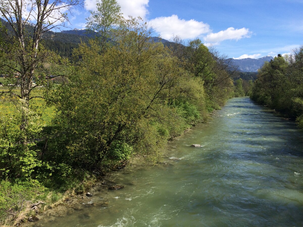
Enns Cycle Path Natural Landscape | © Erlebnisregion Schladming-Dachstein | Katrin Hutegger
3/3

What the weather will be like Schladming (740m)
Today, 18.10.2026
Dry and partly sunny throughout the day, with cloudy periods from time to time.Morning

7°C
sr.Regenwahrscheinlichkeit
0%
sr.Windstärke
0 km/h
Noon
17°C
sr.Regenwahrscheinlichkeit
0%
sr.Windstärke
5 km/h
Night

11°C
sr.Regenwahrscheinlichkeit
0%
sr.Windstärke
5 km/h
Tomorrow, 19.10.2026
Early clouds will clear to leave the region with a dry and sunny day.Morning
5°C
sr.Regenwahrscheinlichkeit
0%
sr.Windstärke
0 km/h
Noon
15°C
sr.Regenwahrscheinlichkeit
0%
sr.Windstärke
10 km/h
Night

10°C
sr.Regenwahrscheinlichkeit
0%
sr.Windstärke
5 km/h
Forecast
20.10.2026
5°C
15°C
21.10.2026

6°C
15°C
22.10.2026

4°C
10°C
