


3-day-tour: Klafferkessel
Accessible by public transport- Public bus (within 15 minutes walking distance from starting point)
- Hiking bus (within 15 minutes walking distance from starting point)
Characteristics
SkillThe tour in numbers
Level of difficulty
challenging
Route
23,4 km
Time
10:00 h
Uphill
1705 hm
Downhill
1705 hm
Highest point
2618 m
Klafferkessel tour is filled with many experiences. With the 3-day-tour you can take all the time you need and take in the wonderful nature along this challenging trail.
Klafferkessel is a laike plateau on 2,300 meters above sea level in the Schladminger Tauern mountain range. The high-alpine scenery impresses with special flora and is a relic from the last Ice Age. Around 30 tarns on this plateau are the core of "Wild Waters" in Untertal valley. Making this tour in 3 days gives you a bit more time, however Klafferkessel tour remains a difficult mountain hike and needs experience!
Best season
January
February
March
April
May
June
July
August
September
October
November
December
More information
From Schladming take provincial highway L722 (Rohrmoosstraße road) to Rohrmoos and at the roundabout continue on provincial highway L723 (Tälerstraße road) towards Untertal. In the village of Untertal continue left on "Untertalstraße" road to Seeleiten car park at the valley head.
Parking is available at Seeleiten car park (parking fee).
Parking is available at Seeleiten car park (parking fee).
Day 1 - Place of the Gods "Gollingwinkel"
The first stage of this 3-day-tour starts at Seeleiten car park and Almgasthaus Riesachfall inn in Untertal valley. You reach the trail head with the Planai buses from Rohrmoos and Schladming. You start your hike on trail n° 778 towards Gollinghütte chalet. A forest lane at first takes you through a pine forest and then via a nice alpine meadow to the "Untere Steinwendalm" chalets. Via 2 switchbacks - or directly passing by the chalets - you reach the meadow of "Laberer Boden". Take a break at the small pond there and enjoy the reflection of Hochgolling summit in the pond.
Continue along the forest lane towards Gollinghütte chalet. Steinriesenbach creek is your constant companion along the way and often flows right next to the trail. Through short forest sections and over alpine meadows you reach the end of the forest lane in the area of "Untere Stegeralm". You continue on the hiking trail to Gollinghütte chalet. All-together you reach the chalet after about 2.5 hours.
As a short walk for the evening we recommend you take a stroll to "Gollingwinkel". This "place of the gods" is a natural amphitheatre at the foot of the Hochgolling North face can be reached from Gollinghütte chalet within 20 minutes.
Day 2 - Klafferkessel: back to the Ice Age
The second stage of this 3-day-tour takes you to the Klafferkessel plateau - the core of Untertal's Wild Waters. After breakfast at Gollinghütte chalet you start the ascent to Greifenberg summit, which is the highest point of this 3-day-tour. From the chalet you cross the river and start hiking up the steep face to Greifenbergsattel mountain saddle via several switchbacks. While ascending, you get some great views to the chalet and to Gollingwinkel and Hochgolling.
Once you reach the mountain saddle, you are rewarded with a breathtaking view to Hochgolling, with the small Greifenbergsee lake in the foreground. Via scree you continue to the summit, where it's time for an extended break. The view over the Schladminger Tauern range is marvellous and before you lies the lake plateau of Klafferkessel with around 30 tarns.
From the summit of Greifenberg the trail descends quite steeply to the plateau. Passing by smaller and bigger tarns you hike through scenery that takes you back to the Ice Ages with its special flora.
Via "Untere Klafferscharte" ridge you leave the plateau and hike down into Lämmerkare cirques, where you reach a trail junction with trail n° 777 at the creek. Follow it to Preintalerhütte and Waldhornalm chalets along the slopes of Waldhorn through a clear forest of larches and stone pines and dwarf pines.
After all-together 4-6 hours of walking you reach the chalets, where you stay overnight. From the chalets you can reach Sonntagskarseen Lakes in 1.5 to 2 hours walk.
Day 3 - Back to the valley via Riesachsee Lake
The last stage of this 3-day-tour brings you back to your starting point at Seeleiten car park. From Preintalerhütte and Waldhornalm chalets you take trail n° 777 towards Riesachsee Lake.
After breakfast you start your way down to Riesachsee Lake. At first via a nice forest trail and then via a forest lane you will soon reach Berallerhütte chalet at Kotalm. At the chalet they produce cheese and milk. Slightly downhill you continue to Kaltenbachalm inn at the Eastern shore of Riesachsee lake.
You pass by the lake along the shore and reach Gfölleralm chalet above the West shore of the lake. The meadows at the shore are a nice place to relax and dip your feet into the cold water of the lake.
The last part of the tour is the way back down to Seeleiten car park. From Gfölleralm at first you take the forest lane. About half way you turn-off left on the hiking trail in a hairpin and reach impressive Riesach waterfall - the tallest in Styria. From there the well-maintained trail takes you down to the valley along the waterfalls and back to Almgasthaus Riesachfall. From there take the bus back to Schladming.
The Klafferkessel tour is a difficult mountain hike where experience in alpine surroundings, surefootedness, a head for heights and good physical condition are a must. We recommend a minimum age of 15 years, with youngsters having enough experience in hiking and mountain tours.
Changes in weather patterns, quick falls in temperature, thunderstorms, wind, fog and snow are some of the dangers that can be encountered on a hiking tour. Hosts of alpine huts and mountain refuges have a lot of experience in the mountains and can give good advice about weather and the trails. Poor equipment, overestimation of one's own capabilities, carelessness, poor personal constitution and/or wrong judgement can lead to critical situations. In case of thunderstorms: avoid summits, ridges and steel ropes.
GPS data and orienteering
Available GPS data - just like hiking maps - is only a guidance for orientation and can never depict a trail exactly with all its details. Especially at dangerous spots it is essential to judge on site how to proceed.
In an emergency please call:
- 140 - for Alpine emergencies (all over Austria)
- 112 - European GSM emergency number
Ankle-high hiking boots are a must.
A well-packed backpack is helpful and especially when touring Alpine terrain a tuque, gloves, a windproof jacket and pants are standard equipment. Good, waterproof shoes, sun glasses, sun cream and sufficient beverages are essential too. Torch light, a map of the area, knie and a small first-aid kit should also be in the backpack.
With the Planai buses from Schladming (Planet-Planai, Lendplatz) or Rohrmoos (Rohrmoos-Zentrum) to Untertal - bus stop "Riesach Wasserfall".
- Buses of Planai-Hochwurzen-Bahnen: www.planaibus.at
Tourist information: www.schladming.com
Information about bus schedules: www.planaibus.at
Information about "Wild Waters": www.wildewasser.com
360° drone images
Get yourself an overview with our 360° drone images:
- View over Klafferkessel: https://vonoben.schladming-dachstein.at/sommer/index.php?S=315
- View into Lämmerkare cirques: https://vonoben.schladming-dachstein.at/sommer/index.php?S=316
- Descent from Preintalerhütte: https://vonoben.schladming-dachstein.at/sommer/index.php?S=317
- View over Riesachsee Lake: https://vonoben.schladming-dachstein.at/sommer/index.php?S=318
- Hiking map Schladming, 1:25.000, available at the tourist office Schladming.
- Hiking map Schladming-Dachstein, 1:50.000, available at the tourist office Schladming.
- Magazine "Wild Waters", available at the tourist office Schladming.
Map & downloads
Gallery
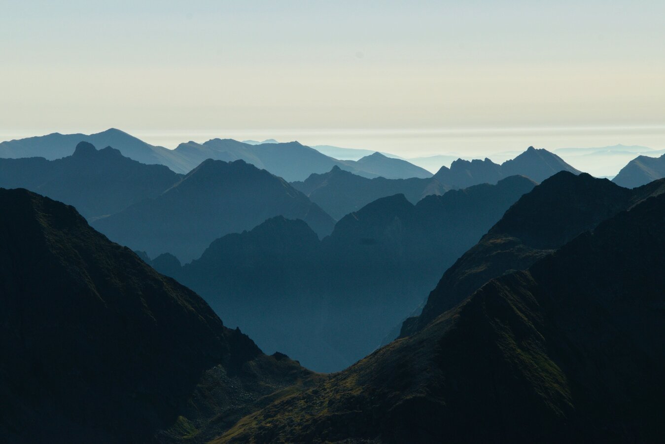
View over the Klafferkessel | © Erlebnisregion Schladming-Dachstein | Marlene Eggmayr
1/9
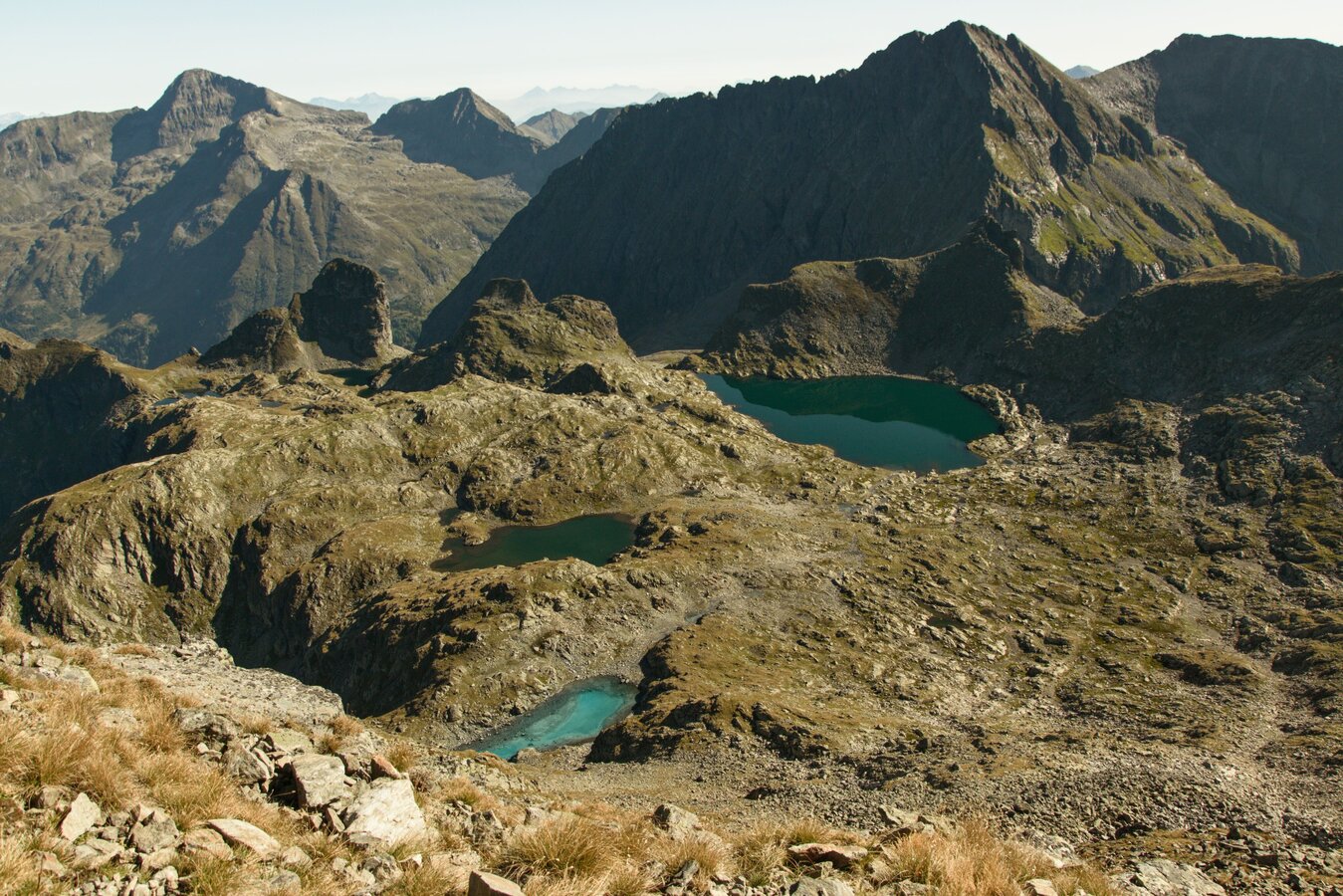
Klafferkessel in the Schladminger Tauern | © Erlebnisregion Schladming-Dachstein | Marlene Eggmayr
2/9
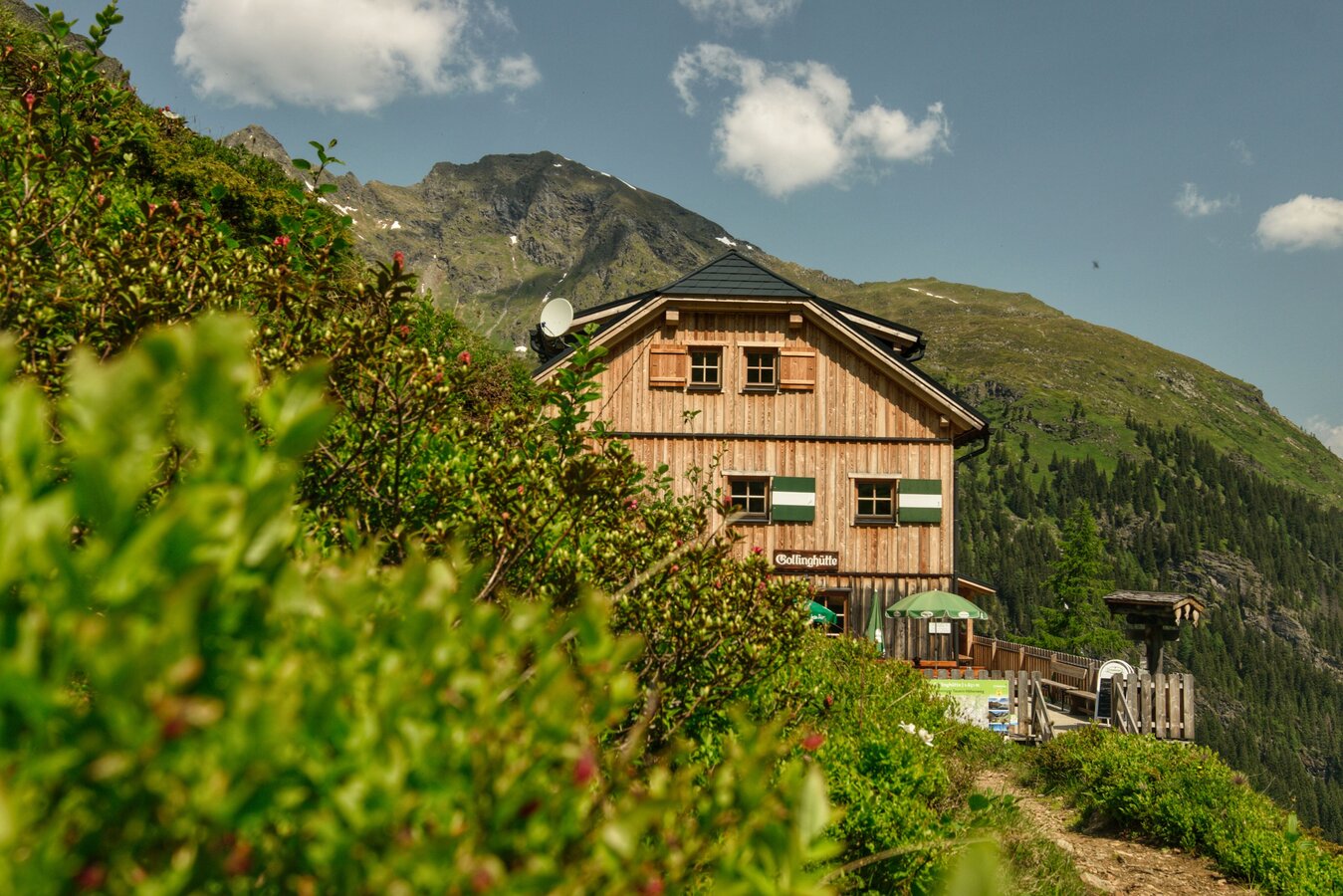
Gollinghütte in the Klafferkessel | © Erlebnisregion Schladming-Dachstein | Marlene Eggmayr
3/9

Entspannen auf den saftigen Moosmatten am Klafferkessel | © Tourismusverband Schladming - Herbert Raffalt | Herbert Raffalt
4/9

Hikers at one of the lakes at Klafferkessel | © Katrin Hutegger | Gerhard Pilz
5/9
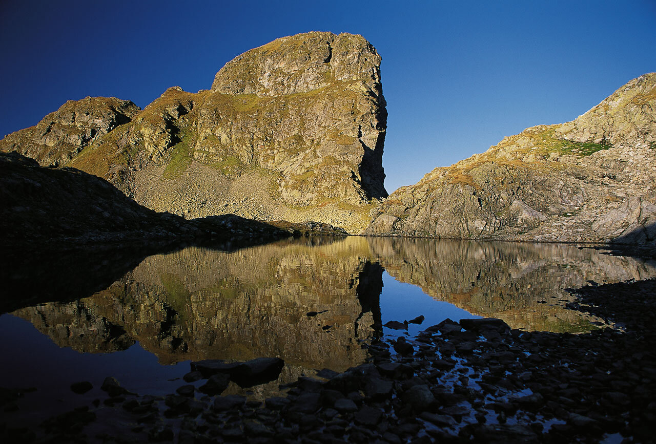
Greifenstein summit - Schladminger Tauern mountain range | © Tourismusverband Schladming - Herbert Raffalt | Herbert Raffalt
6/9

Berallerhütte chalet at Kotalm | © Kotalm - Berallerhütte | Kotalm - Berallerhütte
7/9
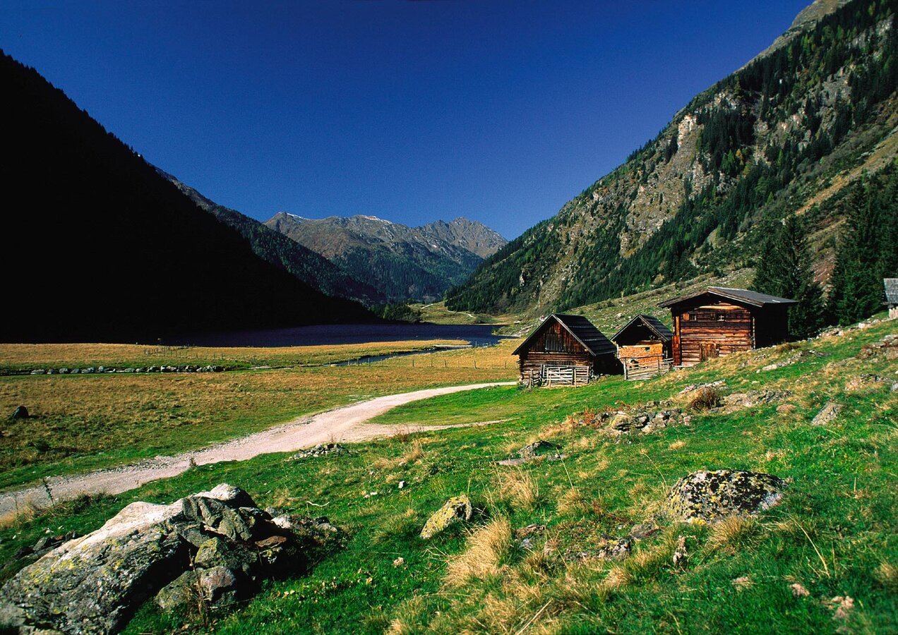
Riesach Lake in the Untertal valley, Rohrmoos | © Tourismusverband Schladming - Herbert Raffalt | Herbert Raffalt
8/9

Kaltenbachalm Inn at Riesachsee Lake, Untertal valley | © Erlebnisregion Schladming-Dachstein | Kaltenbachalm
9/9

What the weather will be like Schladming (740m)
Today, 23.10.2026
The day starts sunny, but will be partly cloudy in the afternoon.Morning

2°C
sr.Regenwahrscheinlichkeit
0%
sr.Windstärke
5 km/h
Noon

10°C
sr.Regenwahrscheinlichkeit
0%
sr.Windstärke
5 km/h
Night
6°C
sr.Regenwahrscheinlichkeit
5%
sr.Windstärke
5 km/h
Tomorrow, 24.10.2026
Rainfall will end around noon, then the clouds will break up.Morning

3°C
sr.Regenwahrscheinlichkeit
80%
sr.Windstärke
5 km/h
Noon

6°C
sr.Regenwahrscheinlichkeit
85%
sr.Windstärke
5 km/h
Night

3°C
sr.Regenwahrscheinlichkeit
45%
sr.Windstärke
5 km/h
Forecast
25.10.2026
-1°C
9°C
26.10.2026
1°C
11°C
27.10.2026
0°C
14°C
